
Gowhar Meraj – författare

2 059 kr
Skickas inom 10-15 vardagar

738 kr
Skickas inom 10-15 vardagar
841 kr
Läs direkt efter köp
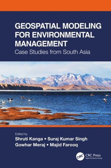
This is a comprehensive resource that integrates the application of innovative remote sensing techniques and geospatial tools in modeling Earth systems for environmental management beyond customary digitization and mapping practices. It identifies the most suitable approaches for a specific environmental problem, emphasizes the importance of physically based modeling, their uncertainty analysis, advantages, and disadvantages. The case studies on the Himalayas with a complex topography call for innovation in geospatial techniques to find solutions for various environmental problems.
Features:
Presents innovative geospatial methods in environmental modeling of Earth systems.
Includes case studies from South Asia and discusses different processes and outcomes using spatially explicit models.
Explains contemporary environmental problems through the analysis of various information layers.
Provides good practices for developing countries to help manage environmental issues using low-cost geospatial approaches.
Integrates geospatial modeling with policy and analysis its direct implication in decision making.
Using a systems’ approach analysis, Geospatial Modeling for Environmental Management: Case Studies from South Asia shall serve environmental managers, students, researchers, and policymakers.

841 kr
Läs direkt efter köp
This is a comprehensive resource that integrates the application of innovative remote sensing techniques and geospatial tools in modeling Earth systems for environmental management beyond customary digitization and mapping practices. It identifies the most suitable approaches for a specific environmental problem, emphasizes the importance of physically based modeling, their uncertainty analysis, advantages, and disadvantages. The case studies on the Himalayas with a complex topography call for innovation in geospatial techniques to find solutions for various environmental problems.
Features:
Presents innovative geospatial methods in environmental modeling of Earth systems.
Includes case studies from South Asia and discusses different processes and outcomes using spatially explicit models.
Explains contemporary environmental problems through the analysis of various information layers.
Provides good practices for developing countries to help manage environmental issues using low-cost geospatial approaches.
Integrates geospatial modeling with policy and analysis its direct implication in decision making.
Using a systems’ approach analysis, Geospatial Modeling for Environmental Management: Case Studies from South Asia shall serve environmental managers, students, researchers, and policymakers.

2 337 kr
Läs direkt efter köp
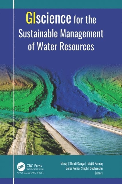
Water is one of the most critical resources of nature that is necessary for sustaining life for all living things. This volume discusses in detail a selection of geospatial approaches, tools, and techniques for understanding the root causes behind the degradation of our water resources.
Satellite remote sensing provides essential data for mapping water resources, hydrology flux measurement, monitoring drought, and flood inundation. With an abundance of informative case studies, this volume discusses the use of the satellite remote sensing and GIS-based systems for managing urban storm water; for flood and soil erosion management; for mapping groundwater zones; for crop production, including measuring soil moisture and aridity; for gauging the impact of climate change; for evaluating glacier change dynamics; for assessing the impact of urban growth on water resources; for measuring the degradation of rivers; and more.
2 337 kr
Läs direkt efter köp
Water is one of the most critical resources of nature that is necessary for sustaining life for all living things. This volume discusses in detail a selection of geospatial approaches, tools, and techniques for understanding the root causes behind the degradation of our water resources.
Satellite remote sensing provides essential data for mapping water resources, hydrology flux measurement, monitoring drought, and flood inundation. With an abundance of informative case studies, this volume discusses the use of the satellite remote sensing and GIS-based systems for managing urban storm water; for flood and soil erosion management; for mapping groundwater zones; for crop production, including measuring soil moisture and aridity; for gauging the impact of climate change; for evaluating glacier change dynamics; for assessing the impact of urban growth on water resources; for measuring the degradation of rivers; and more.
2 059 kr
Skickas inom 10-15 vardagar
2 286 kr
Läs direkt efter köp

2 286 kr
Läs direkt efter köp
2 540 kr
Skickas inom 11-20 vardagar

3 037 kr
Läs direkt efter köp
Geographic Information Science for Land Resource Management is a comprehensive book focusing on managing land resources using innovative techniques of spatial information sciences and satellite remote sensing. The enormous stress on the land resources over the years due to anthropogenic activities for commercialization and livelihood needs has increased manifold. The only solution to this problem lies in stakeholder awareness, which can only be attained through scientific means. The awareness is the basis of the sustainable development concept, which involves optimal management of natural resources, subject to the availability of reliable, accurate, and timely information from the global to local scales. GIScience consists of satellite remote sensing (RS), Geographical Information System (GIS), and Global Positioning System (GPS) technology that is nowadays a backbone of environmental protection, natural resource management, and sustainable development and planning. Being a powerful and proficient tool for mapping, monitoring, modeling, and managing natural resources can help understand the earth surface and its dynamics at different observational scales. Through the spatial understanding of land resources, policymakers can make prudent decisions to restore and conserve critically endangered resources, such as water bodies, lakes, rivers, air, forests, wildlife, biodiversity, etc. This innovative new volume contains chapters from eminent researchers and experts. The primary focus of this book is to replenish the gap in the available literature on the subject by bringing the concepts, theories, and experiences of the specialists and professionals in this field jointly. The editors have worked hard to get the best literature in this field in a book form to help the students, researchers, and policymakers develop a complete understanding of the land system vulnerabilities and solutions.
2 121 kr
Skickas inom 5-8 vardagar

2 441 kr
Skickas inom 5-8 vardagar
2 672 kr
Läs direkt efter köp
Overuse of natural resources results in environmental deterioration, lowering the effectiveness of important ecosystem services, such as the mitigation of floods and landslides. This leads to a greater risk of disaster and, in turn, natural hazards that can further deteriorate the environment. The deterioration of the capacity of the environment to meet social and ecological aims and demands is described as environmental degradation. This degradation and the concomitant reduction of ecosystems and their irreplaceable services (the benefits humans gain) are driving disaster risk. Changes to the environment can alter the frequency and intensity of risks, as well as our exposure and sensitivity to these hazards. Addressing these issues requires improvement of the capacity to perform short and medium-term operations in disaster management based on long-term environmental considerations. At the local level, minimizing environmental degradation and ecosystem loss involves awareness of the links between unsustainable development and poverty.
Communities are often driven to ruin their natural environment as a short-term coping mechanism for dealing with immediate issues; for instance, surviving a bad harvest by selling wood. Strategies for decreasing poverty by investing in environment-sensitive development should therefore support initiatives to minimize disaster risk and build resilience. There are common aspects in successful policies throughout various regions at the policy level, which extends to controlling climate change. Tools such as integrated water resources and coastal zone management, the removal of environmentally harmful subsidies, especially on fossil fuels and/or carbon taxes, renewable energy, marine protected areas, and cross-boundary biodiversity conservation, are all examples of policies used in more than one region but customized to each context. This scoping study finds and assesses available materials that relate environmental challenges and management with catastrophes and risk reduction activities in the Asia-Pacific area. This volume''s analysis relies on case studies, examples, and the results of questionnaires and interviews of practitioners and organizations operating in the environment, disaster, and development domains.
2 578 kr
Läs direkt efter köp
Overuse of natural resources results in environmental deterioration, lowering the effectiveness of important ecosystem services, such as the mitigation of floods and landslides. This leads to a greater risk of disaster and, in turn, natural hazards that can further deteriorate the environment. The deterioration of the capacity of the environment to meet social and ecological aims and demands is described as environmental degradation. This degradation and the concomitant reduction of ecosystems and their irreplaceable services (the benefits humans gain) are driving disaster risk. Changes to the environment can alter the frequency and intensity of risks, as well as our exposure and sensitivity to these hazards. Addressing these issues requires improvement of the capacity to perform short and medium-term operations in disaster management based on long-term environmental considerations. At the local level, minimizing environmental degradation and ecosystem loss involves awareness of the links between unsustainable development and poverty.
Communities are often driven to ruin their natural environment as a short-term coping mechanism for dealing with immediate issues; for instance, surviving a bad harvest by selling wood. Strategies for decreasing poverty by investing in environment-sensitive development should therefore support initiatives to minimize disaster risk and build resilience. There are common aspects in successful policies throughout various regions at the policy level, which extends to controlling climate change. Tools such as integrated water resources and coastal zone management, the removal of environmentally harmful subsidies, especially on fossil fuels and/or carbon taxes, renewable energy, marine protected areas, and cross-boundary biodiversity conservation, are all examples of policies used in more than one region but customized to each context. This scoping study finds and assesses available materials that relate environmental challenges and management with catastrophes and risk reduction activities in the Asia-Pacific area. This volume''s analysis relies on case studies, examples, and the results of questionnaires and interviews of practitioners and organizations operating in the environment, disaster, and development domains.
2 990 kr
Läs direkt efter köp
This book is essential for anyone interested in understanding and implementing sustainable resource development strategies, as it covers the crucial first stage of assessing resource availability and condition, along with the use of modern geospatial technologies such as remote sensing, GIS, and GPS for surveying, mapping, and monitoring various resources for global environmental protection and sustainable development.
The first step in developing a sustainable resource strategy is assessing the availability and condition of resources. This involves evaluating baseline levels, identifying trends, and understanding their consequences. Mitigation policies are then developed based on this assessment. Modern geospatial technologies like Remote Sensing (RS), Geographic Information Systems (GIS), and Global Positioning Systems (GPS) offer powerful tools for surveying, mapping, and monitoring both renewable and nonrenewable resources. These technologies support global environmental protection, disaster management, and sustainable development by providing repetitive and global data. GPS provides accurate geographic coordinates, while GIS allows visualization, analysis, and decision-making through spatial data, enabling the study of complex environmental and natural resource challenges at various scales.

2 499 kr
Kommande
1 961 kr
Skickas inom 10-15 vardagar
1 514 kr
Skickas inom 10-15 vardagar
1 416 kr
Läs direkt efter köp
South Asia, harboring the complex Himalayan terrains, has over one-fifth of the world’s population and is recognized as the most hazard-prone region of the world. The exponential increase in population with the consequent pressure on natural resources and continued high rates of poverty and food insecurity also makes this region the most vulnerable region to hazards in the world as far as the impacts of climate change are concerned.
Over the last century, the climatic trends in South-Asia have been observed to be characterized by increasing air temperatures and an increasing trend in the intensity and frequency of extreme events. IPCC (2014) has reported that the Himalayan highlands shall face significant warming over the next century. The increasing frequency of natural hazards due to the impacts of climate change in the Himalayas calls for efficient management and policymaking in these regions, which can only be implemented by the local governments through an established science-based robust action plan.
This edited volume focuses on the management of natural hazards using innovative techniques of spatial information sciences and satellite remote sensing. It contains chapters from eminent researchers and experts in the field of hazard management, remote sensing, and GIS. The primary focus of this book is to replenish the gap in the available literature on the subject by bringing the concepts, theories, and practical experiences of the specialists and professionals in this field together in one volume to help students, researchers, and policymakers to address issues concerning management and policy implications of natural hazards in the complex Himalayan region.

1 083 kr
Skickas inom 10-15 vardagar
1 837 kr
Skickas inom 10-15 vardagar
2 366 kr
Läs direkt efter köp
"Nature''s Fury: Navigating Natural Hazards in Mountainous Topographies" shall be a comprehensive guide to the unique challenges and hazards associated with mountainous regions, and the efforts being made to mitigate their impact. The book shall provide a detailed overview of natural hazards such as earthquakes, landslides, avalanches, and flash floods, and explores their impacts on communities and the environment. It would delve into the science of risk assessment and vulnerability analysis, and shall offer practical insights into mitigation strategies such as early warning systems, evacuation plans, and disaster response efforts. The book will also explore the role of technology and predictive modeling in mountain hazards management, and the relationship between mountain hazards and climate change.
With realworld examples and case studies from the Himalayas, the Andes, and the Rockies, the book shall provide a comprehensive examination of the field of mountain hazards management. It will cover community-based disaster management and preparedness, environmental conservation and sustainable development, and the balancing of tourism and conservation in mountainous regions. The book will also include lessons learned from major mountain disasters, and the importance of international cooperation in mountain hazards management.
It would cater wide audience including professionals in the field of disaster management, an environmental scientist, or even an enthusiast of mountain landscapes. We propose to have an engaging writing style and practical insights in this book, that will provide a valuable resource for anyone interested in navigating the unique challenges and hazards of mountainous topographies.
IoT-Based Models for Sustainable Environmental Management
Sustainable Environmental Management
1 622 kr
Skickas inom 10-15 vardagar
2 049 kr
Läs direkt efter köp
This book is a testament to the dynamic intersection of environmental responsibility and the applications of IoT-based models for reader.The applications of IoT-based models, ranging from environmental sustainability and the impact of environmental pollution to human health, sustainable production, and conservation of natural resources, have long grappled with the challenges posed by waste management. It provides:
A transformative solution.Sustainability and efficiency of earth protection operations.New ideas with global views and state-of-the-art results and fosters a culture of environmental stewardship.The book evaluates the environmental, economic, and social impacts of new technologies, shedding light on their potential to transform environmental facilities into models of sustainability. It provides valuable information on best practices, case studies, and practical guidance for integrating new models for environment sustainability. By addressing the varied needs of these stakeholders, it facilitates informed decision-making and promotes sustainable development with global perspectives. It will also serve as a valuable reference, inspiring innovation, fostering collaboration, and driving progress in the application of IoT technologies in environment sustainability.

1 862 kr
Kommande