
Visar resultat för..."Imray, Laurie, Norie & Wilson Ltd"
154 produkter
154 produkter
Häftad, Engelska, 2023
339 kr
Skickas
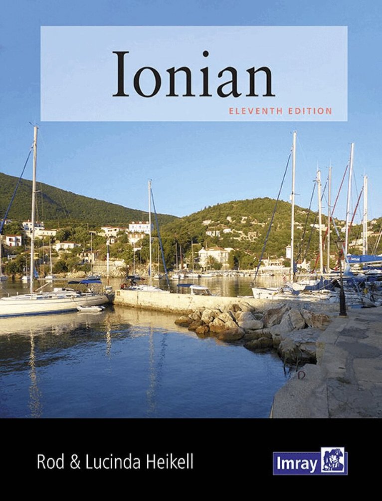
Like its companions West Aegean and East Aegean, Ionian is ideal for charterers and flotilla sailors who are onboard for a relatively short time, but also for longer term cruisers on their own yachts who are looking for additional pilotage and background information for this popular cruising ground. As with all the Heikell guides, Ionian not only gives all the essential information you need but also exudes the charm and flavour of this corner of the Mediterranean. 'Heikell's style is easy to digest and gives pleasure in the details of the history, geography and social circumstances of the places described as well as the essential sailing information.' The Little Ship 'This book, as well as being a practical manual on Ionian cruising, seems to have absorbed much of the author's personal feelings regarding the charm which draws him back to it, and any reader who has had a whiff of the magic spell of the Greek islands will sense this, and inevitably renew the resolve to return and experience it once again in greater measure.' Nautical Magazine 'Rod Heikell nowadays is to the Mediterranean as gin is to tonic. It is difficult to imagine sailing there without one of his guides. Clear pilot notes, chartlets and plentiful illustrations, with entertaining commentaries on each place. Up-to-date observations on local and national regulations. The new edition does not disappoint. If one must choose, I would have no hesitation in recommending Heikell.' Cruising Association 'Rod has a knack for dropping in snippets of interest and colour to give the reader a feel for the atmosphere of each port or bay.' Yachting Monthly 'Like all Rod Heikell's pilots, it is also a travel guide in its own right.' Ionian Magazine 'The sailing directions are particularly useful when entering the smaller anchorages and harbours, for which little information is to be found on charts, and include excellent harbour plans and top quality aerial photographs.' Flying Fish Magazine (Ocean Cruising Club)
186 kr
Skickas
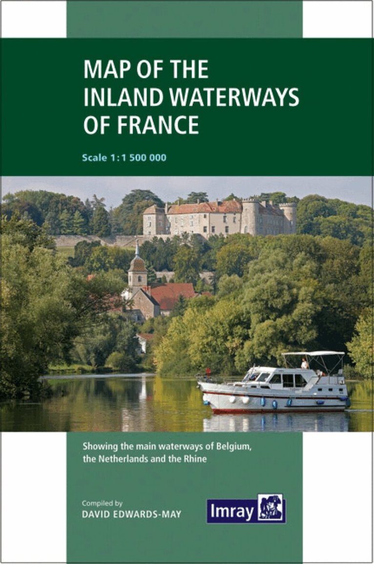
First published in the 1950s under the editorship of EE Benest and later Konrad Nussbaum, the Imray map of the French inland waterway system has always been regarded as the essential reference for planning a visit to France by boat. It is now superseded by this completely recompiled and redrawn edition by David Edwards-May, the leading authority on World canals and waterways. The new cartography includes improved detail and presents essential information concerning distances and dimensions with a greater clarity than on previous editions. The map continues to cover the Low Countries and the western part of Germany and now also includes large scale insets of the Paris region and northeast France. The scale remains at 1:1 500 000
Häftad, Engelska, 2025
440 kr
Skickas
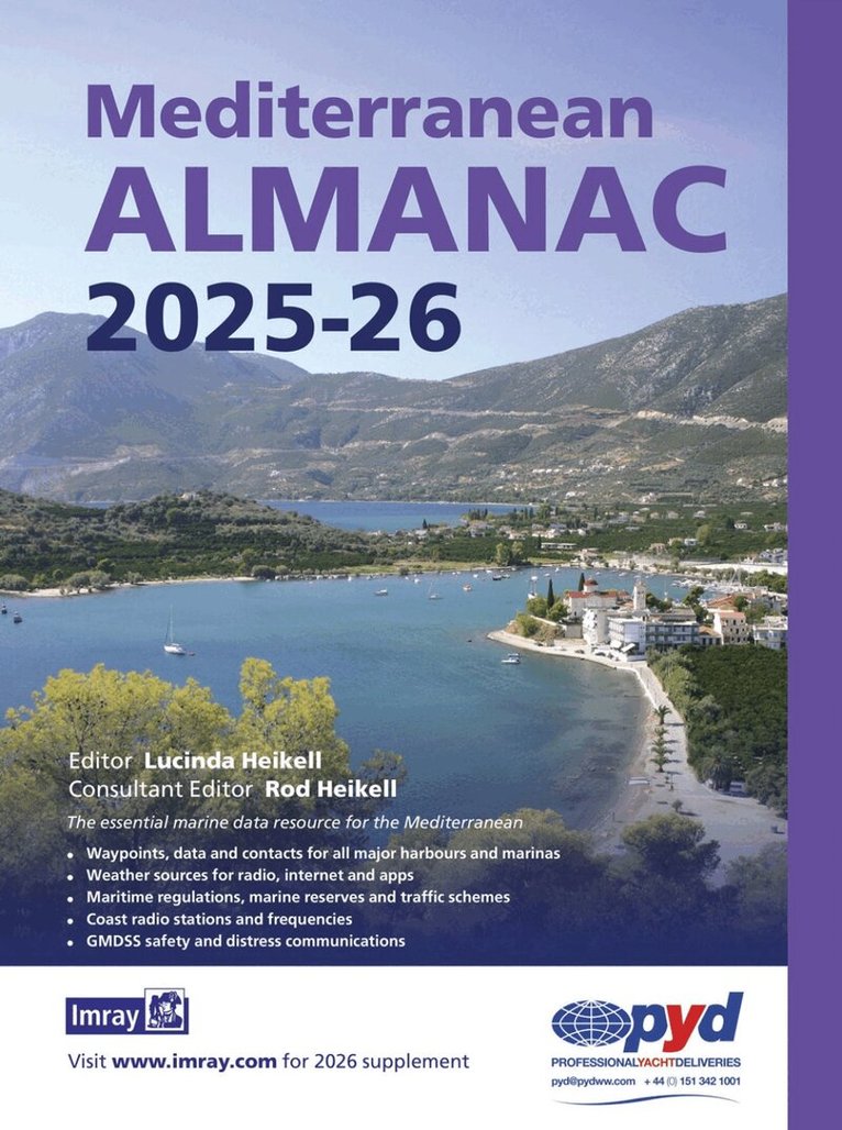
The essential marine data resource for yachts sailing the Mediterranean, the Imray Mediterranean Almanac is published biennially with updates available in a downloadable supplement at the end of the first year. It includes: Data, waypoints and contacts for all major harbours and marinas throughout the Mediterranean Sea plus Atlantic Islands Weather sources for radio, internet and apps Information on lights and buoys Maritime regulations, marine reserves and traffic schemes Coast radio stations and frequencies GMDSS safety and distress communications Harbour plans throughout, with the familiar Imray cartography which adds clarity to their use. There are the usual detailed revisions throughout this edition, plus many new harbour plans.
Häftad, Engelska, 2021
274 kr
Skickas
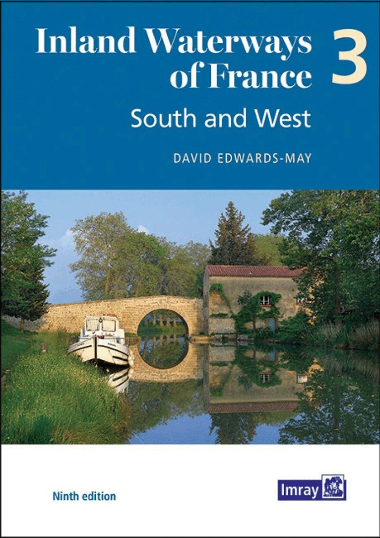
The ninth edition of Inland Waterways of France is the ideal guide for planning cruises in and through the most fascinating and diverse waterway network in Europe. Author David Edwards-May has researched the many changes that have taken place during the last 10 years, and presents a detailed overview of the waterways extending throughout the South ('Midi'), the Southwest and Western France. This system totals 3000 kilometres of waterways that are maintained and developed almost exclusively for recreational navigation. This third volume of the new edition sets out the current state of the network in 146 pages in full colour, with detailed maps of junctions and other key sites on the network, overview maps for each waterway, and route descriptions. It is a unique blend of practical information, maps, background historical notes and colour photographs. It also highlights ongoing waterway restoration projects, in which the author has been personally involved for many years.
Inbunden, Engelska, 2025
699 kr
Skickas
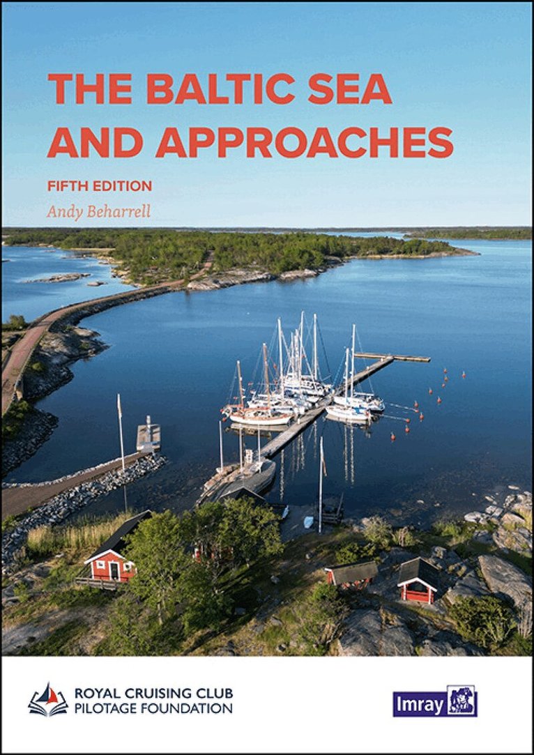
This comprehensive volume provides an overview of the Baltic Sea and its approaches from the west for cruising sailors. Thoroughly overhauled by editor Andy Beharrell, much of the text has been rewritten since the last edition, with useful photos and detailed plans updated throughout. The nine countries bordering the Baltic Sea offer an immense variety of cruising grounds, people and cultures. There are thousands of harbours and innumerable anchorages. The information contained in this book provides edited highlights chosen for their value both at the planning stages and again on arrival, when a general overview of each individual country is followed by specific harbour information. Where detailed cruising information is readily available - effectively Germany, Denmark, Sweden and Finland - only selected harbours are covered, chosen, with a few exceptions, as fulfilling certain key needs. Where cruising information is more limited - Poland, Kaliningrad, Lithuania, Latvia, Estonia and Russia - many smaller harbours are also featured in detail. Beautiful, secluded anchorages, picturesque canals, bustling marinas, dramatic cities - all await those considering a Baltic cruise.
Inbunden, Engelska, 2022
756 kr
Skickas
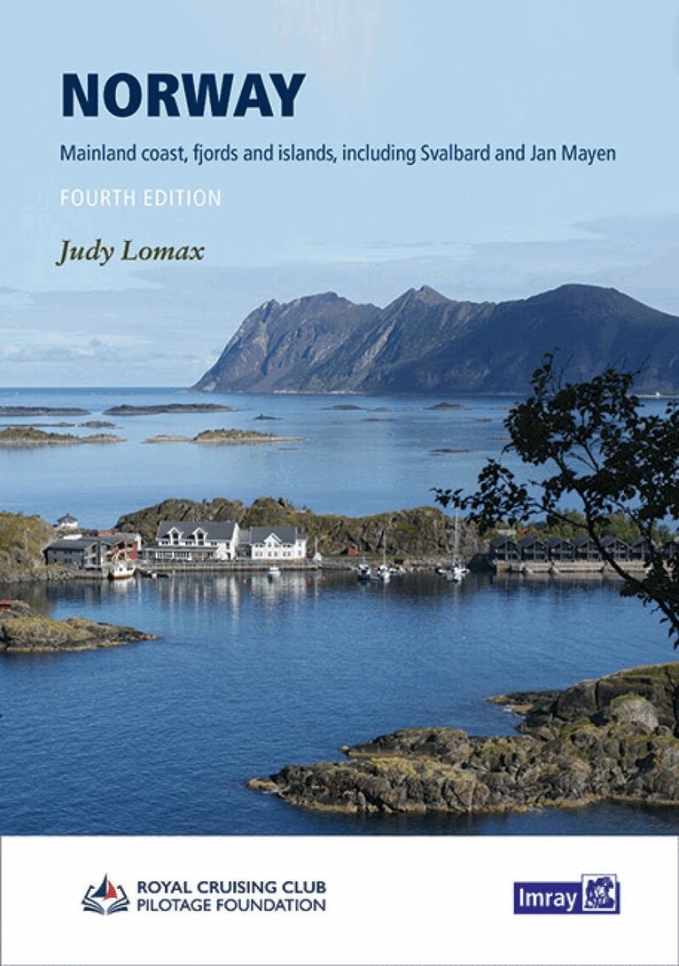
This well-established cruising guide covers the coast of Norway northwards from the Swedish border in the Skagerrak around the North Cape to the Russian border. It includes coverage of the Lofoten and Vesterålen islands, the Arctic archipelago of Svalbard and the remote volcanic island of Jan Mayen. Author Judy Lomax continues to sail this beguiling coastline of majestic fjords and multiple islands and uses her extensive network of contacts, built up over more than 30 years, to help monitor changes in the region. This fourth edition incorporates numerous updates to her previous work and expands on the detail for some areas such as the Oslo Fjord and the Telemark Canal. There is a wealth of new photographs and revised Imray plans throughout. Whether you are on a private vessel or one of the many ships cruising this stunningly beautiful region, Norway is a trusted and proven companion. 'Any yachtsman even contemplating a visit to this loveliest of cruising areas could be considered negligent if he did not buy this book'. - RHR, Cruising '...The author finds it difficult to avoid superlatives when talking about Norwegian scenery. I find it equally difficult to avoid superlatives when talking about this book. I am impressed. Also most Norwegians may learn a lot of facts from this excellent book. This will remain a classic, and will come in new editions in the foreseeable future...' Customer feedback 'For anyone sailing in Norwegian waters this book is an absolute must. It is the perfect example of a truly excellent pilot from which practically nothing can be found missing.' Christine Holroyd, Cruising Association magazine.
Inbunden, Engelska, 2023
639 kr
Skickas
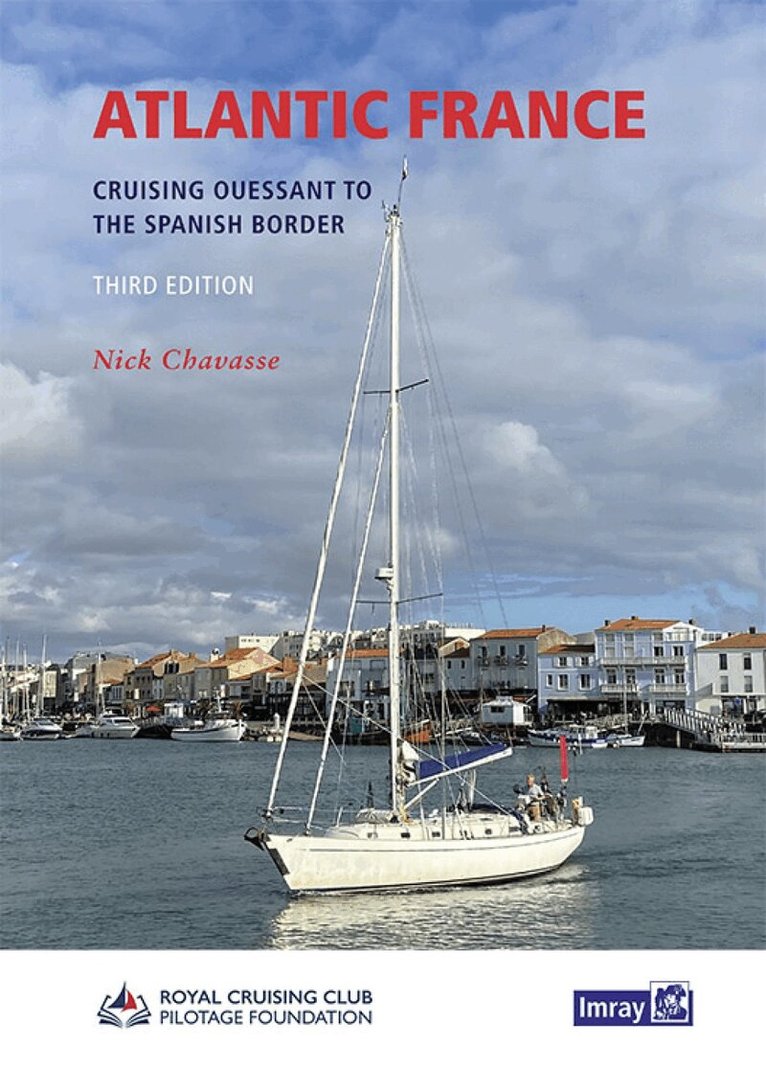
From Ouessant in the north to Hendaye on the Spanish border, the third edition of this comprehensive sailing guide to the Atlantic coast of France has, once again, been thoroughly revised and updated by Nick Chavasse aboard his Bowman 40, Wild Bird. His coastal explorations have taken him over drying causeways and under mast-height bridges, up tranquil rivers and around sand-strewn islands and this first-hand familiarity is evident in the extent and depth of coverage. Plans have been revised and updated throughout and there are numerous new photographs to help the navigator identify key features. Atlantic France is the authoritative cruising guide for this most popular coastline of historic ports and idyllic anchorages with its sometimes-challenging tides, currents and pilotage.
Inbunden, Engelska, 2023
642 kr
Skickas
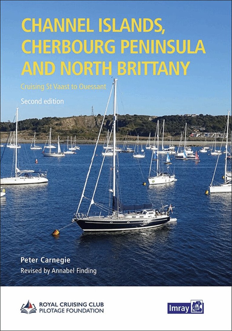
This revision of the RCC Pilotage Foundation''s pilot updates the combined volume for this area which encompasses the Channel Islands and extends from St Vaast La Hougue on the east of the Cherbourg peninsula, and works westwards along the Normandy and Brittany coasts to Ouessant. Coverage includes the Plateau des Roches Douvres as well as detailed sections on the navigable rivers. The navigator benefits enormously from the painstaking approach with which Peter Carnegie has documented his own explorations of these, his home waters. His numerous annotated photographs and the many accompanying charts detail the network of transits between the off-lying rocks and islands of the region. Waypoints are used judiciously to further inform, but the emphasis remains on time-proven and trusted methods of safe navigation in these waters of high tidal range and fast-moving currents. The Channel Islands, Normandy and Brittany coasts can seem a daunting sailing area for those unaccustomed to their ways, but 'Carnegie's book provides reassurance and so much practical advice that anyone using it will feel confident of success.'' (Yachting Monthly). It is the definitive pilot for anyone interested in the challenge of exploring the less frequently used passages and anchorages.
Engelska, 2023
325 kr
On this edition the chart specification has been improved to show coloured light flashes. There has been general updating throughout.
Inbunden, Engelska, 2024
665 kr
Skickas
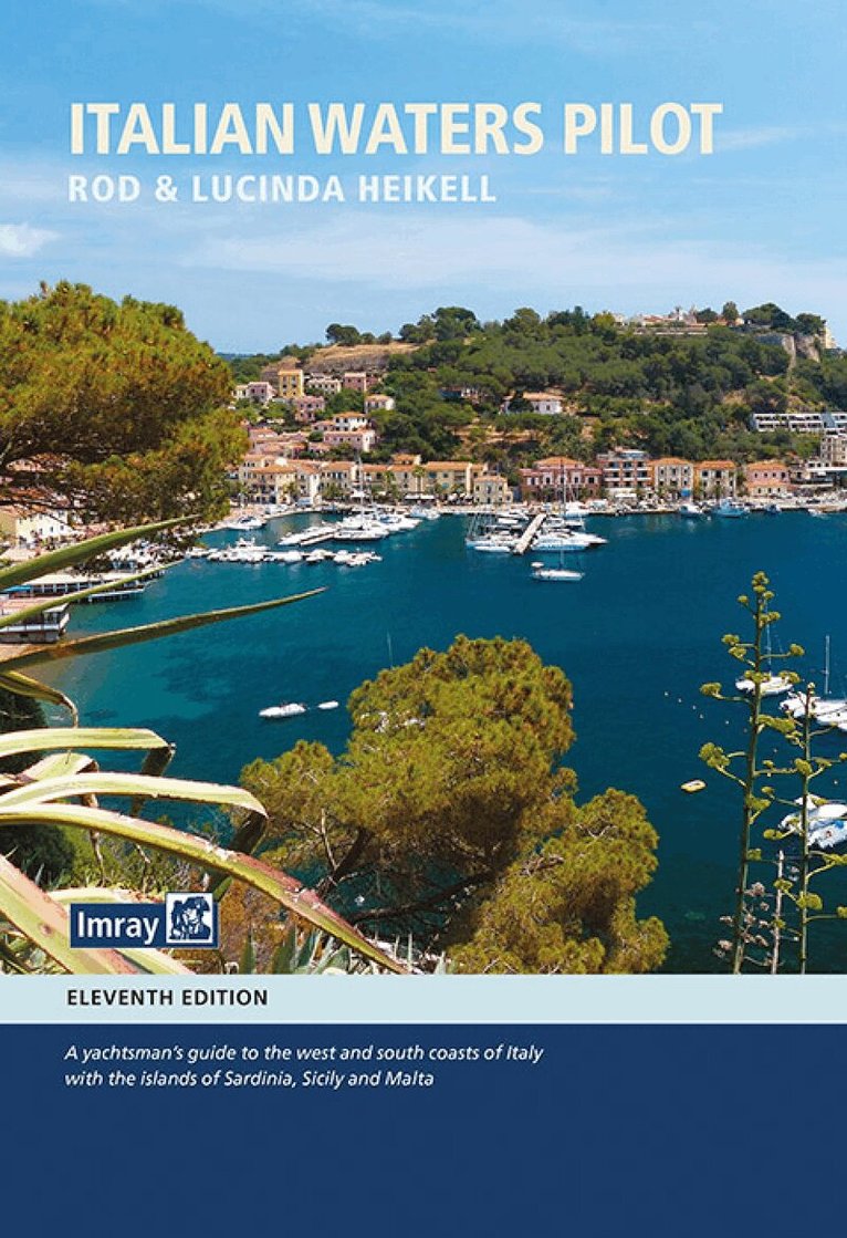
Italian Waters Pilot is the only guide for yachtsmen in English that covers the coasts of the Ligurian and Tyrrhenian Seas, Sardinia, Sicily, the Ionian ''heel'' and Malta in one volume. This new eleventh edition has numerous updates throughout, with contact details, plans and text undergoing a thorough revision. Care has been taken to research the details of marina developments. Where available, information is given on proposed changes and extensions to yacht harbours. Marine reserves are an important feature of the coasts and off-lying islands, particularly in Sardinia and Sicily, and this edition provides updated details of the latest regulations. Climate change and extreme weather events are becoming a major issue and this edition includes a section on the how climate change might affect sailing in the Mediterranean. Italian Waters Pilot is the last word on the area for yachts cruising there and on their way between western and eastern parts of the Mediterranean. Rod and Lucinda Heikell have also authored companion guides on France, Greece and Turkey which are acclaimed as the best pilot books currently available. Recommended by the Royal Cruising Club and The Cruising Association.Amazon customer reviews:We sail the Med summers and keep the Heikells' pilot books by our side. We update them as they are published. Last summer we sailed to Italy and consider his books a necessary part of both our planning and charting. Can't do without them! PHThe Heikells have produced a very informative volume again. Great details of coast and up to date marina details. A must if you are sailing in the area. IBIdeal for our purposes. Detailed with useful comments about weather, safety, services, officials, eating and drinking ashore. CIt not only provides the necessary information for the sailor but also gives the most interesting local and historical information. A most interesting book. CC
Inbunden, Engelska, 2008
439 kr
Skickas
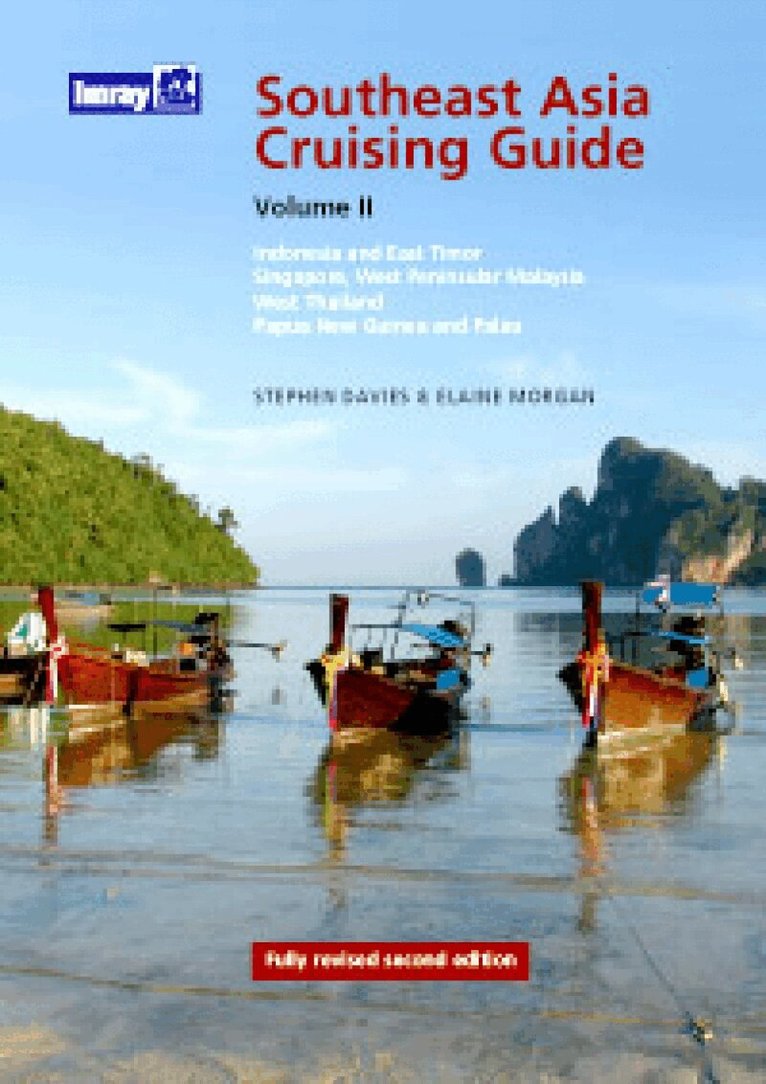
This is the first of the two-volume set of the Southeast Asia Cruising Guide to reach a second edition. It is the only guide that covers the entire length and breadth of a region frequently visited by round-the-world sailors, many of whom leave Australia to head west. This edition concentrates on the most frequented routes and includes the most popular stops. There are hundreds of possible anchorages, the most popular of which are usefully summarised in tables. Introductory sections cover planning and the last part of the book deals with more general topics including advice on provisioning and the problems that are often faced by cruisers. Stephen Morgan and Elaine Davies first arrived in the region over 30 years ago. They work in Hong Kong; Stephen Davies as Director of the Hong Kong Maritime Museum and Elaine Morgan as a writer and editor. While this pilot is aimed at yachtsmen and indeed was surveyed from the Davies/Morgan yacht, it is just as relevant to the commercial or military mariner. The part of the world described in this work is one of the most interesting on our planet. Culturally, scenically, climatically and commercially; it has everything. This excellent book ? now in its second edition, describes it all very enticingly. Set to the usual high standard of the Imray pilots that precede it, this one is spiced up by the wit and anecdotes the authors are so good at.
Inbunden, Engelska, 2023
594 kr
Skickas
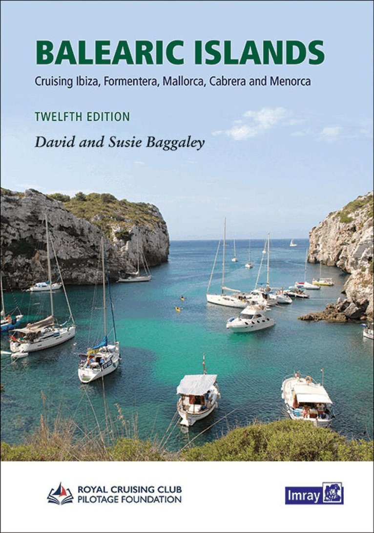
The twelth edition of this renamed popular title covers Ibiza, Formentera, Mallorca, Cabrera and Menorca. The only fully comprehensive pilot guide to the Spanish islands in English, Balearic Islands offers guidance and information to yacht charterers or cruising sailors looking to explore this popular cruising ground. It's been revised and updated for the Royal Cruising Club Pilotage Foundation by David and Susie Baggaley, whose Beneteau 42, Kookaburra was based in Addaya, Menorca for several years. The authors share their knowledge enthusiastically and authoritatively, offering a taste of the culture of the Balearics with information about the islands as a destination alongside in-depth data on the marinas, ports, and delightful 'cala' anchorages for which the islands are so popular, The introductory sections contain detail on regulations, marine reserves and environmental concerns, climate, weather and practical considerations for yachts, both mono- and multi-hull. Imray chartlets have been updated throughout. There are also many attractive new photographs which are informative to the navigator.
Häftad, Engelska, 2022
476 kr
Skickas
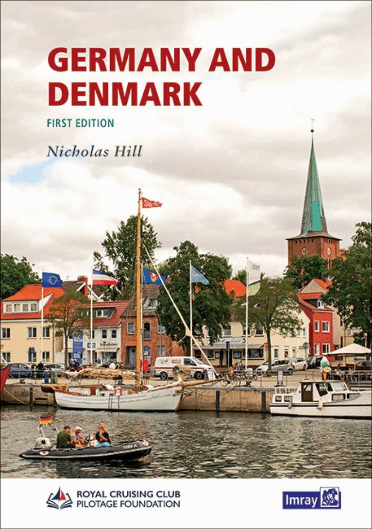
This new Royal Cruising Club Pilotage Foundation title is the successor to Brian Navin?s cruising guide to the area, covering the exposed North Sea coasts and the more protected Baltic Sea coasts of both Germany and Denmark. Coverage has been updated and expanded from specific routes to a comprehensive sequence of ports and anchorages along each area of coast, with introductory information about places of interest to visit ashore. Author Nicholas Hill cruised the region extensively for many years and has enriched the text with new photographs throughout. Plans include up to date hydrographic data for both German and Danish waters. This cruising guide is an ideal companion for those who plan to explore the more challenging, shifting coastline of the North Sea and the comparatively gentle and intricate indentations and archipelagos in the entrance to the Baltic. It is also a useful resource for anyone on a more direct passage through to the Baltic Sea proper. Germany and Denmark is one of the best new pilot guides for this area of the Baltic, and should be essential reading for anyone choosing to cruise there. [Nicholas Hill] writes with sensitivity and appreciation skilfully conveying a feeling for the essential characteristics and individualities of this area. The choice of photographs and their captioning is outstandingly good. These are working photos giving clear visitor guidance, just as they should in a pilot book this admirable volume should facilitate the pleasure and safety of cruising yachtsmen for many years to come. Yachting Monthly
Inbunden, Engelska, 2023
633 kr
Skickas
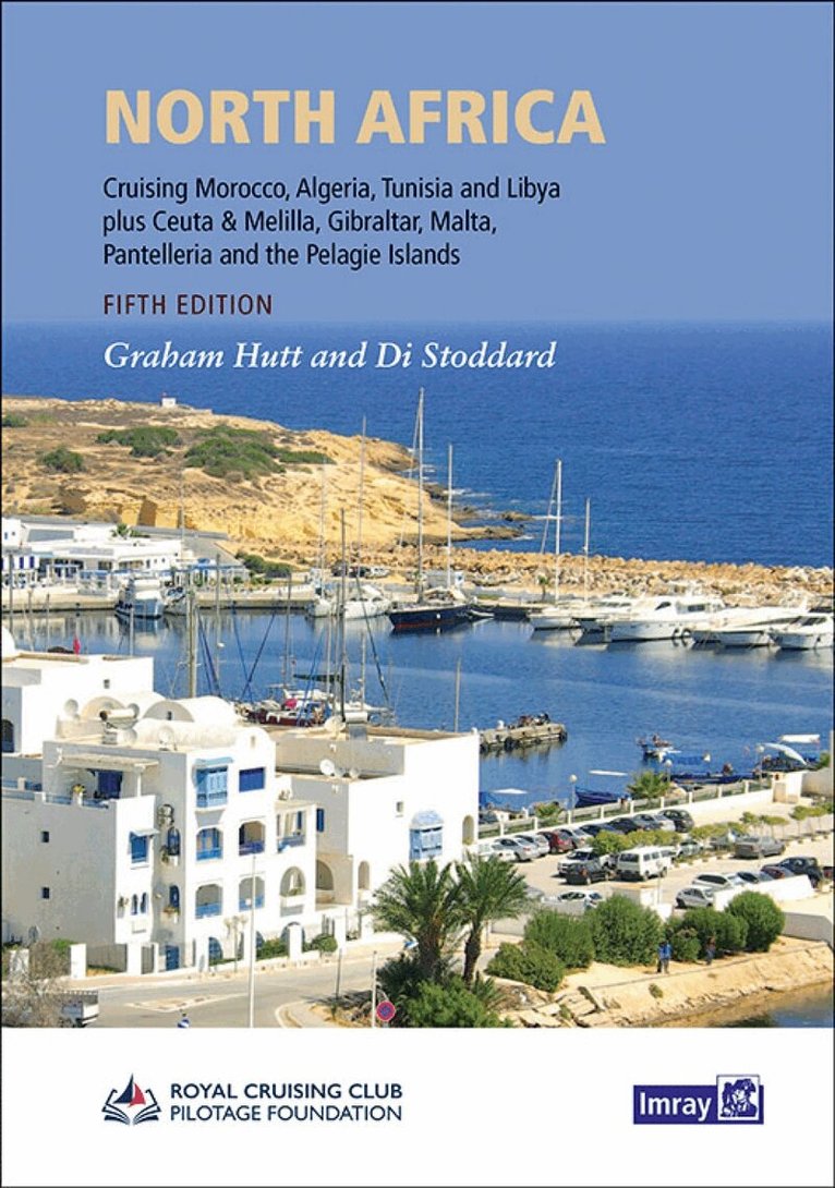
Di Stoddard has worked with Graham to update this fifth edition. This comprehensive guide provides detailed information on marinas, harbours and anchorages as well as introductory sections covering topics specific to the area, including the modernised formalities in most ports. In several locations new harbours have opened and facilities have markedly improved. Familiar Imray cartography is included throughout; harbour plans have been updated and extended to reflect changes, and many new photographs are included to assist navigation and inform the reader about this most beguiling region. Whether overwintering or on passage across the Mediterranean or down the Atlantic coast, North Africa is an essential cruising companion.
Häftad, Engelska, 2025
472 kr
Skickas
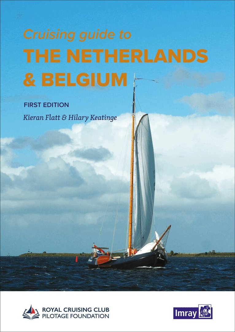
Cruising Guide to the Netherlands and Belgium is a new first edition from the Royal Cruising Club Pilotage Foundation, building on Brian Navin's popular guide which was regarded as the authoritative companion for anyone cruising the Netherlands using fixed mast routes. The new guide provides a comprehensive overview and pilotage of the coastal ports and the mast-up routes through the heart of the Netherlands. Coverages stretches from Nieuwpoort in Belgium via the Rhine-Maas-Schelde Delta, up the coast of Holland and into the stunning cruising grounds of the Waddenzee to the border with Germany. Additionally, an edited selection of inland routes for yachts covers the rivers and canals of north and south Holland, Friesland and Groningen. The marinas, ports, and waterways of the IJsselmeer, Markermeer and Randmeren complete the volume. The authors Kieran Flatt and Hilary Keatinge look in extensive detail at the practicalities, culture, and history of the countries, and have illustrated the guide with excellent photographs. Familiar Imray chartlets provide useful guidance. A must for anyone exploring these countries for the first time, or for frequent visitors.
Inbunden, Engelska, 2020
863 kr
Skickas
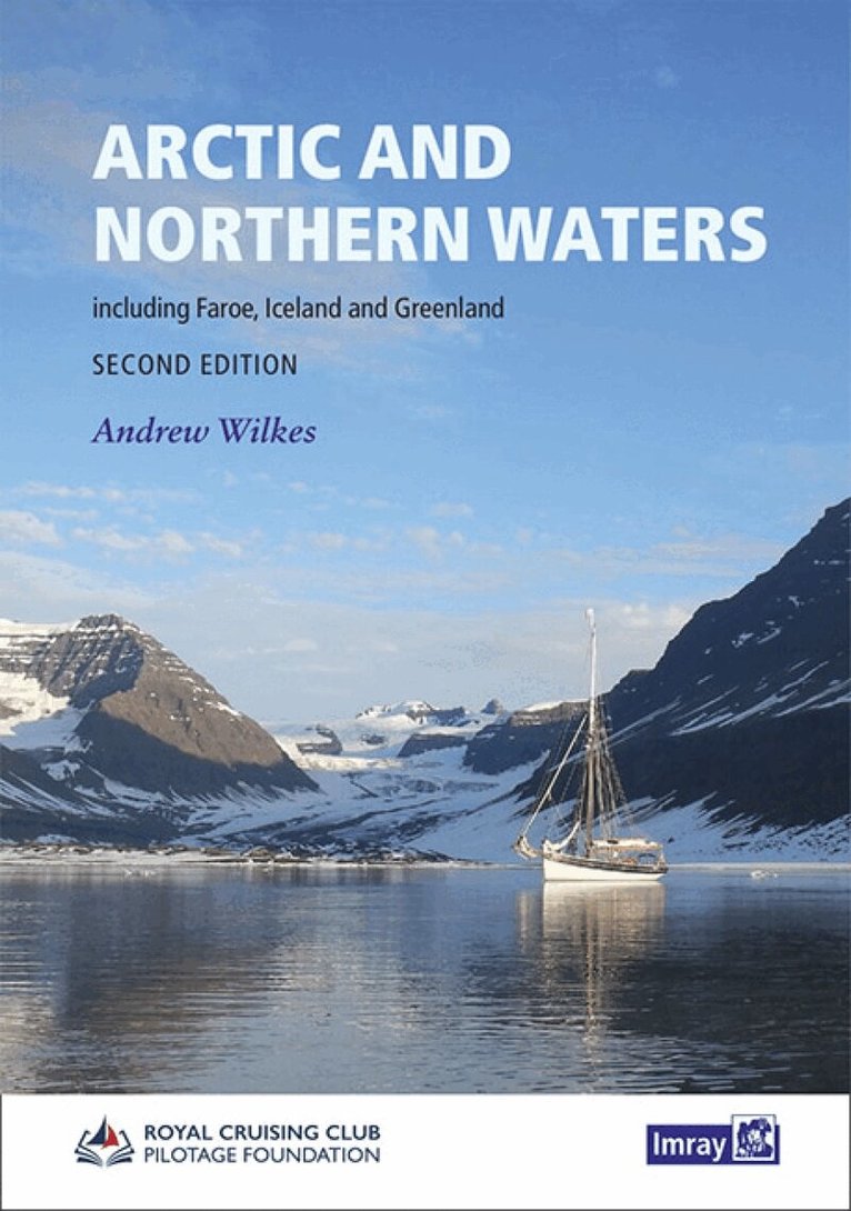
This handbook from the RCC Pilotage Foundation, covers the Northwest and Northeast Passages through the Arctic Ocean as well as Faroe, Iceland and Greenland. Incorporating information collected on a number of voyages over recent years this work is an impressive resource which brings together experience and background Digital on a region that is not only in the news but increasingly accessible to cruising yachts. Arctic and Northern Waters is in the same style as other PF pilots and is a practical cockpit reference as well as a source of inspiration for planning. This second edition contains revisions and additional information, some of which was previously published in the annual supplement. There are new photographs and harbour plans. ...'Thank you very much for this invaluable reference work! ... it's astonishing the amount of information in it - I wish that everyone who is going to the areas covered would have a copy of it! The extent of the work that went into it is amazing...' Peter Semotiuk- Northwest Passage 'guru' 'All the information required for Arctic navigation is here in one volume. A comprehensive and exceptionally well presented and illustrated book.' OCC Flying Fish Magazine 'For armchair voyagers, it's a compelling volume that takes the reader into waters that few will travel- for those who go there this is essential reading.' Irish Cruising Club Magazine Of the first edition, 'The reviewer cannot recommend this volume strongly enough to anyone intending to venture to these waters.' John Andrews, Cruising Association Magazine
Inbunden, Engelska, 2020
602 kr
Skickas
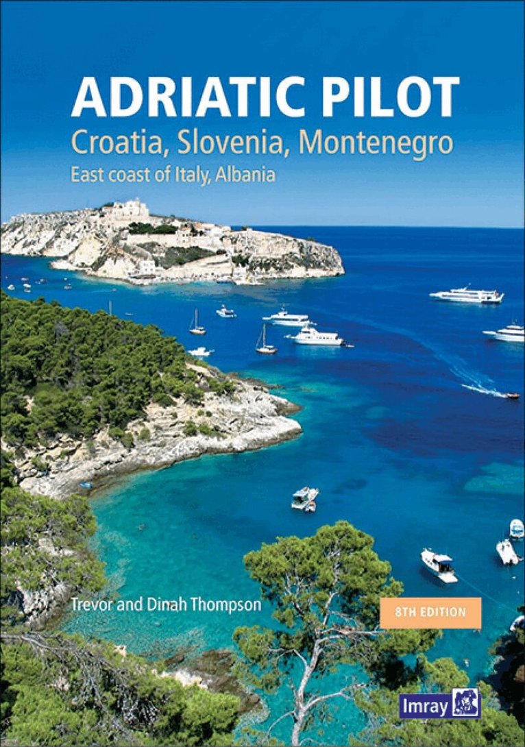
In publication for over thirty years, Adriatic Pilot remains the only single volume to cover the whole region, from Albania and the heel of Italy in the south to Venice and Slovenia in the north. The ever-popular cruising ground of Croatia is covered extensively in four separate chapters. This 8th edition has been fully revised to include new information on marinas, visitor moorings and anchorages, with all the attendant facilities available to cruising sailors. There is also plenty to give historical context and to whet the appetite for visits and exploration ashore. Plans have been updated throughout. Numerous photographs help to orientate, inform and inspire, including a new set of images for the Italian coast and Venice lagoon. For occasional charterers or long-term cruisers alike, Trevor and Dinah Thompson's thorough and comprehensive work should be the first choice of any cruising sailor wanting to make the most of this rich and diverse coastline.
Engelska, 2024
343 kr
Skickas
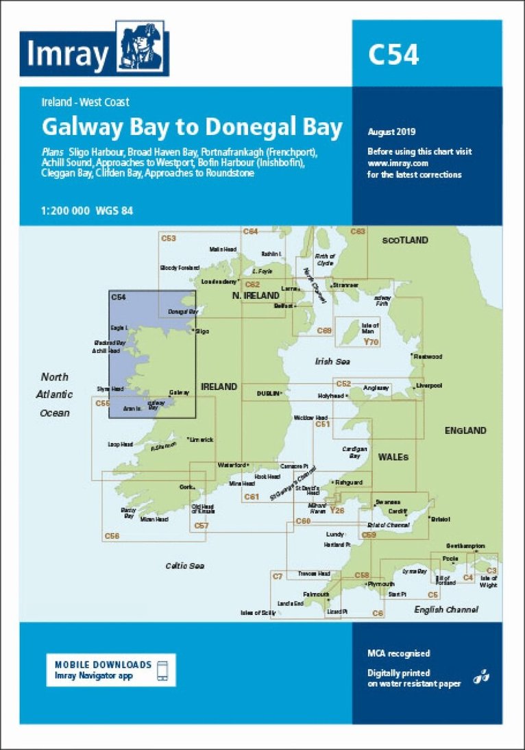
Plans included: Sligo Harbour (1:70 000) Broad Haven Bay (1:75 000) Portnafrankagh (Frenchport) (1:25 000) Achill Sound (1:70 000) Approaches to Westport (1:45 000) Bofin Harbour (Inishbofin) (1:20 000) Cleggan Bay (1:50 000) Clifden Bay (1:75 000) Approaches to Roundstone (1:50 000) On this edition the chart specification has been improved to show coloured light flashes. Depths have been updated from the latest surveys where available. The inset plan of Broad Haven Bay has been extended east to include Ross Port. There has been general updating throughout.
339 kr
Skickas
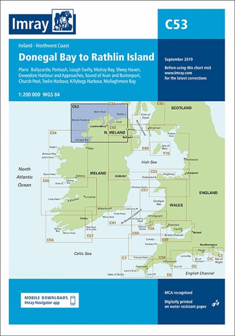
Plans included: Ballycastle (1:5000) Portrush (1:15 000) Lough Swilly (1:45 000) Mulroy Bay (1:30 000) Sheep Haven (1:30 000) Gweedore Harbour and Approaches (1:40 000) Sound of Aran and Burtonport (1:30 000) Church Pool (1:20 000) Teelin Harbour (1:10 000) Killybegs Harbour (1:12 500) Mullaghmore Bay (1:50 000) On this edition the chart specification has been improved to show coloured light flashes. Depths have been updated from the latest surveys where available. New plans of Ballycastle and Church Pool are now included. There has been general updating throughout.
Engelska, 2024
342 kr
Skickas
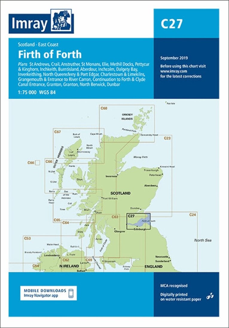
Plans included: St Andrews (1:7500) Crail (1:7500) Anstruther (1:7500) St Monans (1:7500) Elie (1:10 000) Methil Docks (1:11 000) Pettycur & Kinghorn (1:17 500) Inchkeith (1:25 000) Burntisland (1:20 000) Aberdour (1:12 500) Inchcolm (1:15 000) Dalgety Bay (1:15 000) Inverkeithing (1:15 000) North Queensferry & Port Edgar (1:20 000) Charlestown & Limekilns (1:15 000) Grangemouth & Entrance to River Carron (1:17 500) Continuation to Forth & Clyde Canal Entrance (1:17 500) Granton (1:12 500) Fisherrow (1:12 500) North Berwick (1:7500) Dunbar (1:7500) On this edition the chart specification has been improved to show coloured light flashes. Depths have been updated from the latest surveys where available. Additional tidal stream Digital has been added. There has been general updating throughout.
342 kr
Skickas
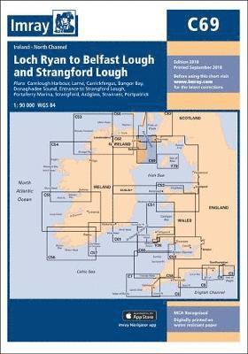
Plans included: Carnlough Harbour (sketch plan) Larne (1:18 500) Carrickfergus (1:15 000) Bangor Bay (1:17 500) Donaghadee Sound (1:25 000) Entrance to Strangford Lough (1:37 500) Portaferry Marina (1:7500) Strangford (1:5000) Ardglass (1:15 000) Stranraer (1:12 500) Portpatrick (1:6000) On this 2018 edition the chart specification has been improved to show coloured light flashes. Depths have been updated from the latest surveys. The Marine Nature Reserve in Strangford Lough is included. There has been general updating throughout.
Engelska, 2024
339 kr
Skickas
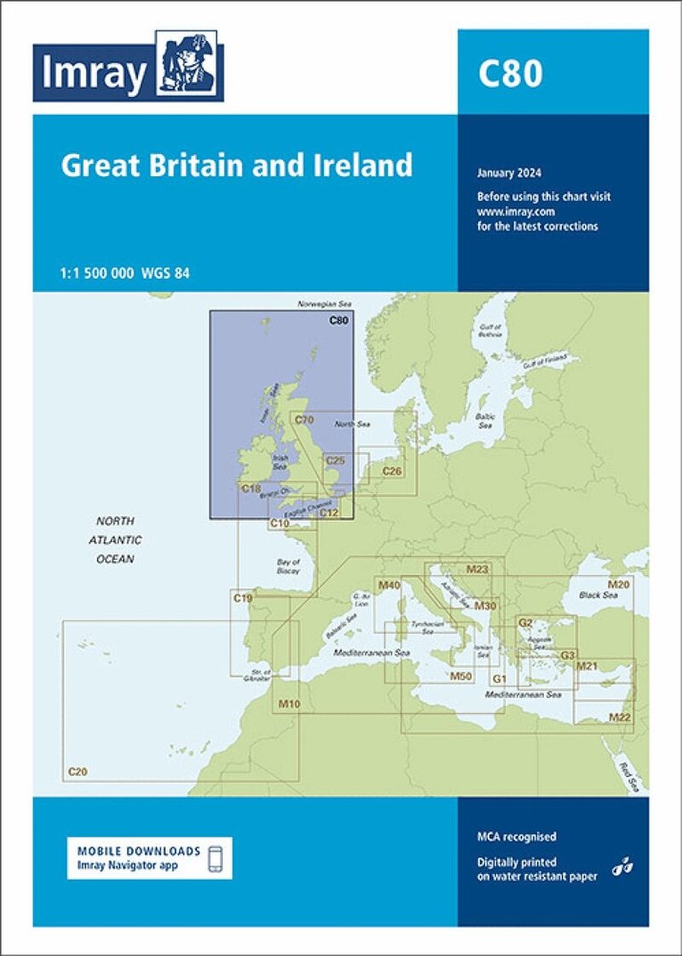
Handy for planning round-Britain circumnavigations, chart C80 British Isles provides an overview of Britain, Ireland and adjacent islands including Orkney and Shetland. On this edition the magnetic variation curves have been updated with 2020 Digital. There has been general updating throughout.
110 kr
Skickas
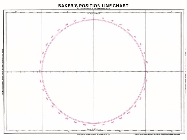
For plotting a vessel's position to a tenth of a mile.

Häftad, Engelska, 1995
217 kr
Skickas
Imray Laurie Norie & Wilson Ltd was formed in 1904 when three private chart publishing firms amalgamated. Each of these London companies had a long history going back to the mid-18th century. James Imray and Son published an extensive list of charts and pilot books. RH Laurie and Sons was associated with charts published for the East India Company. Norie and Wilson, founded by JW Norie, whose Nautical Tables are still supplied to navigators across the world, produced charts and books on navigation and sold nautical instruments.Until 1939 we were based in the City of London, where long serving cartographers produced charts from copper plate engravings which were supplied to mariners throughout the World. For over a century Blueback Charts were the first choice of many shipping companies. Now based in St Ives in Cambridgeshire, Imray charts are produced digitally for printed and electronic editions by our drawing office team. Our catalogue of yachting charts is regarded by the sailing community as the most comprehensive available. Our paper charts are complemented by a growing list of electronic publications and high quality pilot books by leading authors.
213 kr
Skickas inom 11-20 vardagar
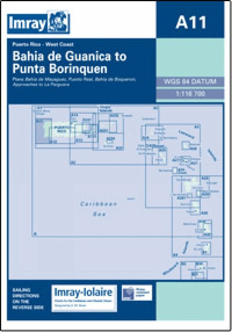
Imray-Iolaire charts for Caribbean are widely acknowledged as the best available for the cruising sailor. They combine the latest official survey Digital with first-hand information gathered over 60 years of research by Don Street Jr and his wide network of contributors. Like all Imray charts, they are printed on water resistant Pretex paper for durability, and they include many anchorages, facilities and inlets not included on official charts. West Coast of Puerto Rico Plans include: Bahia de Mayaguez Puerto Real Bahia de Boqueron Approaches to La Parguera
226 kr
Skickas inom 11-20 vardagar
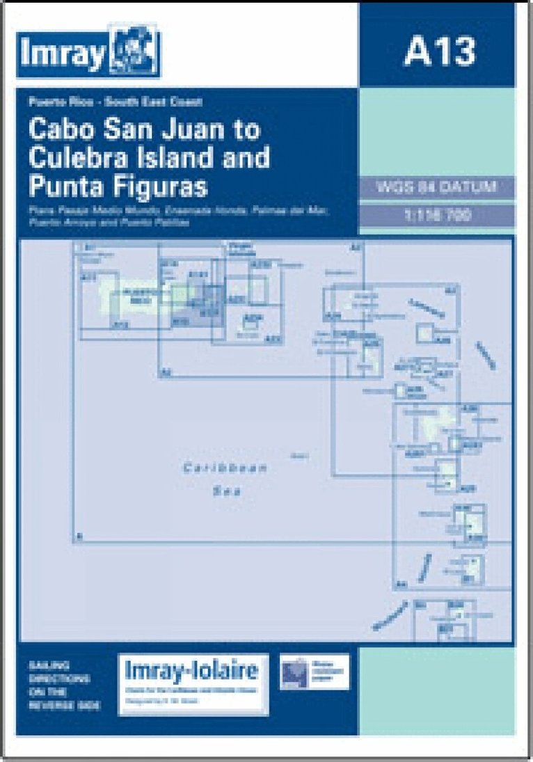
Imray-Iolaire charts for Caribbean are widely acknowledged as the best available for the cruising sailor. They combine the latest official survey Digital with first-hand information gathered over 60 years of research by Don Street Jr and his wide network of contributors. Like all Imray charts, they are printed on water resistant Pretex paper for durability, and they include many anchorages, facilities and inlets not included on official charts. Southeast Coast of Puerto Rico Plans include: Pasaje Medio Mundo Ensenada Honda Palmas del Mar Puerto Arroyo & Puerto Patillas
Häftad, Engelska, 2001
317 kr
Skickas
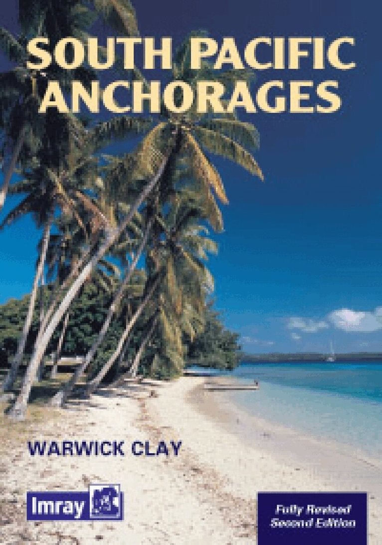
South Pacific Anchorages by Warwick Clay details the harbours and anchorages in the pacific south of the equator between New Guinea and South America. The aim of the anchorage listing is to provide yachts with enough information so that they can choose their destination for the day, confident it will suit their needs and that they can arrive with the minimum of difficulty. Anchorages have been chosen to suit the long distance cruising yacht. They are all suitable for night anchoring of yachts drawing up to two meters and in most cases larger yachts. Sketches are provided for most of the better anchorages.
Inbunden, Engelska, 2006
257 kr
Skickas
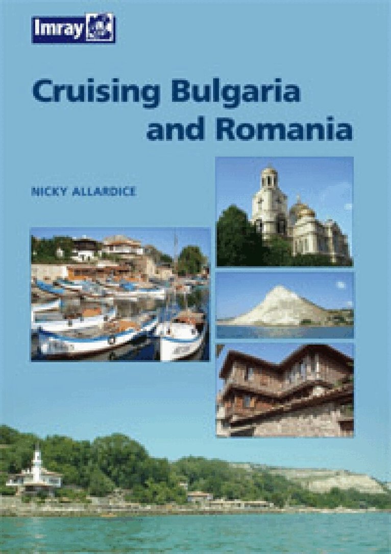
'Cruising Bulgaria and Romania' aims to encourage many more yachtsmen to discover the pleasures of cruising the Lower Danube and the western Black Sea, to visit the ports and harbours (both antique and modern) and the miles of unspoilt beaches in these fascinating areas. For the visiting yachtsman, the cruising areas of Bulgaria and Romania, the River Danube, parts of the Black Sea coast, and (in Romania) the Danube delta (a special area in its own right), offer an interesting diversity. Despite being close geographical neighbours, Bulgaria and Romania are culturally very different. Bulgaria shares the Orthodox religion and Slavic cultural roots of Russia and Serbia, whereas Romania is a country with Latin cultural traditions similar to other western Mediterranean countries. Srebarna Lake, the North Romanian Black Sea coast, Kamchia and Strandja and the Danube Delta are internationally important as nature reserves and as homes to some rare and endangered species. The River Danube is one of Europe's most ancient thoroughfares, but between Vienna and Bratislava the number of vessels on the river drops dramatically and the area is still relatively unknown to foreign boats. Nicky Allardice has lived and worked in both countries and his guide is based on extensive first-hand experience.
279 kr
Skickas
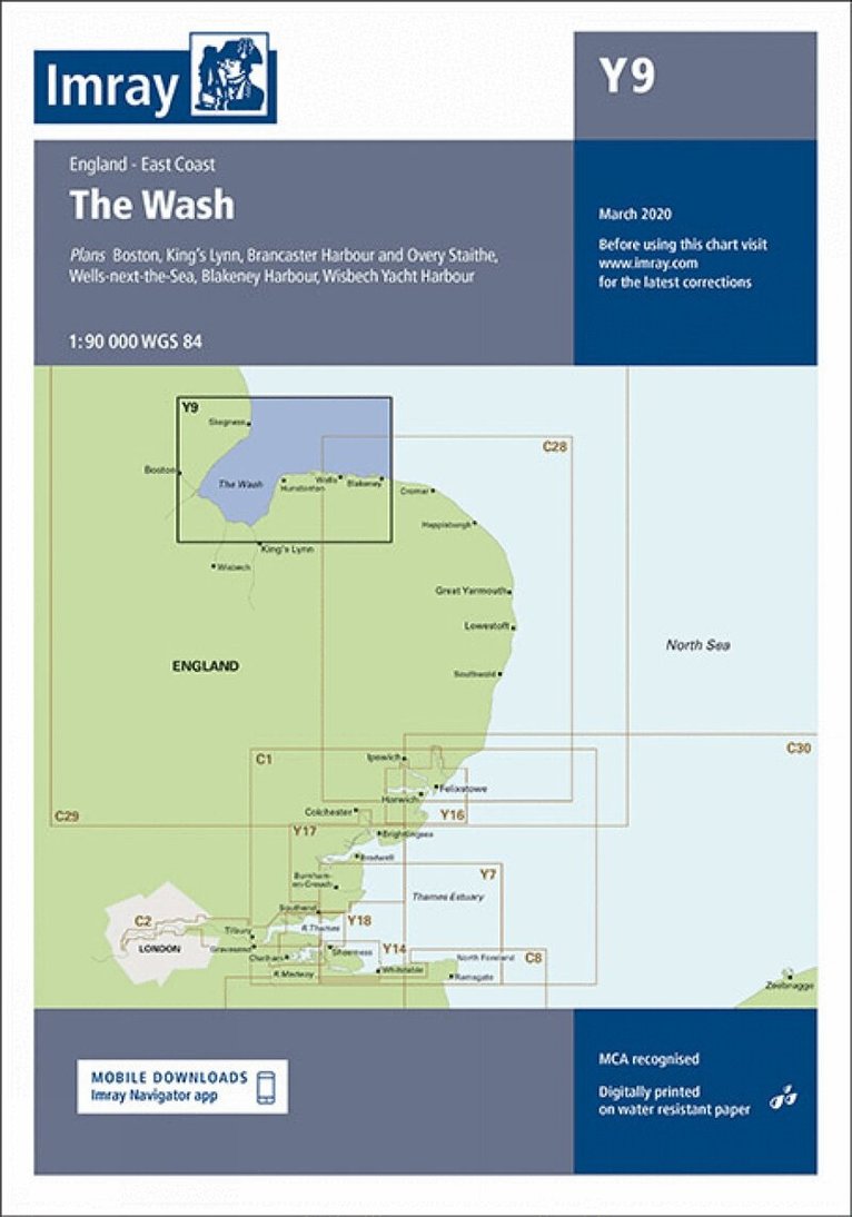
Plans - Boston, Kings Lynn, Brancaster Harbour and Ovary Staithe, Wells-next-the-Sea, Blakeney Harbour, Wisbech Yacht Harbour
Letar du efter digitala böcker?
E-böcker och ljudböcker handlar du än så länge på vår tidigare sajt.