
Visar resultat för..."Cicerone Press"
498 produkter
498 produkter
Häftad, Engelska, 2024
190 kr
Skickas
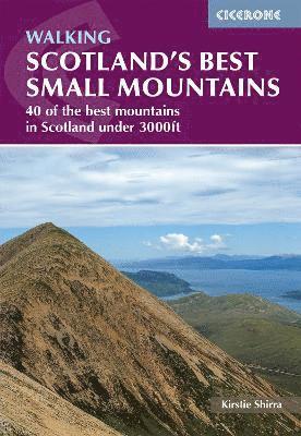
Scotland's best mountains are not all Munros. From the rocky pinnacle of Suilven in Sutherland to the jagged Storr on Skye and the iconic Cobbler above Arrochar, the country's peaks under 3000ft are every bit as spectacular and rewarding as their taller neighbours. Curated by author Kirstie Shirra, this second edition Cicerone guidebook to Scotland's Best Small Mountains covers 40 of the country's most distinctive summits under 3000ft across seven regions. Walks range from 5 to 25km with options to suit all abilities, from a first day on the Scottish hills to a seasoned hillwalker seeking something new. 40 hand-picked summits are described across seven regions, from Sutherland and Torridon to Glencoe, the Trossachs and the islands of Skye, Eigg, Mull and ArranIconic summits are covered, including Suilven, Quinag, Stac Pollaidh, the Storr, the Pap of Glencoe, the Cobbler, Ben Venue, Goatfell and An Sgurr on Eigg1:50,000 OS mapping and GPX downloads provided for every route, with one main ascent per mountain plus alternative traverses, circuits and shortcutsA Gaelic glossary of common mountain features helps walkers connect with the landscape and its namesPractical planning and access information throughout, with guidance on getting to and around all seven regions of Scotland covered in the guidebook The Munros are just the beginning. This guidebook is proof that Scotland's most memorable mountain days have nothing to do with height and everything to do with character.
Häftad, Engelska, 2026
212 kr
Skickas
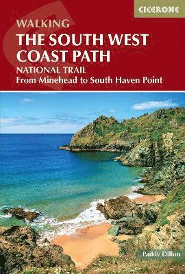
Experience the beauty of the South West Coast Path, a 1022km (635-mile) National Trail from Minehead to South Haven Point, offering unmatched coastal scenery. Stretching across Somerset, Devon, Cornwall and Dorset, including the Exmoor National Park and the Jurassic Coast World Heritage Site, this epic long-distance walking trail can be completed in roughly four weeks or tackled in sections. This guidebook transforms planning into a straightforward process, with 45 clearly defined stages between 12 and 38km (7.5–24 miles) and expert guidance on every aspect of the route. An optional diversion onto the 17-mile South Dorset Ridgeway from West Bexington to Osmington Mills provides a scenic shortcut, shaving 42 miles off the full distance for those short on time. For every stage, the guidebook provides detailed route descriptions, 1:50,000 OS mapping and elevation profiles so you're aware of what the coastal path has in store nextPractical essentials are woven throughout, with comprehensive accommodation listings covering B&Bs, campsites, and hostels in towns and villages along the route, like St Ives, Falmouth, Plymouth, and Lyme RegisPublic transport options are clearly presented to allow you to break each stage into manageable chunks, ideal for section hikers to plan their journeyYou'll find expert advice on baggage transfer services, when to go (spring and autumn are ideal) and what to pack, as well as considerations specific to coastal walking, such as tide awareness and rescue servicesDownloadable GPX files offer a digital alternative for navigating along the coast, suitable for use on your smartphone or GPS devices Whether you are walking the entire path or exploring it in sections, this guidebook offers all the tools you need to plan your walking holiday with confidence. Immerse yourself in the freedom and beauty of England’s southwest coast, where every stage brings breathtaking views, historic sites, and unforgettable walking experiences. Three separate OS map booklets covering Minehead-St Ives, St Ives-Plymouth and Plymouth-Poole are also available to purchase, creating the ultimate navigation package for this world-class coastal trail.
Häftad, Engelska, 2025
299 kr
Skickas
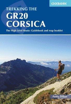
Tackle one of Europe’s greatest trekking challenges on the GR20, Corsica’s legendary high-level route that runs the length of the island’s mountainous spine from Calinzana in the north to Conca in the south. Often described as Europe’s toughest trek, this 190km (118-mile) trail is best suited to experienced hikers as it follows rugged granite ridges and remote cols, with steep ascents, scrambling sections and exposure to rapidly changing mountain weather. This expertly crafted Cicerone guidebook is the essential companion for anyone planning to tackle the GR20, whether you aim to complete the full route in 16 days or focus on one half. The trek is commonly split into the northern section, widely considered the most challenging with its rugged alpine terrain and exposed scrambles, and the southern section, which is still demanding but generally less technical. The GR20 is split into 16 stages (5 to 20km per stage) with high-level and low-level alternatives for some sections, so you can make the journey your own Detailed route descriptions and elevation profiles are supported by a separate map booklet featuring 1:25,000 IGN mapping with the route line clearly marked for navigation through Corsica's rugged mountainsTips from experienced author, Paddy Dillon, on safety measures, what to pack and when to go are provided, essential when tackling such a tough trek Accommodation listings are included for each stage, which are mainly refuges maintained by Parc Naturel Régional de Corse. Clear guidance on where advance booking is required is also provided. Downloadable GPX files are available for the entire trail from Calinzana to Conca, as a digital navigation option for use on smartphones and GPS devices More than just a walk, the GR20 is a true test of endurance, resilience and spirit. With this trusted Cicerone guidebook in your pack, you’ll be fully equipped to face the challenge, embrace the unpredictability and experience the raw beauty of Corsica’s mountains. Plan well, walk wisely, and step into an adventure that will stay with you long after the final descent to the Mediterranean.
Häftad, Engelska, 2026
230 kr
Skickas
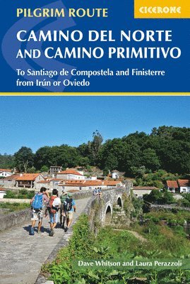
Walk two of northern Spain’s most iconic pilgrimage routes, the Camino del Norte and Camino Primitivo, popular variants of the Camino de Santiago to Santiago de Compostela. The Camino del Norte stretches 820km (510 miles) along the scenic northern coastline, visiting historic cities such as Irun, San Sebastián, Bilbao, and Santander. The inland Camino Primitivo (221 miles) follows 355km from Villaviciosa through Oviedo and Lugo, offering a quieter, more mountainous route steeped in cultural and religious history. Suitable for walkers of most abilities, the Camino del Norte typically takes around five weeks, while the Camino Primitivo can be completed in about two weeks. The Camino del Norte is described in 32 stages and the Camino Primitivo in 12 stages, each between 15 and 39km (9–24 miles) in length. Extensions to Finisterre and link routes connecting the Norte and Primitivo are also included, giving pilgrims the flexibility to plan a longer or customised journey. 32 stage-by-stage descriptions of the Camino del Norte and 12 stages of the Camino Primitivo, each between 15 and 39km (9–24 miles) in length, with distances, terrain summaries, and daily walking times1:100,000 mapping for both routes, plus larger-scale town maps for key locations such as San Sebastián, Bilbao, Oviedo, and Lugo for precise navigationGPX files for the Camino del Norte and Camino Primitivo compatible with GPS devices and smartphone apps, supporting digital navigationDetailed accommodation and pilgrim lodging listings along both routes, including hostels, albergues, and hotels for planning overnight staysHandy route summary tables, refreshment stops, and facilities along each stage to assist with daily planning on your pilgrimage Practical advice on preparation, packing, seasonal considerations, and optional extensions, including the Finisterre route and link paths between the Norte and Primitivo Plan your pilgrimage along northern Spain’s Camino del Norte and Camino Primitivo with confidence, experiencing coastal landscapes, historic towns, and mountain scenery with this comprehensive guidebook.
Häftad, Engelska, 2025
230 kr
Skickas
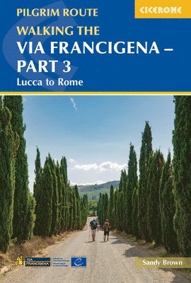
Walk the rolling Tuscan hills, historic towns, and sacred sites of Italy on Part 3 of the Via Francigena pilgrimage route, covering 413km (255 miles) from Lucca to Rome. This central-southern section of the world-famous 2000km route threads through the heart of Tuscany and Lazio, offering medieval villages, vineyards, and iconic landmarks, culminating in the Eternal City. Suitable for walkers of most abilities, this section requires moderate fitness due to hilly terrain and can be completed in under three weeks. The route is presented in 18 stages of 14–33 km (9–20 miles), passing through the walled town of San Gimignano, the historic streets of Siena, the medieval centre of Viterbo, and the ancient temples of Sutri before reaching Rome’s magnificent Piazza San Pietro. 18 stage-by-stage route descriptions covering Lucca to Rome along the Via Francigena, including medieval villages, Tuscan landscapes, and Lazio’s rolling hillsEach stage includes distance, estimated walking time, ascent and descent, and terrain summary for planning daily sections and managing the hilly terrain1:100,000 mapping for the full route, plus larger-scale town maps for key locations such as Lucca, Siena, Viterbo, and Rome and the Vatican City for precise navigationGPX files provided for the Via Francigena Part 3, compatible with GPS devices and smartphone apps for easy digital navigationDetailed accommodation listings, pilgrim lodging options, and refreshment points along each stage to support comfortable walkingHandy route summary tables and planning advice, including facilities, public transport links, and tips for preparation and packing for your Italian adventure Plan your Via Francigena adventure from Lucca to Rome with confidence, and experience one of Italy’s most iconic long-distance pilgrim walks with this comprehensive guidebook.
Häftad, Engelska, 2025
230 kr
Skickas
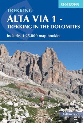
Begin your Dolomites adventure and discover the Alta Via 1 (AV1) — a classic hut-to-hut trek through northeastern Italy’s spectacular alpine scenery. Covering 115km from Lago di Braies to Belluno, this long-distance trail offers a perfect introduction to trekking in the Dolomites, suitable for both first-time and experienced trekkers, and typically completed in around two weeks. This Dolomites hiking guidebook makes planning simple, with stage-by-stage descriptions and expert advice from author Gillian Price. A dedicated map booklet, featuring Kompass 1:25,000 maps with the full route line clearly marked, allows you to navigate the trail with confidence. The trek is divided into 11 stages, each between 6 and 14km long, with detailed descriptions of the route, terrain, and key landmarks such as war tunnels from the Austro-Hungarian EmpireEach stage is paired with a 1:75,000 overview map, while the additional 1:25,000 map booklet offers detailed navigation through the heart of the Dolomites.Downloadable GPX files provide an additional digital navigation option, making it simple to use your smartphone or GPS device to track progress between alpine huts, among the immense rock formations unique to the area. The guide includes essential details on mountain huts, transport links, what to pack, and the best time to go — everything you need to plan your trip to Italy. Short on time? Alternative paths, exit routes to public transport, and optional side trips to nearby summits, such as Croda del Beco, are clearly detailed, allowing you to tailor the trek to your schedule and interests. With comprehensive route descriptions, GPX downloads, and a separate 1:25,000 map booklet, this Alta Via 1 guidebook provides a complete navigation package for hut-to-hut hiking in the Dolomites. Plan your next walking holiday with confidence and experience the breathtaking scale, beauty, and adventure of one of Italy’s most iconic long-distance trails.
Häftad, Engelska, 2025
212 kr
Skickas
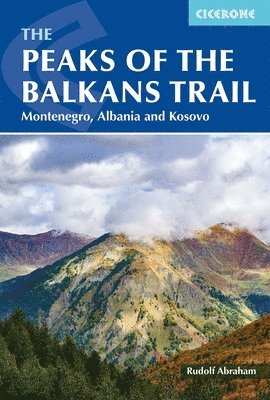
Begin an unforgettable journey along the Peaks of the Balkans trail, one of Europe’s most spectacular long-distance hiking trails. This remote and rewarding circular trek spans approximately 192 km (119 miles) through the rugged mountain regions of Albania, Kosovo, and Montenegro, offering a rare opportunity to experience some of the continent’s last truly unspoiled wilderness. The route takes you across high alpine passes, deep valleys, and traditional villages, immersing you in the timeless culture of the Balkans. Usually completed in 9-10 days, the trail suits fit experienced hikers but requires no technical skills. The Peaks of the Balkans trail is known for dramatic scenery, local hospitality, and the rare experience of crossing borders on foot. Written by award-winning travel writer Rudolf Abraham, this comprehensive Cicerone guidebook is the essential resource for planning your trek. Stage-by-stage route descriptions guide you through the Peaks of the Balkans in a circular loop, with 1:50,000-scale maps to help you navigate the dramatic landscapes of Albania, Kosovo, and Montenegro with confidence.The trail is divided into 10 stages, with advice on completing the route in 8 days for faster trekkers. Each stage connects mountain villages such as Valbona, Theth, Dobërdol, Plav, and Vusanje, giving you the flexibility to plan your journey around these key points.Optional detours and side trips are included, such as visiting the Grbaja Valley from Plav, climbing Gjeravica or Hajla, or exploring classic highlights like Valbona Valley and Theth National Parks, so you can customise your adventure and discover more of the region’s standout locations.Each stage details start and finish points, daily distances, elevation profiles, and accommodation options—such as guesthouses and mountain huts—in villages like Valbona, Theth, Plav, and Dobërdol, to help you shape your journey.Downloadable GPX files provide digital navigation, allowing you to confidently follow the Peaks of the Balkans route on your smartphone or GPS device through some of the Balkans’ most spectacular mountain scenery.Practical advice covers border crossings between Albania, Kosovo, and Montenegro, permits, transport to trailheads like Plav or Valbona, and local customs, ensuring a seamless experience along the international route.The guide recommends hiking from June to September, when snow has cleared mountain passes such as Qafa e Pejës and guesthouses along the route, including in Theth, Valbona, and Dobërdol, are open to welcome travellers. Plan your Peaks of the Balkans adventure with confidence and enjoy one of Europe’s most iconic multi-country hikes with this definitive guidebook.
- Nyhet
Häftad, Engelska, 2026
224 kr
Skickas
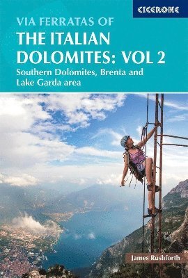
Uncover the explosive peaks, vivid colours, and unique culture of the southern Italian Dolomites, Europe’s crown jewels and the birthplace of via ferrata adventure. From the soaring spires of the Brenta to the dramatic ridgelines above Lake Garda, this UNESCO World Heritage mountain range offers an unrivalled collection of via ferrata routes. Fixed cables, ladders, and airy bridges open up dramatic terrain to adventurous walkers, scramblers, and climbers eager to experience the thrill of these protected paths. Expertly curated, this comprehensive Cicerone guidebook details 77 outstanding via ferratas across the southern Dolomites, Brenta, and Lake Garda regions. Routes range from short, accessible outings to long, committing multi-day journeys, with distances from 1 to 60km (½ to 37 miles) and durations of 1 to 12 hours. This ensures a rewarding experience for everyone from confident novices to seasoned ferratisti. Explore celebrated Dolomite areas including Brenta, Lake Garda, Pale di San Martino, Trento, Schiara, Südtirol, Civetta, Vicenza, Rovereto, Riva del Garda, Bolzano, Feltre, Cortina, Agordino, and Belluno. Each is a gateway to unforgettable mountain adventure.All routes require a helmet, harness, and via ferrata lanyard, and are best enjoyed between June and late September. Lower-altitude options around Lake Garda and the Adige valley can be climbed year-round.The guidebook features 1:50,000 mapping and detailed colour photo topos for every via ferrata route, making navigation straightforward and route-finding clear even on the most complex terrain.Practical advice covers essential equipment, safety, choosing the best base, and route planning to help you embark on your Dolomite via ferrata journey with confidence and knowledge.Each route description is accompanied by an at-a-glance information box detailing start and finish points, distance, ascent and descent, estimated time, technical grade, seriousness, wire length, and GPS coordinates for parking. This is perfect for planning your days in the Italian Dolomites.All routes are graded using the widely adopted Smith/Fletcher dual system, offering consistent guidance on both technical difficulty and seriousness unique to this spectacular region.Designed specifically for the southern Dolomites, the guide includes summary tables for quick route comparison and covers everything from short, scenic outings for beginners to challenging, exposed routes for experienced adventurers.Also available from Cicerone is Via Ferratas of the Italian Dolomites Volume 1, which explores the northern, central, and eastern Dolomites. Plan your via ferrata adventure in the Italian Dolomites with confidence using this definitive Cicerone guidebook, and experience the untamed beauty, rich history, and unique alpine culture of Italy’s most celebrated mountain range.
Häftad, Engelska, 2025
195 kr
Skickas
Discover Italy’s dramatic alpine playground — the iconic Dolomites, part of the spectacular Italian Alps. From soaring limestone peaks and serene glacial lakes to hidden valleys and historic mountain trails, this UNESCO World Heritage Site delivers unforgettable scenery and an outstanding walking holiday from June to September. Day Walks in the Dolomites, by renowned guidebook author Gillian Price, known for her extensive expertise in the Italian mountains, transforms walking in the Dolomites into a straightforward and rewarding experience. The guide presents 50 graded day walks, ranging from easier valley and meadow walks to more demanding high-mountain excursions, allowing you to select outings that match your fitness, experience, and available time. Every walk (3 - 21km) includes clear, step-by-step route descriptions accompanied by 1:50,000 mapping for confident navigation through dramatic limestone landscapes and alpine terrainThe 50 routes are carefully graded, making it simple to choose a walk that suits your ability, whether you prefer a gentle scenic outing or a more strenuous mountain day, so you can explore the Dolomites at your own paceWalks are based around key centres including Cortina d’Ampezzo, San Vito di Cadore, Sesto and Misurina, allowing you to plan rewarding day hikes directly from well-located accommodationPractical information is woven throughout, with helpful guidance on access, local transport and facilities so you can organise each walk efficiently and make the most of your time in Italy GPX files are available to download for use on GPS devices and smartphones, providing an additional layer of navigational support for independent hiking in the Italian Alps Each route has been carefully selected to showcase the very best of walking in the Dolomites: iconic views, hidden corners, and unforgettable viewpoints. With trusted guidance and detailed mapping, you can focus less on logistics and more on the pure enjoyment of day walks in the Italian mountains.
Häftad, Engelska, 2017
167 kr
Skickas
Explore the northern Haute Savoie and discover a wonderfully varied corner of the French Alps, stretching south from the shores of Lake Geneva through the limestone ridges of the Salève and Chablais to the flower-filled valleys of Abondance, Morzine, and the Vallée Verte. Less visited than the Mont Blanc massif to the south, this is an accessible and rewarding walking region with a distinctly local character, historic alpine villages, and outstanding views across to Switzerland. Suitable for beginner and experienced walkers alike, this comprehensive Cicerone guidebook describes 30 walks in the northern Haute Savoie, covering areas including Salève, the Vallée Verte, Val d'Abondance, and Val de Morzine. Routes range from 7 to 14km (4–9 miles) and take between 2 and 7 hours to complete, with walks graded from easy to difficult. Choose from 30 walks across the northern Haute Savoie, exploring limestone gorges and ridges around the Salève, high summits in the Chablais including the Cornettes de Bise and Dent d'Oche, and the quieter valleys of Abondance and Morzine, with routes suitable for a wide range of abilities.Plan your Haute Savoie walking holiday for the ideal season, with guidance on local conditions showing why spring through to autumn offers the best walking weather, with alpine flowers in bloom from late spring and the valleys at their most colourful in autumn.Navigate with confidence using 1:50,000 maps included for every route in the northern Haute Savoie, alongside downloadable GPX files to support your planning and navigation on the ground.Benefit from clear grading and detailed route descriptions for every walk, with routes rated from easy to difficult and practical information on distance, walking time, and terrain to help you choose walks suited to your ability and fitness.Find practical holiday planning advice for the northern Haute Savoie, with notes on the best bases including Evian-les-Bains, Morzine, Abondance, and Bellevaux, plus comprehensive information on accommodation, Savoyard food and drink, transport, and safety.Deepen your experience of the region with sections on the history of the Haute Savoie, local wildlife, plants and flowers, and the fascinating network of medieval abbeys, mountain chapels, and historic smugglers' routes across the French-Swiss border.Extend your walking in the region with the companion volume, Walking in the Haute Savoie: South, which together with this guide, covers the full breadth of this exceptional corner of the French Alps. Plan your French Alps walking holiday with confidence using this trusted Cicerone guidebook. Immerse yourself in the valleys, summits, and alpine landscapes of the northern Haute Savoie, a rewarding walking destination on the doorstep of Lake Geneva.
Häftad, Engelska, 2023
230 kr
Skickas
Explore the diverse and dramatic landscapes of Austria’s Alps with a guidebook that brings the best of the country’s walking routes within your reach. From gentle valley paths and scenic day walks to multi-day treks and classic hut-to-hut tours across the Rätikon, Silvretta, Stubai and Zillertal Alps, the Hohe Tauern and the Karawanken, this guide opens up Europe’s most walker-friendly terrain. Walking in Austria, written by expert author Kev Reynolds, is the definitive companion for anyone planning a walking holiday or alpine adventure through Austria’s mountains. Covering 101 graded routes ranging from short 3km (2 miles) rambles to challenging 120km (75 miles) treks, the book is designed for walkers of all abilities, with full descriptions, sketch maps and practical planning detail to help you choose walks that suit your experience and ambitions. Includes 101 graded day walks, multi-day treks and hut-to-hut tours from easy to more strenuous, giving you choices for every type of walker in the Austrian AlpsClear route descriptions and sketch maps accompany each walk to help you follow trails with confidence in Austria’s varied terrainFull details of over 100 mountain huts across the Rätikon, Silvretta, Stubai, Zillertal Alps, Hohe Tauern, and Karawanken, making hut-to-hut trekking straightforwardPractical information on public transport, accommodation, gear and safety helps you plan logistics for your Austrian walking holidayPocket-sized and lightweight, so you can add this guidebook to your pack without worrying about the weight Walk through alpine valleys, past glacial lakes and snow-capped peaks, discover charming villages and historic routes, and experience Austria’s welcoming mountain culture and hospitality. With reliable route coverage, transport details and mountain hut information in your pack, you can plan, explore and enjoy walking holidays across Austria’s stunning and varied landscapes.
Häftad, Engelska, 2024
195 kr
Skickas
Discover the enchanting stone cloisters, medieval towers, and cobbled villages along the Via Francigena on this central section of the renowned pilgrimage route, a 726 km journey from Lausanne on Lake Geneva to the historic city of Lucca in Tuscany. Walk shaded lakeside paths by Lac Léman, cross the historic Great Saint Bernard Pass, traverse the Po Valley’s cultural heart, and finish among the scenic hills and coastline of Liguria and Tuscany, where medieval villages and vineyards meet stunning sea views. Designed for modern-day pilgrims and those seeking a reflective walking experience, this comprehensive Cicerone guidebook breaks this section of the Via Francigena into 32 manageable daily stages. The route is described from north to south, beginning in Lausanne on Lake Geneva and concluding in the medieval Tuscan city of Lucca. Each stage features a detailed 1:100,000 route map to guide your journey across the diverse landscapes of the Via Francigena, with enhanced 1:25,000 city maps for Lausanne, Martigny, Aosta, Pavia, Fidenza, and Lucca, providing clear navigation through these key urban centres.Comprehensive, step-by-step directions guide you along the route, whether crossing the vineyards around Vevey, the alpine valleys approaching the Great St Bernard Pass, or the rolling hills of Tuscany, with each section supported by downloadable GPX files for GPS devices and smartphone apps.For every stage, you’ll find start and finish points, precise distances, total ascent and descent, estimated walking times, and a terrain summary, helping you plan for days that might take you from the lakeside promenades of Montreux to the medieval streets of San Gimignano.Accommodation and refreshment options are listed for each stage, highlighting welcoming places to stay and eat in towns and villages, including Lausanne, Montreux, Aigle, Aosta, Pavia, and Lucca, as well as trail-side facilities and services in smaller settlements.A handy trek planner and route summary table let you customise your itinerary, whether you want to linger in the Roman spa town of Aosta, explore the historic abbeys of Pavia, or enjoy the world-famous cuisine of Parma.With detailed mapping and practical advice, this guide ensures a safe, enjoyable, and culturally rich Via Francigena walking experience, whether you’re tackling alpine passes, following riverside paths, or exploring the cobbled streets and lively piazzas of Italy’s northern cities. Plan your Via Francigena adventure from Lausanne to Lucca with confidence, and experience one of Italy’s most iconic long-distance pilgrim walks with this definitive guidebook.
Häftad, Engelska, 2021
208 kr
Skickas
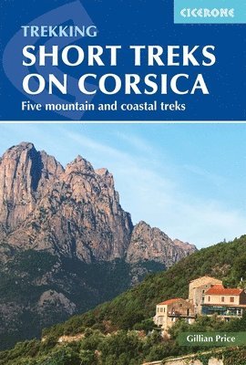
Explore the dramatic mountain landscapes, rugged coastline, and scented maquis of Corsica with this comprehensive Cicerone guidebook to five short mountain and coastal treks. From exposed coastal paths around Cap Corse to classic mountain-to-sea routes through the island’s wild interior, these walks reveal Corsica’s striking contrasts, rich biodiversity, and distinctive local culture. Designed for hikers and walkers with good fitness, the five short treks on Corsica range from accessible coastal outings to longer multi-day walking routes through forested hills and remote uplands, perfect for anyone seeking a taste of the island’s legendary trekking. Each route is presented in daily stages of 8-18km (5–11 miles), finishing where accommodation is available. Comprehensive day-by-day walking and trekking route descriptions for five of Corsica’s classic short treks: the 2-day Sentier du Douanier, the 10-day Mare e Monti, the 11-day Mare a Mare Nord, the 5-day Mare a Mare Sud, and the 5-day Mare e Monti Sud, offering flexibility to mix, match, or adapt your Corsican hiking itinerary.Clear, step-by-step walking directions, with detailed 1:50,000 mapping and elevation profiles for every stage of these Corsican hiking routes.Downloadable GPX files for all five routes on Corsica, suitable for use with GPS devices and smartphone navigation appsRefreshment and accommodation details for every stage, highlighting Corsican villages, mountain inns, and trail-side facilities valued by walkers and trekkers.Practical hiking advice on planning and preparation, including the best time to walk in Corsica, transport logistics, and tips for combining treks into longer walking adventures.Notes on Corsican plants, wildlife, and local cuisine enrich your experience of the diverse landscapes encountered on these walks and treks. Plan your walking holiday on Corsica with confidence and enjoy some of the island’s most rewarding short mountain and coastal treks with this practical and inspiring guidebook from the experts at Cicerone.

Häftad, Engelska, 2022
189 kr
Skickas
A guidebook to walking the northern section of the GR34 Brittany Coast Path, following 624km (388 mile) of dramatic coastline from Mont-Saint-Michel to Roscoff. Known as the Sentier des Douaniers or Customs Officers’ Path, the trail traces one of France’s most celebrated long-distance routes, revealing a constantly changing landscape of rugged cliffs, sweeping bays, sandy beaches and rocky headlands. Along the way, walkers pass historic ports, traditional fishing villages and lively seaside towns, experiencing the distinctive character, history and culture of Brittany. Suitable for any moderately fit walker, this section of the GR34 can be completed in around a month and requires no technical skills. The route is described from east to west in manageable daily stages, allowing walkers to experience the full variety of Brittany’s coastline at a comfortable pace. For those with less time, the guide also highlights shorter itineraries that capture some of the most spectacular scenery and rewarding sections of the trail. The Brittany Coast Path is described in 28 stages of between 13 and 33km, with clear step-by-step route descriptions, detailed mapping and route summary tables to help you plan daily distances and accommodation.Includes 1:100,000 mapping for each stage, larger-scale maps for towns and key locations, like Saint-Malo, Saint-Laurent de la Mer, Morlaix, Carantec and Roscoff.GPX files for the Brittany Coast Path available to download for easy navigation on digital devices.Comprehensive practical information on accommodation, food and refreshments, public transport connections and local facilities, making it easy to organise and adapt your GR34 itinerary.Includes four suggested 5-day highlight itineraries, ideal for walkers who want to experience the highlights of the Brittany Coast Path on a shorter trip.Helpful planning advice covering preparation, travel to and from the route, accommodation listings, and tips for walking a long-distance coastal trail. Following in the footsteps of the customs officers who once patrolled this coast to prevent smuggling, the GR34 offers an unforgettable journey through one of France’s most beautiful and culturally rich regions. With ever-changing sea views, abundant wildlife and countless opportunities to enjoy Breton hospitality and cuisine, this guide provides everything you need to explore this remarkable coastline with confidence.

Häftad, Engelska, 2025
199 kr
Skickas
Most visitors to Mallorca never venture beyond the coast, yet rising immediately behind the shoreline lies the Serra de Tramuntana, a UNESCO World Heritage mountain range of rugged limestone peaks, ancient terraced hillsides, hidden gorges and centuries-old stone paths that rival any mountain walking destination in the Mediterranean. This comprehensive guidebook by expert author Paddy Dillon presents 50 walks across the Tramuntana, ranging from 4 to 24km (2 to 15 miles) and taking between 2 and 8 hours. Many routes involve steep ground, hands-on scrambling and navigational challenge, and are primarily geared towards those comfortable with mountain conditions. 50 walks are included, divided across seven areas, spanning the full length of the Serra de Tramuntana from Andratx in the southwest to Formentor and Alcúdia in the northeast, with bases including Valldemossa, Sóller, Deià and PollençaHighlights of the walk include the Torrent de Pareis gorge, one of the most dramatic canyon walks in the Balearic Islands, the island of Sa Dragonera, the Camí de s'Arxiduc ridge and the summit of Puig de Massanella, the highest accessible peak in MallorcaMallorca's ancient mountain heritage is experienced throughout, with routes following centuries-old drovers' paths, dry stone terraces and historic mountain tracks that formed the basis for the Serra de Tramuntana's UNESCO World Heritage designation1:25,000 Editorial Alpina mapping and downloadable GPX files for every walk, with detailed public transport information making most routes accessible from Palma and the island's main towns without a hire carPractical mountain guidance on weather, path conditions, kit requirements and safety, alongside notes on wildlife, wildflowers, history and food and drink throughout Mallorca mountain walking is unlike anything the island's coastal reputation suggests. This guidebook is the essential companion for exploring the Serra de Tramuntana on foot, and the best reason to see a very different side of one of Europe's most visited islands.
Häftad, Engelska, 2025
219 kr
Skickas
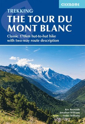
Discover the legendary Tour du Mont Blanc (TMB), one of the world's most renowned long-distance hiking trails. Traverse a diverse tapestry of landscapes, alpine meadows, glacial valleys, rugged peaks, and picturesque mountain villages. This multi-day circular route covers 170 km (105 miles), beginning and ending in Les Houches, guiding you past welcoming refuges, sparkling streams, cascading waterfalls, and awe-inspiring mountain vistas. Perfect for fit walkers who have some long-distance hiking experience, this comprehensive guidebook divides the Tour du Mont Blanc into 11 manageable daily stages. Follow the journey as it winds through the enchanting alpine villages of Les Houches and Les Contamines, as well as the picturesque Italian town of Courmayeur. Along the way, experience a harmonious blend of spectacular mountain views, genuine hospitality, and memorable cultural encounters. The Tour du Mont Blanc is described in both anti-clockwise and clockwise directions, allowing you to tailor your journey from Les Houches through key locations such as Les Contamines and Courmayeur, to accommodate your transport, accommodation, or preferred mountain conditions.Clear, step-by-step directions guide you around the full TMB circuit, with 1:100,000 IGN planning maps and downloadable GPX files to help you navigate between iconic villages and mountain passes, including Les Houches, Les Contamines, and Courmayeur.Each stage includes detailed, stage-by-stage route descriptions and suggested itineraries for completing the Tour du Mont Blanc in 9, 7, or 5 days, with daily start and finish points in villages such as Les Houches, Les Contamines, and Courmayeur.For every stage: start/finish points, distance, estimated walking time, elevation profiles, terrain summaries, refreshment stops, and accommodation options in villages including Les Houches, Les Contamines, and Courmayeur.Stage facilities planner helps you estimate distances to the next refreshments, accommodations, and notable high points, with details for popular stopping points across the route such as Les Houches, Courmayeur, and Les Contamines.Refreshment stops and accommodation options are highlighted for each stage, with special notes on trail-side facilities in Les Houches, Courmayeur, and Les Contamines, essential hubs for walkers along the circuit.A pocket-sized map booklet (available separately) with detailed 1:25,000 IGN maps ensures confident navigation through every stage, from Les Houches to Courmayeur and beyond. Plan your Tour du Mont Blanc adventure with confidence and experience one of the world’s greatest long-distance walks with this definitive guidebook.
Häftad, Engelska, 2023
212 kr
Skickas
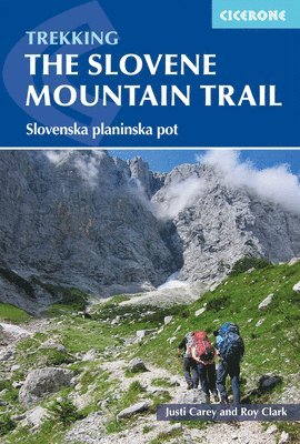
Discover the remarkable beauty and diversity of Slovenia as you walk from Maribor near the Austrian border to Ankaran on the Adriatic Coast on the legendary Slovene Mountain Trail (Slovenska planinska pot or Transverzala). This inspiring long-distance route traverses the heart of Slovenia, crossing the Julian Alps, the Karavanke, and the Kamnik-Savinja Alps, as well as the forested Pohorje plateau and the rolling hills and olive groves of the Karst, offering a unique blend of dramatic mountain landscapes and rich cultural heritage. Perfect for fit walkers and mountaineers with some alpine experience, this comprehensive Cicerone guidebook presents the complete Slovene Mountain Trail, described in 12 stages of 3–6 day treks, covering 550km (342 miles) and taking a total of 49 days to complete. Each stage can be tackled individually or linked together, allowing you to tailor the adventure to your own plans and ambitions. Explore Slovenia’s most iconic mountain regions, including the vast forests of Pohorje, the sheer limestone peaks of the Julian and Kamnik-Savinja Alps, the flower-strewn alpine pastures and ridges of the Karavanke, and the scenic limestone Karst on the approach to the Adriatic. Each day brings new scenery, from high summits to tranquil woodlands and traditional villages.The Slovene Mountain Trail is best enjoyed from mid-June to the end of September, when routes are generally snow-free, and mountain huts are open.Stages of the Slovene Mountain Trail are clearly described with daily distance, ascent/descent, grade of difficulty, and estimated walking times, making it easy to plan each day, whether you seek a gentle track-based stage or challenging technical terrain with via ferrata and fixed protection.The stages are designed for maximum flexibility, with ease of access via public transport and the option to complete sections in any order, whether you dream of a continuous 49-day trek or prefer to savour individual highlights of the Slovene Mountain Trail at your own pace.Each route description includes essential information on start and finish points, public transport connections, mountain huts, accommodation, refreshment options, and facilities, making it easy to plan every stage of your Slovenian Mountain Trail journey.Features detailed sketch maps, profiles, and photographs for every stage, plus practical advice on Slovenian wildlife and flora, waymarking, traditions such as collecting summit stamps, and enjoying local food and drink along the trail. Plan your adventure along the Slovene Mountain Trail with this definitive Cicerone guidebook and discover one of Europe’s most varied and rewarding long-distance walks, where each stage reveals a new facet of Slovenia’s natural and cultural treasures, from alpine peaks to the sparkling Adriatic coast.
Häftad, Engelska, 2025
219 kr
Skickas
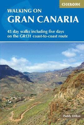
Gran Canaria is far more than a beach destination. Away from the coastal resorts lies a remarkably varied interior of deep volcanic barrancos, ancient laurisilva forests, pine-covered ridges and the dramatic rock formations of Roque Nublo and Roque Bentayga, rising from the island's rugged highland core. Known as a continent in miniature, Gran Canaria packs an extraordinary range of landscapes into a single island. With walks varying from short and easy to long and demanding, this comprehensive guidebook by expert Paddy Dillon covers 40 day walks and a five-stage GR131 coast-to-coast route across Gran Canaria. Day walks range from 5 to 22km (3 to 14 miles) and take between 2 and 7 hours, while the GR131 covers 77km (48 miles) in five stages from Puerto de las Nieves to Maspalomas. 40 day walks across Gran Canaria's most varied terrain, from the central highlands around Cruz de Tejeda and Tejeda to the Tamadaba pine forest, La Aldea, Mogán and the sand dunes of Maspalomas, with shorter walks combinable into longer itinerariesThe GR131 coast-to-coast route, described in five stages, crosses Gran Canaria from north to south as part of the long-distance trail that traverses all seven Canary Islands, offering a memorable multi-day walking experienceIconic highlights include Roque Nublo, one of Gran Canaria's most recognisable landmarks, Roque Bentayga, the Caldera de Bandama and the high point of Pico de las Nieves, the island's highest summit1:50,000 mapping for every walk alongside practical information on public transport, facilities and access, making it straightforward to reach trailheads without a car from Las Palmas or the southern resortsA year-round walking destination, with spring the ideal season, winter offering reliable good weather on lower routes Gran Canaria's walking landscape is one of the best-kept secrets in the Canary Islands, where deep barrancos, ancient forests and volcanic ridges sit just a bus ride from the beach resorts. This guidebook is your essential companion for discovering every part of it. Discover the rest of the Canary Islands with Walking in Tenerife, Walking on La Palma, Walking on La Gomera and El Hierro and Walking on Lanzarote and Fuerteventura available for purchase separately.
Häftad, Engelska, 2025
190 kr
Skickas
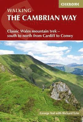
Tackle one of Wales’s great mountain challenges on the Cambrian Way, a demanding 479km (298 miles) long-distance walk from Cardiff to Conwy. Often following long, lofty ridgelines, this three-week trek crosses wild, rugged terrain and visits many of Wales’s highest mountains, offering experienced hillwalkers a continuous journey through the heart of the country’s most dramatic landscapes. Often called “the mountain connoisseurs’ walk”, this coast-to-coast route crosses the Brecon Beacons, Cambrian Mountains and Snowdonia, traversing two national parks and summiting some of the most iconic peaks in Wales — including Pen y Fan, Pumlumon, Cadair Idris and Snowdon.This comprehensive Cambrian Way guidebook is your essential companion for planning, navigating and completing this classic Welsh mountain route. Combining detailed route descriptions with practical navigational tools, it guides you step by step from south to north, helping you prepare for and enjoy one of Britain’s most challenging long-distance walks. The route is split into 21 clearly defined stages, breaking the trail into manageable sections that support flexible itinerary planning, whether you intend to walk the entire Cambrian Way or tackle it in shorter sectionsAccommodation information is provided throughout the guidebook, including hostels, B&Bs, campsites and other facilities in key centres such as Pontypool, Llandovery, and Pen-y-Pass, enabling you to choose between backpacking or carrying a lighter load Integrated elevation profiles and OS 1:50,000 mapping give a clear picture of the terrain ahead and support confident navigation across remote upland and mountainous landscapesDownloadable GPX files are available for your Welsh journey, providing a digital navigation option for use on smartphones and GPS devicesPractical advice on planning and preparation is included, covering essential considerations such as transport to and from the route, seasonal timing, equipment choices and navigation skills required for one of Wales’ most demanding long-distance walks Challenging and richly rewarding, the Cambrian Way is a celebration of Welsh mountain walking. With this Cicerone guidebook in hand, you can set out from Cardiff Castle and follow the spine of Wales all the way to Conwy’s medieval walls, confident you have the detailed information and planning support needed to successfully walk and enjoy this outstanding long-distance trail.
Häftad, Engelska, 2022
208 kr
Skickas
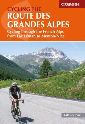
Cycle the Route des Grandes Alpes and take on one of the great challenges of European road cycling, a 720km (447-mile) journey from the southern shore of Lake Geneva to the Mediterranean coast at Nice, crossing 17 major alpine passes through the Vanoise, Écrins, and Mercantour national parks. Entirely on road and demanding throughout, this is a serious cycling adventure for well-prepared riders with experience of mountain roads. Suitable for experienced long-distance cyclists, this trusted Cicerone guidebook by cycling writer Giles Belbin describes the full route in 14 stages of 31–75km (20–46 miles), completable in 1–2 weeks. Six route variants are also described for those who want to adjust the itinerary, and with plenty of eBike charging points along the way, the route is increasingly well-suited to electric bikes. Cycle the Route des Grandes Alpes in 14 stages from Thonon-les-Bains on Lake Geneva to Nice on the Mediterranean, passing through the Vanoise, Écrins, and Mercantour national parks and overnight stops including Bourg-Saint-Maurice, Val d'Isère, Briançon, and Saint-Martin-Vésubie.Conquer 17 major alpine climbs along the route, including the Col de l'Iseran, the highest paved pass in the Alps, the legendary Col du Galibier and Col d'Izoard, the Cime de la Bonette, the Col de la Cayolle, and the Col de Turini above the French Riviera.Choose from 6 route variants to adapt the itinerary to your schedule, fitness, and preferences, with alternatives described for stages across the Savoie, the Queyras, and the approach to the Mercantour.Navigate with confidence using 1:150,000 mapping and elevation profiles included for each stage, alongside GPX files available to download for the full route and all variants.Plan your Route des Grandes Alpes cycling trip with comprehensive practical information on bike selection and preparation, eBike riding and charging stations, accommodation, food and drink, getting there, and safety and emergencies in the mountains.Discover the highlights beyond the cols, including the medieval town of Briançon, the Guil Valley, the Grande Corniche, the lakeside town of Annecy, the dramatic Casse Déserte below the Col d'Izoard, and the final descent to the French Riviera at Nice. Take on the Route des Grandes Alpes with confidence using this trusted Cicerone guidebook. From the shores of Lake Geneva to the warmth of the Mediterranean, this is the essential companion for one of the most demanding and rewarding long-distance cycle routes in the Alps.
Häftad, Engelska, 2024
219 kr
Skickas
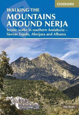
Just a short drive from the Costa del Sol, the limestone mountains of the Sierras Tejeda, Almijara and Alhama rise dramatically from the Mediterranean coastline to summits exceeding 2000m, offering some of the most rewarding and accessible mountain walking in southern Spain. With over 50 peaks above 915m packed into a relatively compact area, the mountains around Nerja deliver outstanding natural beauty, remote gorges, ancient white villages, and striking geological landscapes that feel a world away from the coast below.Whether you're a first-time visitor lured up from the coast or a seasoned Andalucian walker returning for another summit, this trusted Cicerone guidebook describes 32 graded day walks ranging from 3 to 22km (2 to 14 miles). It combines detailed route descriptions with rich local knowledge to help walkers of every level explore these magnificent mountains with confidence, from tackling the iconic summit of La Maroma to a gentle stroll through the gorges of the Rio Chillar. The 32 walks are graded 1 to 10 and organised by area, covering routes from Nerja and Frigiliana, the Competa area, the approaches to La Maroma, the eastern and northern flanks, and the Cisne massif, so you can choose routes to suit your abilityClear route descriptions are accompanied by 1:50,000 or 1:25,000 maps for every walk, with detailed instructions on getting to each start point and information on refreshments and water sources along the wayDownloadable GPX files enable easy digital navigation on GPS devices or smartphone apps, so you can focus on the stark limestone ridges, peaceful valleys, and sweeping views across to the Mediterranean Packed with background information on the geology, history, and wildlife of Andalucia, the guidebook also covers some routes along sections of the Gran Senda de Malaga (Great Path of Malaga), the 700km long-distance path that traverses the provincePractical planning sections cover getting to Nerja, accommodation options across the area's villages, the best seasons to visit, and a glossary of useful Spanish words to help you make the most of every walk From easy strolls through fragrant pine forests to the serious ascent of La Maroma, this guidebook's route descriptions, 1:50,000 and 1:25,000 maps, and GPX downloads provide everything you need to explore the mountains around Nerja with confidence. Discover one of Andalucia's finest walking destinations.
Häftad, Engelska, 2025
219 kr
Skickas
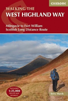
Walk the West Highland Way, Scotland’s most iconic long-distance hiking trail, and experience 156km (96 miles) of ever-changing landscapes — from the gentle paths north of Glasgow to the dramatic mountains of the Scottish Highlands. Running from Milngavie to Fort William, this legendary route is the first of Scotland’s Great Trails and is achievable for most walkers, typically completed in around one week. Whether you’re planning your first multi-day walk or returning to tackle a classic route, this trusted Cicerone guidebook gives you everything you need to walk the West Highland Way with confidence. It combines clear, stage-by-stage route descriptions with practical planning advice, helping you prepare thoroughly and enjoy the journey once you’re on the trail. The West Highland Way is described south to north in 7 stages, allowing you to follow the trail through increasingly dramatic Highland scenery while managing daily distances to suit your fitness and scheduleEach stage features clear, step-by-step route descriptions, supported by 1:100,000 OS mapping, helping you stay on track along the lochs and glens of Scotland's Great Trail Downloadable GPX files enable easy digital navigation on GPS devices or smartphone apps, so you can enjoy the sights of Loch Lomond and Bridge of Ochry without any stress A handy trek planner highlights facilities, public transport links and services along the route, alongside a comprehensive accommodation table for key destinations like Kinlochleven to help organise every aspect of your journeyAdditional insights from experienced guidebook author, Terry Marsh, cover the history of the trail as well as important factors to consider, like Scotland's famous midges and deer stalking season diversions Together, the detailed route descriptions, GPX downloads, and OS map booklet provide a trustworthy, all-in-one navigation package for Scotland’s most famous long-distance walk. Tackle the iconic West Highland Way with confidence.
Häftad, Engelska, 2024
230 kr
Skickas
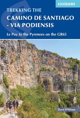
Journey through the heart of rural France on the iconic Via Podiensis, where rolling hills, ancient pilgrimage shrines, and timeless villages create an inspiring route from Le Puy-en-Velay to Saint-Jean-Pied-de-Port. Experience the best of the French countryside and culture as you traverse historic market towns, dramatic river valleys, and the legendary Aubrac plateau, all while following in the footsteps of centuries of pilgrims heading to Santiago de Compostela. Ideal for long-distance walkers and those seeking a classic pilgrimage adventure, this comprehensive Cicerone guidebook presents the complete Via Podiensis (GR65), described in 28 day-long stages and covering 735km (457 miles) through southern France. Two major variants, the stunning Célé Valley and the evocative Rocamadour route, offer alternative paths, alongside connections to the Camino del Norte, enabling you to tailor your journey to your ambitions and schedule. Includes advice for walking the route in sections, making the Via Podiensis accessible whether you have a month or just a week or two to spare, and depending on whether you’re looking for a gentle pace or a more challenging itinerary.Each stage description includes an at-a-glance information box with start and finish points, total ascent/descent, accommodation, and refreshment options - perfect for planning your journey along the Chemin du Puy.Explore the charm of France’s most beautiful villages along the Via Podiensis, including Estaing, Saint-Cirq-Lapopie, and Lauzerte, discover world-renowned pilgrimage sites such as Conques and Rocamadour, and enjoy the warm hospitality of local gîtes and inns.The Via Podiensis is best walked from spring through autumn, when fields and valleys are lush, accommodation is plentiful, and local bakeries and cafés welcome pilgrims with delicious regional fare.Features 1:100,000 mapping and larger-scale urban maps for key towns, plus free downloadable GPX tracks for every stage, ensuring confident navigation and route-finding throughout your Via Podiensis pilgrimage.Covers essential Via Podiensis planning advice, fitness, equipment, travel, public transport, and accommodation in pilgrim lodgings, guesthouses, and inns, as well as guidance on food, local customs, and practicalities such as pilgrim credentials and baggage transport. Plan your pilgrimage on the Via Podiensis with the definitive Cicerone guidebook and discover a route that blends spiritual tradition, French hospitality, and the ever-changing beauty of the southern French countryside, from Le Puy-en-Velay to the gateway of the Pyrenees.
Häftad, Engelska, 2024
210 kr
Skickas
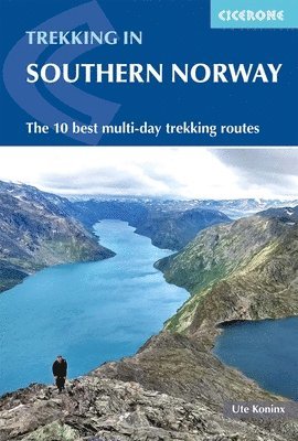
Embark on an unforgettable trekking adventure through the breathtaking mountains and fjords of southern Norway with 10 of southern Norway’s most rewarding short treks, ranging from 3 to 8 days (41–152km), with options to link routes for longer expeditions. Explore Norway’s highest peaks, deep fjords, and vast wilderness south of Trondheim. Whether you’re an experienced trekker or looking for your next big challenge, this comprehensive Cicerone guidebook takes you deep into Norway’s most renowned hiking regions, including Jotunheimen, Rondane, Dovrefjell, Trollheimen, and Ryfylke. Each trek is divided into manageable daily stages and features awe-inspiring highlights, from the world-famous Besseggen ridge and the iconic Kjeragbolten to the 4444-step Flørli staircase and the majestic summits of Galdhøpiggen and Glittertinden. Experience hiking highlights including challenging scrambles, exhilarating vertigo hikes, and the remarkable hospitality of Norway’s mountain huts, set amidst some of Europe’s most pristine natural beauty.Benefit from detailed 1:200,000 Norwegian Kartverket mapping, stage-by-stage elevation profiles, downloadable GPX files, and up-to-date route descriptions, ensuring confident planning and navigation across southern Norway’s demanding and varied terrain.Choose from suggested itineraries for different durations and abilities, with expert advice on combining routes, using Norway’s excellent public transport, and making the most of the short but magical hiking season from mid-July to late September.Find comprehensive listings for mountain huts and lodges, along with tips on booking, packing essentials, safety, weather, and what to expect from hut-to-hut life in Norway’s mountains.Get invaluable guidance on the skills required for these routes, including navigation, stamina, and a head for heights, plus practical advice on gear, weather preparedness, and enjoying the unique camaraderie of the southern Norwegian outdoors. Plan your hiking adventure in southern Norway with confidence, and experience the wild beauty of fjords, peaks, and mountain hospitality with this definitive Cicerone guidebook.
Häftad, Engelska, 2025
384 kr
Skickas
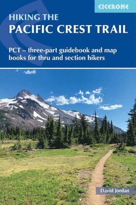
Experience one of the world’s most iconic long-distance hiking trails with the Pacific Crest Trail (PCT), a legendary 4,265km (2,650-mile) journey stretching from Mexico to Canada. Traversing California, Oregon and Washington, the trail passes through vast deserts, the snowbound High Sierra, ancient forests, and rugged mountain wilderness, including Yosemite, Kings Canyon, Crater Lake and North Cascades National Parks. It is typically completed over four to six months. This unique three-part guidebook set is designed specifically for the demands of such an epic trail, where preparation, clarity and weight truly matter. Created with long-distance hikers in mind, the set splits essential information into lightweight, pack-friendly booklets, ensuring you only carry what you need on the trail while keeping critical details always to hand.The introductory booklet (130g) focuses on planning and preparation, helping you make informed decisions long before you set foot on the trail. Whether you’re aiming for a full thru-hike or a shorter section, it provides the essential background needed to approach the PCT realistically and safely. Practical guidance on permits, timing and logistics is included, essential for navigating regulations across multiple US states and land agenciesInsight into gear selection and managing pack weight on long-distance trails, helping you prepare efficiently and avoid costly mistakes before you goClear guidance is provided on resupply strategy, trail towns and food planning, allowing you to plan supply boxes and resupplies well in advanceIncludes a detailed overview of the entire Pacific Crest Trail, including terrain, climate and seasonal challengesSuggested itineraries for 110-, 120-, 130- and 140-day thru-hikes, including an easy-going start option, are described to help you plan a realistic and achievable timelineFor use while hiking, the set includes two compact map booklets (200g and 170g), designed for clarity, durability and minimal weight. These booklets are intended to be carried on trail or sent on in supply packages, giving you immediate access to critical navigation and planning information without the burden of a single heavy volume. Clear, easy-to-read mapping covering the full length of the Pacific Crest Trail: one covering the southern stages from the Mexico border to northern California at Interstate 5, the other detailing the northern stages in Oregon and Washington to the Canadian border.The route is presented as 100 one- to three- day stages for easy planning of either day, section or thru hikes, with stages starting and ending at trailheads where possible1:100,000 topographic maps for the whole PCT, allowing you to supplement or replace digital mapping apps in areas with limited battery life or signalKey features such as water sources, camping locations and resupply points are clearly marked on the map, supporting confident decision-making in remote sections of the trail like the Sierra Nevada Whether you’re preparing for a life-changing thru-hike or planning to explore the Pacific Crest Trail in stages, this three-part guidebook set offers a rare combination of thorough preparation, practical on-trail navigation and lightweight design. Written by two-time PCT thru-hiker David Jordan, you'll get advice from someone who has been there and walked the trail, invaluable when tackling such a challenging long-distance hike. For every copy of Hiking the Pacific Crest Trail sold, Cicerone will donate $1.50 to the PCTA.
Häftad, Engelska, 2026
123 kr
Skickas
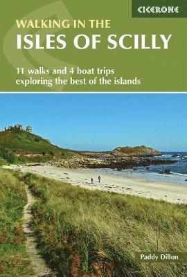
Discover the wild beauty of the Isles of Scilly, a remote Atlantic archipelago off the coast of Cornwall where turquoise seas, white-sand beaches and rugged granite headlands create some of the most distinctive coastal scenery in Britain. With a mild climate, abundant wildlife and peaceful island landscapes, the Isles of Scilly offer exceptional low-level walking across five inhabited islands, where coastal paths, historic sites and hidden coves are never far away. This Cicerone guidebook, written by expert Paddy Dillon, is the ideal companion for exploring the Isles of Scilly on foot, combining practical route guidance with inspiring insight into the islands’ landscapes and history. Featuring 11 day walks and 4 boat trips, it helps walkers discover the very best day walks in the Isles of Scilly across St Mary’s, Tresco, St Martin’s, St Agnes and Bryher. The guidebook describes 11 carefully selected day walks across the main islands, allowing you to explore the diverse landscapes of the Isles of Scilly, from windswept granite headlands and sandy bays to peaceful heathland and historic coastal pathsFour recommended boat trips help you experience the wider archipelago, making it easy to reach remote islands and hidden corners of the islands that highlight the region’s maritime character and natural beauty Walks range from 3 to 14km (2–9 miles), taking in highlights such as the historic harbour town of Hugh Town on St Mary’s and the quiet coastal paths and open heathland landscapes of BryherEach walk includes clear step-by-step route descriptions supported by detailed 1:25,000 OS mapping and GPX downloads, helping you navigate coastal paths, ancient field systems and sandy bays across the islands with confidence Practical travel and planning information helps you organise your Isles of Scilly walking holiday, including advice on island transport, boat services and places to stop for food and refreshments during your walks With carefully selected routes and practical navigation tools, this guidebook helps you uncover the very best walking on the Isles of Scilly. Follow quiet coastal paths, explore historic island landscapes and experience the freedom of discovering this extraordinary archipelago on foot.
Häftad, Engelska, 2023
199 kr
Skickas
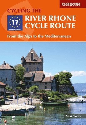
Cycle the River Rhone from the Swiss Alps to the Mediterranean Sea and experience 895km of spectacular, mostly downhill riding through Switzerland and France. Starting high at the Furkapass and finishing at Port-Saint-Louis-du-Rhône on the Mediterranean coast, this iconic EuroVelo EV17 route is accessible to most cyclists and typically completed in 12 to 14 days. Mike Wells's trusted Cicerone guidebook covers the full route in detail, with stage-by-stage descriptions, 1:150,000 mapping and everything you need to plan and enjoy the ride. It draws on his extensive experience of European cycle touring to provide practical advice on preparation, transport, accommodation and navigation, so you can focus on the riding once you're on the route. The route is divided into 20 stages averaging 45km each, with a 12-day schedule provided, making it manageable for most cyclists — an optional prologue stage from Andermatt or Oberwald takes you to the high-altitude start point at FurkapassTwo route options are described along either the north or south shore of Lake Geneva, passing through Lausanne and Montreux or Thonon-les-Bains, giving you flexibility to tailor the ride Detailed route descriptions are supported by 1:150,000 mapping for each stage, guiding you through key cities and towns including Martigny, Geneva, Lyon, Vienne, Valence, Montélimar and AvignonDownloadable GPX files enable easy digital navigation on GPS devices or smartphone apps, so you can take in the vineyards of the Côtes du Rhône, the papal city of Avignon and the Roman remains at Arles without losing your wayComprehensive practical chapters cover preparation, transport options, accommodation, food and drink, and what to take, alongside a facilities summary, tourist information appendix and French/German language glossary From the Furkapass to the Mediterranean, this comprehensive Cicerone guidebook provides everything you need to ride one of Europe's great river routes. Follow the Rhone from the Alps to the sea.
Häftad, Engelska, 2025
189 kr
Skickas
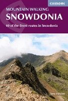
Discover the sweeping ridges, tranquil valleys, and dramatic peaks of Eryri (Snowdonia) National Park, the heart of Welsh mountain adventure and one of Britain’s finest walking destinations. From the iconic Snowdon Horseshoe and airy Bristly Ridge to the rugged wilderness of the Rhinogs and the grassy plateaux of the Carneddau, each route offers the promise of exploration amid breathtaking scenery. Ideal for walkers seeking longer low-level trails to experienced hikers ready for demanding days and airy scrambles, this definitive Cicerone guidebook presents 40 graded mountain walks across every corner of Snowdonia National Park. Routes range from easy strolls to strenuous ridge walks, with most falling into the moderate and strenuous categories. Four routes include low-grade scrambling for those ready to push their skills a little further. Explore the diverse mountain regions of Eryri, including the Carneddau, Glyderau, Snowdon, Eifionydd, Moelwyns, Rhinogs, Cadair Idris, Betws-y-Coed and Dolgellau, each offering unique perspectives and character.Features all the classic walks of Snowdonia National Park, Snowdon, Tryfan, Y Garn, Cadair Idris, The Rhinogs, and celebrated routes such as the Snowdon Horseshoe, Crib Goch, Bristly Ridge, and the traverse of all 15 of Snowdonia’s 3000ft peaks.Includes 1:50,000 OS mapping for every Snowdonia mountain walk and a handy summary table, ensuring straightforward navigation and helping you select the perfect route by distance, ascent, grade, and walking time.Practical advice covers access, parking, public transport, travel and transport options, accommodation, the best times of year to visit, and essential equipment, giving you the confidence to plan every detail of your adventure in Eryri.Each route is accompanied by at-a-glance information on start/finish points, distance (in km and miles), total ascent (in metres and feet), estimated time, grade, terrain summary, and key logistical details, providing everything you need to plan and enjoy a mountain walk in the spectacular landscapes of Snowdonia.Additional features include insights into Snowdonia’s geology, history, and wildlife, plus a Welsh–English glossary to enrich your experience of the land and its culture.Walks are suitable year-round in Snowdonia, with clear notes on local weather and conditions. Scrambles are graded for difficulty and exposure, helping you select the right level of challenge for your mountain adventures in this iconic Welsh region. Plan your mountain walking adventure in Snowdonia with confidence using this trusted Cicerone guidebook, and discover the wide variety, wild beauty, and unique spirit of Wales’s most celebrated national park.
Häftad, Engelska, 2022
199 kr
Skickas
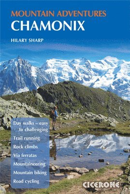
Discover the full range of summer adventures available in one of the world's great mountain destinations, from easy family walks and hut-to-hut treks in the shadow of Mont Blanc to alpine mountaineering on the Cosmiques Arête, via ferratas, rock climbing, bouldering, mountain biking, and road cycling. With something for every level of ability and ambition, Chamonix offers an unrivalled variety of mountain activities within one of the most spectacular alpine settings in Europe. Suitable for families, groups of friends, and experienced mountaineers alike, this comprehensive Cicerone guidebook brings together over 80 routes and activities across eight disciplines in and around the Chamonix valley. Routes range from easy lakeside strolls accessible to all the family to moderate rock climbs and glacier routes requiring technical skills or a professional guide. Choose from over 80 routes and activities across walking, alpine mountaineering, mountain biking, road cycling, via ferratas, rock climbing, bouldering, and trail running, covering the full Chamonix valley from Les Houches and Les Contamines in the west to Vallorcine and the Col des Montets in the east.Tackle alpine mountaineering routes including the Cosmiques Arête, the Aiguille du Tour, the Petite Aiguille Verte, and the classic Normal Route on Mont Blanc itself, with clear guidance on the technical skills and experience required for each ascent.Explore the Chamonix valley on two wheels with 10 mountain biking routes, including the Petit Balcon Nord and the Vallorcine to Martigny descent, and 4 road cycling routes, including the Col des Montets and the descent of the Col de la Forclaz.Discover the area's best rock climbing at crags including Les Gaillands, the Index, and the Aiguillette d'Argentière, alongside 5 bouldering areas and 4 via ferratas, including the dramatic route at Sixt-Fer-à-Cheval.Walk to mountain huts including the Refuge du Lac Blanc, Refuge Albert Premier, and Refuge de Tré-la-Tête, with classic walks taking in the Mer de Glace, the Aiguilles Rouges, and Lac Blanc, and family-friendly routes including the dinosaur tracks and the Bérard valley.Plan your Chamonix summer adventure with comprehensive practical information on getting there and around, accommodation, when to go, health and safety, glacier travel techniques, and the lift systems that open up the high mountain terrain from mid-June to mid-September. Experience the full range of adventures Chamonix has to offer with confidence using this trusted Cicerone guidebook. Whether you are a first-time visitor or a seasoned alpine regular, this is the essential companion for a multi-activity summer holiday in the shadow of Mont Blanc.
Häftad, Engelska, 2023
223 kr
Skickas
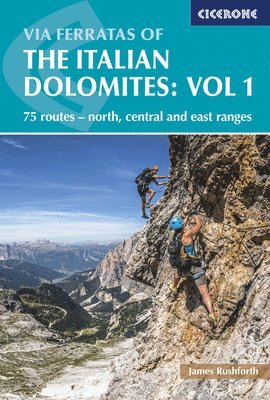
Discover the dramatic peaks and ridgelines of the Italian Dolomites, home to the world’s greatest concentration of legendary via ferratas, ‘iron way’ climbs that trace airy ledges and vertical walls across this UNESCO World Heritage landscape. From the iconic spires of Tre Cime di Lavaredo to the mighty Marmolada, Sella, and Catinaccio ranges, each route promises adventure amid scenery famed for explosive rock formations, ever-changing colours, and a unique blend of cultures. Ideal for adventurous walkers, scramblers, and climbers with a head for heights, this comprehensive Cicerone guidebook details 75 outstanding via ferratas spanning the northern, central, and eastern Dolomites. Routes range from short, accessible outings to long, technical challenges, offering a wide selection of grades and styles to suit both novices and seasoned ferratisti. Each via ferrata is meticulously described, with distances from 3 to 29km (2–18 miles) and durations of 2 to 12 hours, ensuring you’ll find the perfect challenge for your ambitions. Explore celebrated Dolomite areas, including Val di Fassa/Canazei, Selva, Badia/La Villa, Corvara, Arabba, Falzarego, Cortina, Misurina, Sesto, and Auronzo, each a gateway to unforgettable mountain adventures.All routes require a helmet, harness, and via ferrata lanyard, and are best enjoyed between June and September, when the Dolomites are at their most accessible.The guidebook features 1:50,000 mapping and detailed colour photo topos for every via ferrata route (with select routes at 1:40,000), making navigation straightforward and route-finding clear even on complex terrain in the Dolomites.Practical advice covers essential equipment, safety, accommodation, getting there, getting around, and route planning, ensuring you embark on your via ferrata journey in the Dolomites with the confidence and knowledge needed for a rewarding experience.Each route description is accompanied by an at-a-glance information box detailing start and finish points, distance, ascent and descent, estimated time, technical grade, seriousness, wire length, and GPS coordinates for parking, perfect for planning your days in the Italian Dolomites.In the Italian Dolomites, the via ferrata routes featured in this guide are graded using the widely adopted Smith/Fletcher dual system, offering consistent guidance on both technical difficulty and seriousness unique to this spectacular region.Designed specifically for the Italian Dolomites, the guide includes summary tables for quick route comparison and covers everything from short, scenic routes for beginners to demanding, exposed climbs for experienced adventurers tackling the region’s most iconic via ferratas.Also available from Cicerone is Via Ferratas of the Italian Dolomites: Volume 2, which explores the southern Dolomites, Pala, Brenta, and Garda regions. Plan your via ferrata adventure in the Italian Dolomites with confidence using the definitive Cicerone guidebook, and discover the untamed beauty, rich history, and unique alpine culture of Italy’s most celebrated mountain range.
Letar du efter digitala böcker?
E-böcker och ljudböcker handlar du än så länge på vår tidigare sajt.