• Fri frakt över 249 kr
  • •
  • Snabba leveranser
  • •
  • Billiga böcker
Kundservice

Du är på sajten för privatpersoner.

Företag, bibliotek eller offentlig verksamhet?

Du handlar på classic.bokus.com, där alla dina funktioner finns intakta.
Till classic.bokus.com
Bokus logotyp. Gå till startsidan.
  • Erbjudanden
  • Nyheter
  • Student
  • Topplistor
  • Barn & ungdom
  • Bokus Play
  • E-böcker
  • Pocketböcker
  • Spel & pussel

10% studentrabatt med kod TERM26

Sidfot

Mina sidor

    Hjälp

    • Kundservice
    • Vanliga frågor och svar
    • Frakt och leverans
    • Retur vid ångerrätt
    • Reklamera vara
    • Betalning
    • Köpvillkor
    • Allmänna villkor
    • Information om webbplatsens tillgänglighet

    Om Bokus

    • Om oss
    • Pressrum
    • För studenter
    • För företag
    • För bibliotek och offentlig verksamhet
    • För leverantörer
    • Hållbarhet

    Populärt

    • Aktuella erbjudanden
    • Presentkort
    • Studentlitteratur
    • Nya böcker
    • Topplistor
    • Signerade böcker
    • Engelska böcker

    Inspiration

    • Boktips
    • BookTok
    • Populära bokserier
    • Barnbokskaraktärer
    • Populära författare
    Logotyp för Bokus
    Följ oss på Facebook (extern länk)Följ oss på Instagram (extern länk)Följ oss på YouTube (extern länk)Följ oss på TikTok (extern länk)
    bokus @ CookiesAnpassa cookiesIntegritetspolicyKöpvillkor
    Till Citymail hemsida (extern länk)Till Budbee hemsida (extern länk)Till Postnord hemsida (extern länk)Till Schenker hemsida (extern länk)Till Early Bird hemsida (extern länk)Till Walleys hemsida (extern länk)
    1. Sport, fritid och hobby
    2. Fordonsböcker
    3. Böcker om tåg

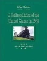
    Railroad Atlas of the United States in 1946

    Volume 3: Indiana, Lower Michigan, and Ohio

    AvRichard C. Carpenter

    Inbunden, Engelska, 2009

    Del i serien Creating the North American Landscape

    1 131 kr

    Beställningsvara. Skickas inom 3-6 vardagar. Fri frakt över 249 kr.

    Fler format och utgåvor

    Inbunden

    1 122 kr

    Inbunden

    1 145 kr

    Inbunden

    Tillf. slut

    Beskrivning

    A Railroad Atlas of the United States in 1946 recalls an era when steam locomotives were still king and passenger trains stopped at nearly every town in America. Railroad companies employed over a million workers, on the trains and along the tracks. Everything moved by rail: travelers, mail, and freight-whether a massive electric generator or a child's bicycle. Richard C. Carpenter's hand-drawn color maps recapture the precise details: the various trunk and ancillary railroad passenger lines that served thousands of towns; long-since demolished steam locomotive and manual signal tower installations; towns that functioned solely as places where crews changed over; track pans; coaling stations; tunnels; bridges and viaducts; and other rail-specific sites. The third and largest volume in this acclaimed series includes 276 maps and drawings and focuses on Indiana, Lower Michigan, and Ohio. These states could be called the crossroads of the national railroad network, where east-west transcontinental lines crossed north-south inter-regional lines.Carpenter depicts the major rail centers of Indianapolis, Gary, Detroit, Toledo, Cleveland, and Chicago, as well as every town and rail junction from Mackinaw City, Michigan, to Tell City, Indiana.

    Produktinformation

    • Utgivningsdatum:2009-02-25
    • Mått:216 x 279 x 27 mm
    • Vikt:1 588 g
    • Format:Inbunden
    • Språk:Engelska
    • Serie:Creating the North American Landscape
    • Antal sidor:360
    • Förlag:Johns Hopkins University Press
    • ISBN:9780801890024

    Utforska kategorier

    • Böcker om tåg inom Sport, fritid och hobby
    • Historisk geografi inom Historia och arkeologi

    Mer om författaren

    Richard C. Carpenter is the retired executive director of the South Western Regional Planning Agency in Connecticut.

    Recensioner i media

    An incredible wealth of information... a fine addition to library collections that support interests in railroading, transportation issues, post-World War II history, or the midwest region. American Reference Books Annual 2009 Superb series... As in Carpenter's previous editions on the Mid-Atlantic states and New England, the detail in his hand-drawn, exhaustively researched maps is astonishing... This atlas and its companions are excellent snapshots of railroading's 'classic era.' -- Ronald S. McGonigal Classic Trains 2009 A winning reference. Midwest Book Review 2009 Mr. Carpenter's labor of love appeals to railroad professionals, railroad enthusiasts, sociologists, historians, local historians, cartographers, and collectors of unusual maps. The book belongs on your reference shelf. There's nothing else quite like it. -- John Baesch The Portolan 2009 This atlas is a gem, and certainly should be considred for your bookshelf. -- Robert D. Brubaker Keystone 2010

    Innehållsförteckning

    • IntroductionHow to Use This AtlasAcknowledgmentsThe AtlasKay MapMap Symbols and AbbreviationsThe MapsAppendix: List of Railroads in the AtlasNotes on the Maps: ReferencesIndexesCoaling StationsInterlocking Stations and Former Interlocking StationsPassender and Non-passenger StationsTrack PansTunnelsViaducts