Häftad, Engelska, 2025
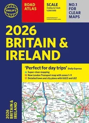
2026 Philip’s Road Atlas Britain & Ireland
181 kr
Beställningsvara. Skickas inom 5-8 vardagar. Fri frakt över 249 kr.
Beskrivning
'Good balance between detail and clarity with excellent town maps' What Car?'Perfect for day trips' The Daily ExpressPHILIP'S - Market leader and No. 1 in the UK for clear maps 2026 Philip's Road Atlas of Britain and Ireland is a top-of-the-range, A4-sized, paperback atlas featuring fully updated maps from the Philip's digital database. Voted Britain's clearest and most detailed in an independent consumer survey, the mapping is super-clear.* 88 fully indexed and detailed town-centre maps with Low Emission Zones and Ultra Low Emission Zones* Top tips for better and safer driving including how to parallel park* 160 pages of fully updated super-clear road maps* 10 pages of detailed route-planning maps, to help plan your route in advance* Mapping at a scale of 3 miles to 1 inch = 1:200,000 for clarity and ease of use* Major city approach maps with named arterial roads* Clear road mapping showing all of IrelandThe maps clearly mark service areas, roundabouts and multi-level junctions, and in rural areas distinguish between roads over and under 4 metres wide. It also includes a 2-page road map of Ireland, 10 pages of route-planning maps, a distance table, 10 large-scale city approach maps with named arterial roads, the latest ULEZ details, and 88 extra-detailed and fully indexed town and city plans. Wherever you are driving in Britain and Ireland, this is the ultimate road trip companion.
Produktinformation
- Utgivningsdatum: 2025-06-05
- Mått: 218 x 298 x 12 mm
- Vikt: 720 g
- Format: Häftad
- Språk: Engelska
- Serie: Philip's Road Atlases
- Antal sidor: 256
- Förlag: Octopus Publishing Group
- ISBN: 9781849077163
Utforska kategorier
Betyg & recensioner
0 recensioner
Inga recensioner tillgängliga.