• Fri frakt över 249 kr
  • •
  • Snabba leveranser
  • •
  • Billiga böcker
Kundservice

Du är på sajten för privatpersoner.

Företag, bibliotek eller offentlig verksamhet?

Du handlar på classic.bokus.com, där alla dina funktioner finns intakta.
Till classic.bokus.com
Bokus logotyp. Gå till startsidan.
  • Erbjudanden
  • Nyheter
  • Student
  • Topplistor
  • Barn & ungdom
  • Bokus Play
  • E-böcker
  • Pocketböcker
  • Spel & pussel

10% rabatt på allt med kod: NYSTART10 →

Sidfot

Mina sidor

    Hjälp

    • Kundservice
    • Vanliga frågor och svar
    • Frakt och leverans
    • Retur vid ångerrätt
    • Reklamera vara
    • Betalning
    • Köpvillkor
    • Allmänna villkor
    • Information om webbplatsens tillgänglighet

    Om Bokus

    • Om oss
    • Pressrum
    • För studenter
    • För företag
    • För bibliotek och offentlig verksamhet
    • För leverantörer
    • Hållbarhet

    Populärt

    • Aktuella erbjudanden
    • Presentkort
    • Studentlitteratur
    • Nya böcker
    • Topplistor
    • Signerade böcker
    • Engelska böcker

    Inspiration

    • Boktips
    • BookTok
    • Populära bokserier
    • Barnbokskaraktärer
    • Populära författare
    Logotyp för Bokus
    Följ oss på Facebook (extern länk)Följ oss på Instagram (extern länk)Följ oss på YouTube (extern länk)Följ oss på TikTok (extern länk)
    bokus @ CookiesAnpassa cookiesIntegritetspolicyKöpvillkor
    Till Citymail hemsida (extern länk)Till Budbee hemsida (extern länk)Till Postnord hemsida (extern länk)Till Schenker hemsida (extern länk)Till Early Bird hemsida (extern länk)Till Walleys hemsida (extern länk)
    1. Naturvetenskap och teknik
    2. Geovetenskap
    3. Geografi

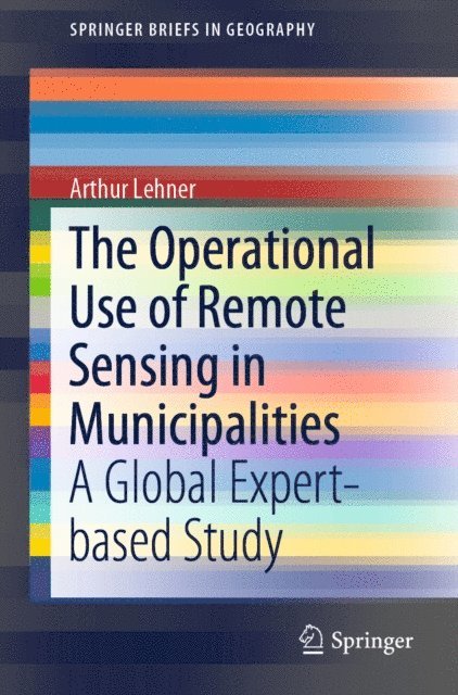
    Operational Use of Remote Sensing in Municipalities

    A Global Expert-based Study

    AvArthur Lehner

    Häftad, Engelska, 2019

    Del i serien SpringerBriefs in Geography

    547 kr

    Beställningsvara. Skickas inom 10-15 vardagar. Fri frakt över 249 kr.

    Fler format och utgåvor

    E-bok

    712 kr

    Beskrivning

    This book presents the operational use of remote sensing in municipalities for urban planning purposes. Through a unique study among more than 70 cities and institutions in 41 countries, it reveals the remaining gap of knowledge and awareness for remote sensing data, methods, and instruments. It sheds light on the uncertainties and shows what remote sensing data are acquired and by which departments they are used. The tasks and activities remote sensing data are used for, are extensively presented. In the times of open government data, digital citizenship and participation movements, this book provides a comprehensive overview of the topic and intends to raise the awareness for the importance of remote sensing to the society.

    Produktinformation

    • Utgivningsdatum:2019-07-11
    • Mått:155 x 235 x 6 mm
    • Vikt:160 g
    • Format:Häftad
    • Språk:Engelska
    • Serie:SpringerBriefs in Geography
    • Antal sidor:84
    • Upplaga:19001
    • Förlag:Springer Nature Switzerland AG
    • ISBN:9783030237998

    Utforska kategorier

    • Geografi inom Naturvetenskap och teknik

    Mer om författaren

    Arthur Lehner studied Landscape Planning & Landscape Architecture at the University of Natural Resource and Life Sciences, Vienna (BOKU) and received his master’s degree in July 2015. Thesis topic: Urban development of the city of Lima, Peru. While studying he worked as a freelancer for the Austrian Water and Waste Management Association (ÖWAV). He also did an internship in a Peruvian NGO (AIDER), position: GIS intern, during a stay of 3 months in Peru. He started his PhD “Applied Geoinformatics” in fall 2015 at the University of Salzburg with the topic “Remote Sensing Derived Building Structure and Parameters for Urban Planning Applications”. His supervisor in Salzburg is Prof. Dr. Thomas Blaschke. Accompanying the studies at the University of Salzburg he received a funding for three years from the AIT-Austrian Institute of Technology for the position of a PhD researcher. His research interests encompass urban remote sensing, Copernicus satellite data, urban planning, open space analysis, urban agriculture, urban morphology studies, and object-based image analysis related analysis of the urban structure.

    Innehållsförteckning

    • Introduction.- Study Areas and Background Information.- Expert Interviews.- Investigated Countries, Cities and Institutions.- Insights into the Global Municipal Use of RS.- Reasoning.- Conclusion.- Appendix.- Glossary.- References.