Övrigt, Tyska, 2023
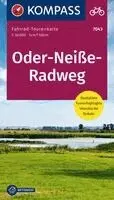
Oder-Neiße-Radweg
188 kr
Beställningsvara. Skickas inom 3-6 vardagar. Fri frakt över 249 kr.
Beskrivning
The KOMPASS cycling map series convinces by its: - clear cartography at a scale of 1: 50.000 - detailed information on road conditions, traffic load and gradient conditions - tips on bike-friendly pubs and restaurants, train stations etc ... - handy format, fold once – fits in the bike map holder - tear and weatherproof paper ideal for all weather conditions The tear and weatherproof KOMPASS bike maps on a scale of 1: 50,000 provide a clear cartography. Detailed route information and tourist information help you to plan your route. With the new KOMPASS bike maps you are on steady the road! The new, sophisticated - and reduced to the essentials - cartography provides the cyclist with exactly the information that is important to him. At an ideal scale of 1: 50,000, the map remains easy to read - and makes orientation fast and easy.- Der rund 600 km lange Fernradweg ist Deutschlands östlichster Radweg und verläuft auf einer Länge von 465 km an der Grenze zu Polen.- Die Route begleitet die beiden Flüsse von der Quelle der Neiße in Nova Ves (Tschechien) bis zur Mündung der Oder in die Ostsee; drei Länder und jede Menge Naturidyll warten an der Strecke.- Entlang der Neiße geht es durch Sachsen – mit schönen Städten wie Zittau oder Görlitz, dem Klosterstift St. Marienthal oder auch dem bekannten FürstPückler-Park, dem größten Landschaftspark in Deutschland.- Nach der Odermündung bezaubert die flache Flusslandschaft, die Strecken auf dem Deich, der Oderbruch, die Moränenhügel und kleinen Seen des Unteren Odertales und schließlich das Stettiner Haff.- Der Radweg endet in Uckermünde, wo die Oder in die Ostsee mündet.
Produktinformation
- Utgivningsdatum: 2023-04-03
- Mått: 110 x 180 x 15 mm
- Vikt: 204 g
- Format: Övrigt
- Språk: Tyska
- Serie: Fahrad-Tourenkarte
- Antal sidor: 1
- Upplaga: 4
- Förlag: Kompass Karten GmbH
- ISBN: 9783991217619
Utforska kategorier
Betyg & recensioner
0 recensioner
Inga recensioner tillgängliga.