Övrigt, Tyska, 2026
Tatra Walking and Cycling Map
188 kr
Beställningsvara. Skickas inom 3-6 vardagar. Fri frakt över 249 kr.
Beskrivning
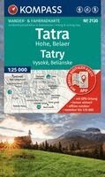
Hiking map Tatra High Mountains, Belaer / Tatry, Vysoké, Belianske: The map for hiking, cycling, and many other outdoor activities.Kompass hiking maps are easy to read yet contain all the information you need for a perfect hike, bike ride, or day trip. They depict the landscape at the appropriate scale. Countless additional details are continuously reviewed and expanded by the cartography team. The precise cartography includes all official hiking trails with names and trail numbers (such as long-distance trails), cycling routes (including trails), via ferratas, inns and huts, parking areas, bus and train connections, ski touring routes and cross-country ski tracks, springs, swimming spots, and much more. This makes the map ideal for discovering new destinations, planning tours, and navigating on the go. An intuitive map image of the landscape is created by the depicted vegetation, contour lines, rock formations, and the shading (shadowing) of the mountains.Features of the Tatra High, Belaer / Tatry, Vysoké, Belianske hiking map:- Scale 1:25,000: 1 cm on the main map corresponds to 250 m in reality- Thanks to the tear-resistant and weatherproof paper, the map withstands all weather conditions- Map section can also be used offline in the Kompass hiking map app.About the region: The Tatra High and Belaer mountains in Slovakia offer an impressive mountain landscape with steep rock faces and green valleys. The highest peak, Gerlachovsky štít (Gerlach Peak), towers majestically over the region.Languages: German, Slovak
Produktinformation
- Utgivningsdatum: 2026-07-10
- Mått: 110 x 185 x 5 mm
- Vikt: 250 g
- Format: Övrigt
- Språk: Tyska
- Serie: Kompass Wanderkarten
- Antal sidor: 2
- Upplaga: 26003
- Förlag: Kompass Karten GmbH
- ISBN: 9783991545514
Utforska kategorier
Betyg & recensioner
0 recensioner
Inga recensioner tillgängliga.