• Fri frakt över 249 kr
  • •
  • Snabba leveranser
  • •
  • Billiga böcker
Kundservice

Du är på sajten för privatpersoner.

Företag, bibliotek eller offentlig verksamhet?

Du handlar på classic.bokus.com, där alla dina funktioner finns intakta.
Till classic.bokus.com
Bokus logotyp. Gå till startsidan.
  • Erbjudanden
  • Nyheter
  • Student
  • Topplistor
  • Barn & ungdom
  • Bokus Play
  • E-böcker
  • Pocketböcker
  • Spel & pussel

10% rabatt på allt med kod NYSTART10 →

Sidfot

Mina sidor

    Hjälp

    • Kundservice
    • Vanliga frågor och svar
    • Frakt och leverans
    • Retur vid ångerrätt
    • Reklamera vara
    • Betalning
    • Köpvillkor
    • Allmänna villkor
    • Information om webbplatsens tillgänglighet

    Om Bokus

    • Om oss
    • Pressrum
    • För studenter
    • För företag
    • För bibliotek och offentlig verksamhet
    • För leverantörer
    • Hållbarhet

    Populärt

    • Aktuella erbjudanden
    • Presentkort
    • Studentlitteratur
    • Nya böcker
    • Topplistor
    • Signerade böcker
    • Engelska böcker

    Inspiration

    • Boktips
    • BookTok
    • Populära bokserier
    • Barnbokskaraktärer
    • Populära författare
    Logotyp för Bokus
    Följ oss på Facebook (extern länk)Följ oss på Instagram (extern länk)Följ oss på YouTube (extern länk)Följ oss på TikTok (extern länk)
    bokus @ CookiesAnpassa cookiesIntegritetspolicyKöpvillkor
    Till Citymail hemsida (extern länk)Till Budbee hemsida (extern länk)Till Postnord hemsida (extern länk)Till Schenker hemsida (extern länk)Till Early Bird hemsida (extern länk)Till Walleys hemsida (extern länk)
    1. Naturvetenskap och teknik
    2. Geovetenskap
    3. Geografi

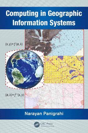
    Computing in Geographic Information Systems

    AvNarayan Panigrahi

    Häftad, Engelska, 2019

    1 032 kr

    Beställningsvara. Skickas inom 10-15 vardagar. Fri frakt över 249 kr.

    Fler format och utgåvor

    E-bok

    1 227 kr

    Inbunden

    2 057 kr

    E-bok

    1 224 kr

    Beskrivning

    Capable of acquiring large volumes of data through sensors deployed in air, land, and sea, and making this information readily available in a continuous time frame, the science of geographical information system (GIS) is rapidly evolving. This popular information system is emerging as a platform for scientific visualization, simulation, and computation of spatio-temporal data. New computing techniques are being researched and implemented to match the increasing capability of modern-day computing platforms and easy availability of spatio-temporal data. This has led to the need for the design, analysis, development, and optimization of new algorithms for extracting spatio-temporal patterns from a large volume of spatial data.Computing in Geographic Information Systemsconsiders the computational aspects, and helps students understand the mathematical principles of GIS. It provides a deeper understanding of the algorithms and mathematical methods inherent in the process of designing and developing GIS functions. It examines the associated scientific computations along with the applications of computational geometry, differential geometry, and affine geometry in processing spatial data. It also covers the mathematical aspects of geodesy, cartography, map projection, spatial interpolation, spatial statistics, and coordinate transformation. The book discusses the principles of bathymetry and generation of electronic navigation charts.The book consists of 12 chapters. Chapters one through four delve into the modeling and preprocessing of spatial data and prepares the spatial data as input to the GIS system. Chapters five through eight describe the various techniques of computing the spatial data using different geometric and statically techniques. Chapters nine through eleven define the technique for image registration computation and measurements of spatial objects and phenomenon.Examines cartographic modeling and map

    Produktinformation

    • Utgivningsdatum:2019-10-23
    • Mått:156 x 234 x undefined mm
    • Vikt:580 g
    • Format:Häftad
    • Språk:Engelska
    • Antal sidor:303
    • Förlag:Taylor & Francis Ltd
    • ISBN:9780367378561

    Utforska kategorier

    • Geografi inom Naturvetenskap och teknik
    • Programmeringsböcker inom Data och IT

    Mer om författaren

    Dr. Narayan Panigrahi is a practicing geo-spatial scientist in the Centre for Artificial Intelligence and Robotics (CAIR), Bangalore, India. He obtained his master's degree from the J.K. Institute of Applied Physics and Technology, University of Allahabad, his M Tech from the Indian Institute of Technology (IIT), Kharagpur, and his PhD from IIT, Bombay, India. His current research interests include geographical information science, design and optimization of algorithms for computation of spatial data in vector and raster form obtained through different sensors, and application of GIS for resource mapping and operation planning.

    Innehållsförteckning

    • Introduction. Computational Geodesy. Reference Systems and Coordinate Transformations. Basics of Map Projection. Algorithms for Rectification of Geometric Distortions. Differential Geometric Principles and Operators. Computational Geometry and its Application to GIS. Spatial Interpolation Techniques. Spatial Statistical Methods. An Introduction to Bathymetry. Spatial Analysis of Bathymetric Data and Sea GIS. Measurements and Analysis Using GIS. Appendix. Appendix-B. Glossary of GIS Terms. Bibliography.