• Fri frakt över 249 kr
  • •
  • Snabba leveranser
  • •
  • Billiga böcker
Kundservice

Du är på sajten för privatpersoner.

Företag, bibliotek eller offentlig verksamhet?

Du handlar på classic.bokus.com, där alla dina funktioner finns intakta.
Till classic.bokus.com
Bokus logotyp. Gå till startsidan.
  • Erbjudanden
  • Nyheter
  • Student
  • Topplistor
  • Barn & ungdom
  • Bokus Play
  • E-böcker
  • Pocketböcker
  • Spel & pussel

10% rabatt på allt med kod NYSTART10 →

Sidfot

Mina sidor

    Hjälp

    • Kundservice
    • Vanliga frågor och svar
    • Frakt och leverans
    • Retur vid ångerrätt
    • Reklamera vara
    • Betalning
    • Köpvillkor
    • Allmänna villkor
    • Information om webbplatsens tillgänglighet

    Om Bokus

    • Om oss
    • Pressrum
    • För studenter
    • För företag
    • För bibliotek och offentlig verksamhet
    • För leverantörer
    • Hållbarhet

    Populärt

    • Aktuella erbjudanden
    • Presentkort
    • Studentlitteratur
    • Nya böcker
    • Topplistor
    • Signerade böcker
    • Engelska böcker

    Inspiration

    • Boktips
    • BookTok
    • Populära bokserier
    • Barnbokskaraktärer
    • Populära författare
    Logotyp för Bokus
    Följ oss på Facebook (extern länk)Följ oss på Instagram (extern länk)Följ oss på YouTube (extern länk)Följ oss på TikTok (extern länk)
    bokus @ CookiesAnpassa cookiesIntegritetspolicyKöpvillkor
    Till Citymail hemsida (extern länk)Till Budbee hemsida (extern länk)Till Postnord hemsida (extern länk)Till Schenker hemsida (extern länk)Till Early Bird hemsida (extern länk)Till Walleys hemsida (extern länk)
    1. Naturvetenskap och teknik
    2. Teknik och industri
    3. Elektronik och kommunikationer

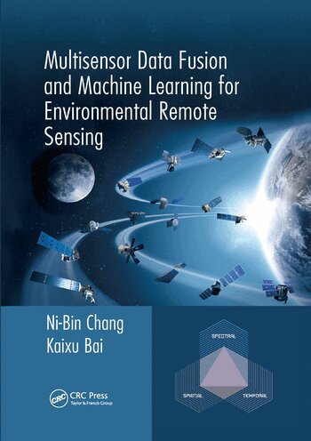
    Multisensor Data Fusion and Machine Learning for Environmental Remote Sensing

    AvNi-Bin Chang,Kaixu Bai

    Häftad, Engelska, 2020

    779 kr

    Beställningsvara. Skickas inom 10-15 vardagar. Fri frakt över 249 kr.

    Fler format och utgåvor

    Inbunden

    3 307 kr

    Beskrivning

    In the last few years the scientific community has realized that obtaining a better understanding of interactions between natural systems and the man-made environment across different scales demands more research efforts in remote sensing. An integrated Earth system observatory that merges surface-based, air-borne, space-borne, and even underground sensors with comprehensive and predictive capabilities indicates promise for revolutionizing the study of global water, energy, and carbon cycles as well as land use and land cover changes. The aim of this book is to present a suite of relevant concepts, tools, and methods of integrated multisensor data fusion and machine learning technologies to promote environmental sustainability. The process of machine learning for intelligent feature extraction consists of regular, deep, and fast learning algorithms. The niche for integrating data fusion and machine learning for remote sensing rests upon the creation of a new scientific architecture in remote sensing science that is designed to support numerical as well as symbolic feature extraction managed by several cognitively oriented machine learning tasks at finer scales. By grouping a suite of satellites with similar nature in platform design, data merging may come to help for cloudy pixel reconstruction over the space domain or concatenation of time series images over the time domain, or even both simultaneously. Organized in 5 parts, from Fundamental Principles of Remote Sensing; Feature Extraction for Remote Sensing; Image and Data Fusion for Remote Sensing; Integrated Data Merging, Data Reconstruction, Data Fusion, and Machine Learning; to Remote Sensing for Environmental Decision Analysis, the book will be a useful reference for graduate students, academic scholars, and working professionals who are involved in the study of Earth systems and the environment for a sustainable future. The new knowledge in this book can be applied successfully in many areas of environmental science and engineering.

    Produktinformation

    • Utgivningsdatum:2020-06-30
    • Mått:178 x 254 x 32 mm
    • Vikt:1 040 g
    • Format:Häftad
    • Språk:Engelska
    • Antal sidor:528
    • Förlag:Taylor & Francis Ltd
    • ISBN:9780367571979

    Utforska kategorier

    • Elektronik och kommunikationer inom Naturvetenskap och teknik
    • Systemvetenskap och AI inom Data och IT
    • Geografi inom Naturvetenskap och teknik

    Mer om författaren

    Ni-Bin Chang is currently a professor with the Civil, Environmental, and Construction Engineering Department at the University of Central Florida. He has authored and coauthored over 230 peer-reviewed journal articles, seven books and 220 conference papers. He is a Fellow of the Royal Society of Chemistry (F.RSC) in the United Kingdom (July, 2015), the International Society of Optics and Photonics (F.SPIE) (Dec., 2014), the American Association for the Advancement of Science (F.AAAS) (Feb., 2012), the American Society of Civil Engineers (F.ASCE) (April, 2009), and a Foreign Member of the European Academy of Sciences (M.EAS) (Nov., 2008). He is also a senior member of Institute of Electrical and Electronics Engineers (IEEE) (since 2012). During Aug. 2012 and Aug. 2014, Prof. Chang has served on a number of professional and government positions including the program director of the Hydrologic Sciences Program and Cyber-innovation Sustainability Science and Engineering Program at the National Science Foundation in the US. He is currently an editor-in-chief, associate editor, or editorial board member of over 30 professional

    Innehållsförteckning

    • Introduction. Part I Fundamental Principles of Remote Sensing. Electromagnetic Radiation and Remote Sensing. Remote Sensing Sensors and Platforms. Image Processing Techniques in Remote Sensing. Part II Feature Extraction for Remote Sensing. Feature Extraction and Classification for Environmental Remote Sensing.Feature Extraction with Statistics and Decision Science Algorithms. Feature Extraction with Machine Learning and Data Mining Algorithms. Part III Image and Data Fusion for Remote Sensing. Principles and Practices of Data Fusion in Multisensor Remote Sensing for Environmental Monitoring. Major Techniques and Algorithms for Multisensor Data Fusion. System Design of Data Fusion and the Relevant Performance Evaluation Metrics. Part IV Integrated Data Merging, Data Reconstruction. Data Fusion, and Machine Learning. Cross-Mission Data Merging Methods and Algorithm. Cloudy Pixel Removal and Image Reconstruction. Integrated Data Fusion and Machine Learning for Intelligent Feature Extraction. Integrated Cross-Mission Data Merging, Fusion, and Machine Learning Algorithms Toward Better Environmental Surveillance. Part V Remote Sensing for Environmental Decision Analysis. Data Merging for Creating Long-Term Coherent Multisensor. Water Quality Monitoring in a Lake for Improving a Drinking Water Treatment Process. Monitoring Ecosystem Toxins in a Water Body for Sustainable Development of a Lake Watershed. Environmental Reconstruction of Watershed Vegetation Cover to Reflect the Impact of a Hurricane Event. Multisensor Data Merging and Reconstruction for Estimating PM Concentrations in a Metropolitan Region.Conclusions.