• Fri frakt över 249 kr
  • •
  • Snabba leveranser
  • •
  • Billiga böcker
Kundservice

Du är på sajten för privatpersoner.

Företag, bibliotek eller offentlig verksamhet?

Du handlar på classic.bokus.com, där alla dina funktioner finns intakta.
Till classic.bokus.com
Bokus logotyp. Gå till startsidan.
  • Erbjudanden
  • Nyheter
  • Student
  • Topplistor
  • Barn & ungdom
  • Bokus Play
  • E-böcker
  • Pocketböcker
  • Spel & pussel

10% rabatt på allt med kod: NYSTART10 →

Sidfot

Mina sidor

    Hjälp

    • Kundservice
    • Vanliga frågor och svar
    • Frakt och leverans
    • Retur vid ångerrätt
    • Reklamera vara
    • Betalning
    • Köpvillkor
    • Allmänna villkor
    • Information om webbplatsens tillgänglighet

    Om Bokus

    • Om oss
    • Pressrum
    • För studenter
    • För företag
    • För bibliotek och offentlig verksamhet
    • För leverantörer
    • Hållbarhet

    Populärt

    • Aktuella erbjudanden
    • Presentkort
    • Studentlitteratur
    • Nya böcker
    • Topplistor
    • Signerade böcker
    • Engelska böcker

    Inspiration

    • Boktips
    • BookTok
    • Populära bokserier
    • Barnbokskaraktärer
    • Populära författare
    Logotyp för Bokus
    Följ oss på Facebook (extern länk)Följ oss på Instagram (extern länk)Följ oss på YouTube (extern länk)Följ oss på TikTok (extern länk)
    bokus @ CookiesAnpassa cookiesIntegritetspolicyKöpvillkor
    Till Citymail hemsida (extern länk)Till Budbee hemsida (extern länk)Till Postnord hemsida (extern länk)Till Schenker hemsida (extern länk)Till Early Bird hemsida (extern länk)Till Walleys hemsida (extern länk)
    1. Naturvetenskap och teknik
    2. Geovetenskap
    3. Geovetenskap
    4. Geologi

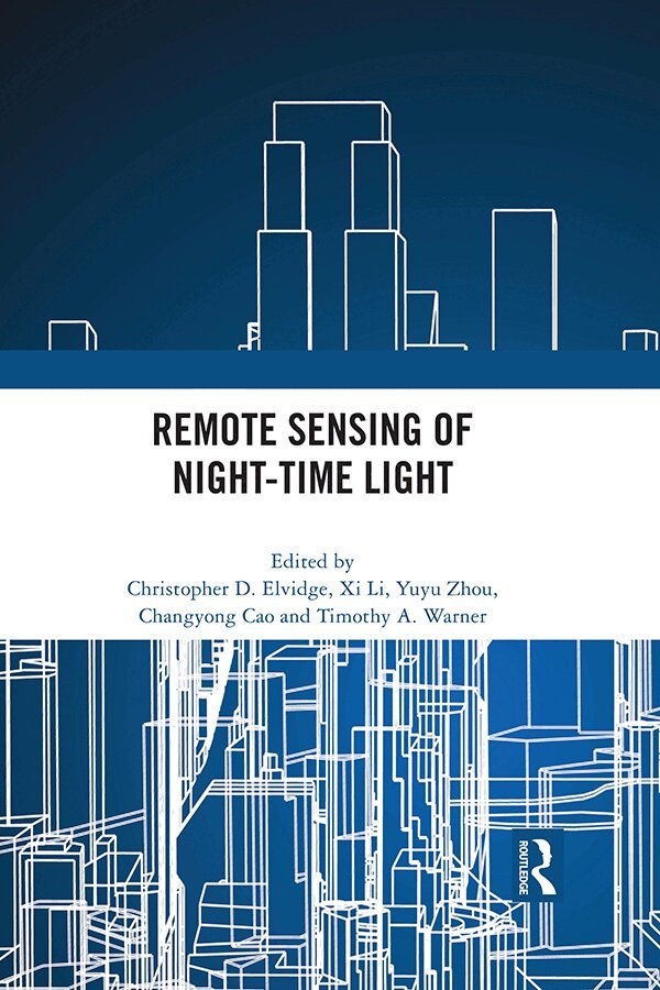
    Remote Sensing of Night-time Light

    AvChristopher Elvidge,Xi Li

    Häftad, Engelska, 2023

    667 kr

    Beställningsvara. Skickas inom 10-15 vardagar. Fri frakt över 249 kr.

    Beskrivning

    Satellite images acquired at night provide a visually arresting perspective of the Earth and the human activities that light up the otherwise mostly dark Earth. These night-time light satellite images can be compiled into a geospatial time series that represent an invaluable source of information for both the natural and social sciences. Night-time light remote sensing has been shown to be particularly useful for a range of natural science and social science applications, including studies relating to urban development, demography, sociology, fishing activity, light pollution and the consequences of civil war. Key sensors for these time-series include the Defense Meteorological Satellite Program’s Operational Linescan System (DMSP/OLS) and the Suomi National Polar-orbiting Partnership Satellite’s Visible Infrared Imaging Radiometer Suite Day/Night Band (Suomi NPP/VIIRS DNB). An increasing number of alternative sources are also available, including high spatial resolution and multispectral sensors.This book captures key methodological issues associated with pre-processing night-time light data, documents state of the art analysis methods, and explores a wide range of applications. Major sections focus on NPP/VIIRS DNB processing; inter-calibration between NPP/VIIRS and DMPS/OLS; applications associated with socio-economic activities, applications in monitoring urbanization; and fishing activity monitoring. The chapters in this book were originally published as a special issue of the International Journal of Remote Sensing.

    Produktinformation

    • Utgivningsdatum:2023-09-25
    • Mått:174 x 246 x undefined mm
    • Vikt:570 g
    • Format:Häftad
    • Språk:Engelska
    • Antal sidor:296
    • Förlag:Taylor & Francis Ltd
    • ISBN:9780367769888

    Utforska kategorier

    • Geologi inom Naturvetenskap och teknik
    • Geografi inom Naturvetenskap och teknik

    Mer om författaren

    Christopher D. Elvidge pioneered the development of global satellite derived night-time lights and led the production of a twenty-one year time series of global DMSP night-time lights (1992–2013). Elvidge was instrumental in establishing the DMSP digital archive at NOAA and led the media migration that rescued the digital records from aging tapes. He developed the VIIRS nightfire (VNF) product, methods for discriminating flaming and smoldering combustion using night-time Landsat data, and developed a night-time boat detection product for VIIRS.Xi Li is Associate Professor at State Key Laboratory of Information Engineering in Surveying, Mapping and Remote Sensing (LIESMARS), Wuhan University. He earned a Ph.D. in Photogrammetry and Remote Sensing at Wuhan University in 2009. His research interests include physical modeling of night-time light as well as night-time light remote sensing applications. He serves as an editorial board member of the International Journal of Remote Sensing and an international consultant for Asian Development Bank. Yuyu Zhou is Associate Professor at the Department of Geological & Atmospheric Sciences, Iowa State University. His research focus has always been in quantifying spatiotemporal patterns of environmental change and developing modeling mechanisms to bridge the driving forces and consequences of environmental change so that the impacts of human activities on the environment can be effectively measured, modeled and evaluated.Changyong Cao is the Chief for the satellite calibration and data assimilation branch at the NOAA Center for Satellite Applications and Research (STAR). He oversees the calibration and validation of satellite radiometers on NOAA polar- orbiting and geostationary satellites. He is also the science team lead for the Visible Infrared Imaging Radiometer Suite (VIIRS) instrument with a research interest on VIIRS on- orbit performance for a variety of applications including night- time lights.Timothy A. Warner is Emeritus Professor of Geology and Geography at West Virginia University. He served as editor in chief of the International Journal of Remote Sensing from 2014 to 2020. He is a Fellow of the American Society of Photogrammetry and Remote Sensing.

    Innehållsförteckning

    • Preface: Remote sensing of night-time lightXi Li, Christopher Elvidge, Yuyu Zhou, Changyong Cao and Timothy A. Warner1. VIIRS nighttime lights Christopher D Elvidge, Kimberly Baugh, Mikhail Zhizhin, Feng Chi Hsu and Tilottama Ghosh 2. Assessment of straylight correction performance for the VIIRS day/night band using Dome-C and Greenland under lunar illuminationShi Qiu, Xi Shao, Chang Yong Cao, Sirish Uprety and Wen Hui Wang3. Improving accuracy of economic estimations with VIIRS DNB image productsNaizhuo Zhao, Feng-Chi Hsu, Guofeng Cao and Eric L. Samson4. A new multichannel threshold algorithm based on radiative transfer characteristics for detecting fog/ low stratus using night-time NPP/VIIRS data. Shensen Hu, Shuo Ma, Wei Yan, Jun Jiang and Yunxian Huang5. Intercalibration between DMSP/OLS and VIIRS night-time light images to evaluate city light dynamics of Syria’s major human settlement during Syrian Civil WarXi Li, Deren Li, Huimin Xu and Chuanqing Wu6. Outdoor light and breast cancer incidence: a comparative analysis of DMSP and VIIRS-DNB satellite dataNataliya A. Rybnikova and Boris A. Portnov7. Using multitemporal night-time lights data to compare regional development in Russia and China, 1992–2012Mia M. Bennett and Laurence C. Smith8. The short-term economic impact of tropical Cyclone Pam: an analysis using VIIRS nightlight satellite imageryPreeya Mohan and Eric Strobl9. Port economics comprehensive scores for major cities in the Yangtze Valley, China using the DMSPOLS night-time light imageryChang Li, Guangping Chen, Jing Luo, Shice Li and Jia Ye10. Urban mapping using DMSP/OLS stable night-time light: a reviewXuecao Li and Yuyu Zhou11. Analysis of urbanization dynamics in mainland China using pixel-based night-time light trajectories from 1992 to 2013Yang Ju, Iryna Dronova, Qin Ma and Xiang Zhang12. Assessing urban growth dynamics of major Southeast Asian cities using Night-Time Light dataShankar Acharya Kamarajugedda, Pradeep V Mandapaka and Edmond Y.M Lo13. A Novel Method for Urban Area Extraction from VIIRS DNB and MODIS NDVI Data: A Case Study of Chinese CitiesQiao Zhang, Ping Wang, Hui Chen, Qinglun Huang, Hongbing Jiang, Zijian Zhang, Yanmei Zhang, Xiang Luo and Shujuan Sun14. Monitoring urban expansion using time series of night-time light data: a case study in Wuhan, ChinaXin Xin, Bin Liu, Kaichang Di, Zhe Zhu, Zhongyuan Zhao, Jia Liu, Zongyu Yue and Guo Zhang15. Predicting potential fishing zones of Japanese common squid (Todarodes pacificus) using remotely sensed images in coastal waters of south-western Hokkaido, JapanXun Zhang, Sei-Ichi Saitoh and Toru Hirawake