• Fri frakt över 249 kr
  • •
  • Snabba leveranser
  • •
  • Billiga böcker
Kundservice

Du är på sajten för privatpersoner.

Företag, bibliotek eller offentlig verksamhet?

Du handlar på classic.bokus.com, där alla dina funktioner finns intakta.
Till classic.bokus.com
Bokus logotyp. Gå till startsidan.
  • Erbjudanden
  • Nyheter
  • Student
  • Topplistor
  • Barn & ungdom
  • Bokus Play
  • E-böcker
  • Pocketböcker
  • Spel & pussel

10% rabatt på allt med kod NYSTART10 →

Sidfot

Mina sidor

    Hjälp

    • Kundservice
    • Vanliga frågor och svar
    • Frakt och leverans
    • Retur vid ångerrätt
    • Reklamera vara
    • Betalning
    • Köpvillkor
    • Allmänna villkor
    • Information om webbplatsens tillgänglighet

    Om Bokus

    • Om oss
    • Pressrum
    • För studenter
    • För företag
    • För bibliotek och offentlig verksamhet
    • För leverantörer
    • Hållbarhet

    Populärt

    • Aktuella erbjudanden
    • Presentkort
    • Studentlitteratur
    • Nya böcker
    • Topplistor
    • Signerade böcker
    • Engelska böcker

    Inspiration

    • Boktips
    • BookTok
    • Populära bokserier
    • Barnbokskaraktärer
    • Populära författare
    Logotyp för Bokus
    Följ oss på Facebook (extern länk)Följ oss på Instagram (extern länk)Följ oss på YouTube (extern länk)Följ oss på TikTok (extern länk)
    bokus @ CookiesAnpassa cookiesIntegritetspolicyKöpvillkor
    Till Citymail hemsida (extern länk)Till Budbee hemsida (extern länk)Till Postnord hemsida (extern länk)Till Schenker hemsida (extern länk)Till Early Bird hemsida (extern länk)Till Walleys hemsida (extern länk)
    1. Naturvetenskap och teknik
    2. Geovetenskap
    3. Geovetenskap
    4. Geologi

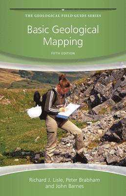
    Basic Geological Mapping

    AvRichard J. Lisle,Peter Brabham

    Häftad, Engelska, 2011

    Del 35 i serien Geological Field Guide

    403 kr

    Beställningsvara. Skickas inom 5-8 vardagar. Fri frakt över 249 kr.

    Beskrivning

    Part of The Geological Field Guide Series, Basic Geological Mapping, 5thEdition is an essential basic guide to field techniques in mapping geology. Now completely revised and updated the book retains the concise clarity which has made it an indispensable instant reference in its previous editions. It provides the reader with all the necessary practical information and techniques that they will need while carrying out work in the field, covering a wide spectrum of different conditions, needs and types of countries. This edition covers new developments in technology including Google Earth and the use of GPS. This is an ideal field guide to geological mapping for 2nd/3rd year undergraduates of Geology, Hydrogeology and Geological Engineering.

    Produktinformation

    • Utgivningsdatum:2011-08-19
    • Mått:114 x 178 x 10 mm
    • Vikt:227 g
    • Format:Häftad
    • Språk:Engelska
    • Serie:Geological Field Guide
    • Antal sidor:240
    • Upplaga:5
    • Förlag:John Wiley & Sons Inc
    • ISBN:9780470686348

    Utforska kategorier

    • Geologi inom Naturvetenskap och teknik
    • Geografi inom Naturvetenskap och teknik

    Mer om författaren

    Richard J. Lisle is a professor at the School of Earth and Ocean Studies, Cardiff University, and his research interests include: Fault-slip analysis, Strain analysis, Fracture Prediction, Numerical modeling.Peter Brabham is a senior lecturer at Cardiff University, his research interests include: Seismic Exploration; Environmental & Engineering Geophysics; South Wales Coalfield - Geology and Industrial development; Landscape Visualization.

    Recensioner i media

    “In summary, the book is written for geology students mapping in the U.K., as opposed to the professional geoscientist. At its best, the book conveys the advice of experienced geology instructors to novice field mapping students as they struggle to learn the fundamentals of geologic observation and interpretation.”  (Environmental & Engineering Geoscience, 2 May 2013)“No field geoscientist should be without this handy, unparalleled guide.  Summing Up: Highly recommended.  Upper-division undergraduates through professionals; two-year technical program students.”  (Choice, 1 August 2012)"This is a "how to do it" book and excels in being a good straight-forward read, packed with detailed information and advice, spiced with a little humour here and there." (Geomatics World, 1 March 2012)

    Innehållsförteckning

    • Preface to the Fourth Edition ixPreface to the Fifth Edition xi1 Introduction 11.1 Outline and Approach 11.2 Safety 21.3 Field Behaviour 41.4 A Few Words of Comfort 52 Field Equipment 62.1 Hammers and Chisels 62.2 Compasses and Clinometers 82.3 Hand Lenses 132.4 Tapes 142.5 Map Cases 142.6 Field Notebooks 152.7 Scales 162.8 Protractors 162.9 Pencils, Erasers and Mapping Pens 172.10 Acid Bottles 182.11 Global Positioning System (GPS) and Mobile Phones 192.12 Other Instruments 232.13 Field Clothing 263 Topographic Base Maps 273.1 Types of Geological Map 273.2 Topographic Base Maps 293.3 Geographic Coordinates and Metric Grids 303.4 Grid Magnetic Angle 333.5 Position Finding on Maps 343.6 Use of Air Photography as a Mapping Tool 433.7 Suitability of Images for Geological Mapping 484 Methods of Geological Mapping 504.1 Strategy for the Mapping Programme 504.2 Mapping by Following Contacts 514.3 Traversing 524.4 Exposure Mapping 554.5 Mapping in Poorly Exposed Regions 574.6 Superficial Deposits 624.7 Drilling 664.8 Geophysical Aids to Mapping 674.9 Large-Scale Maps of Limited Areas 714.10 Underground Mapping 744.11 Photogeology 765 Technological Aids to Mapping 805.1 Digital Terrain Models 805.2 Topographic Surveying Techniques 866 Field Measurements and Techniques 956.1 Measuring Strike and Dip of Planar Structures 956.2 Plotting Strike and Dip 1016.3 Recording Strike and Dip 1016.4 Measuring Linear Features 1026.5 Folds 1056.6 Faults 1106.7 Thrusts 1126.8 Joints 1126.9 Unconformities 1146.10 Map Symbols 1146.11 Specimen Collecting 1166.12 Field Photography 1186.13 Panning 1247 Mappable Rock Units and Lithology 1267.1 Lithostratigraphy and Sedimentary Rocks 1267.2 Sedimentary Formations 1277.3 Rock Descriptions 1287.4 Identifying and Naming Rocks in the Field 1297.5 Fossils 1337.6 Phaneritic Igneous Rocks 1347.7 Aphanitic Igneous Rocks 1357.8 Veins and Pegmatites 1357.9 Igneous Rocks in General 1367.10 Pyroclastic Rocks 1387.11 Metamorphic Rocks 1387.12 Economic Geology 1408 Field Maps and Field Notebooks 1468.1 Field Maps 1468.2 Field Notebooks 1549 Fair Copy Maps and Other Illustrations 1629.1 Fair Copy Maps 1629.2 Transferring Topography 1639.3 Transferring Geology 1639.4 Lettering and Symbols 1649.5 Formation Letters 1659.6 Layout 1659.7 Colouring 1679.8 Stratigraphic Column 1679.9 Overlays 1689.10 Computer Drafting of the Fair Copy Map 16910 Cross-Sections and 3D Illustrations 17110.1 Cross-Sections 17110.2 Method of Apparent Dips 17510.3 Down-Plunge Projection Method 17710.4 Balanced Cross-Sections 17910.5 Columnar Sections 17910.6 Block Diagrams 18010.7 Models 18311 Geological Reports 18511.1 Preparation 18611.2 Revising and Editing 18611.3 Layout 18611.4 The ‘Introduction’ 18811.5 Main Body of the Report 18811.6 The ‘Conclusions’ Section 19111.7 Text Illustrations 19111.8 References 19211.9 Appendices 19311.10 Some Final Thoughts 193Appendix A: Adjustment of a Closed Compass Traverse 195Appendix B: Field Equipment Checklist 197Appendix C: Indicators of Stratigraphical Way-Up 202Appendix D: Useful Chart and Tables 203References 205Index 209