• Fri frakt över 249 kr
  • •
  • Snabba leveranser
  • •
  • Billiga böcker
Kundservice

Du är på sajten för privatpersoner.

Företag, bibliotek eller offentlig verksamhet?

Du handlar på classic.bokus.com, där alla dina funktioner finns intakta.
Till classic.bokus.com
Bokus logotyp. Gå till startsidan.
  • Erbjudanden
  • Nyheter
  • Student
  • Topplistor
  • Barn & ungdom
  • Bokus Play
  • E-böcker
  • Pocketböcker
  • Spel & pussel

10% studentrabatt med kod TERM26

Sidfot

Mina sidor

    Hjälp

    • Kundservice
    • Vanliga frågor och svar
    • Frakt och leverans
    • Retur vid ångerrätt
    • Reklamera vara
    • Betalning
    • Köpvillkor
    • Allmänna villkor
    • Information om webbplatsens tillgänglighet

    Om Bokus

    • Om oss
    • Pressrum
    • För studenter
    • För företag
    • För bibliotek och offentlig verksamhet
    • För leverantörer
    • Hållbarhet

    Populärt

    • Aktuella erbjudanden
    • Presentkort
    • Studentlitteratur
    • Nya böcker
    • Topplistor
    • Signerade böcker
    • Engelska böcker

    Inspiration

    • Boktips
    • BookTok
    • Populära bokserier
    • Barnbokskaraktärer
    • Populära författare
    Logotyp för Bokus
    Följ oss på Facebook (extern länk)Följ oss på Instagram (extern länk)Följ oss på YouTube (extern länk)Följ oss på TikTok (extern länk)
    bokus @ CookiesAnpassa cookiesIntegritetspolicyKöpvillkor
    Till Citymail hemsida (extern länk)Till Budbee hemsida (extern länk)Till Postnord hemsida (extern länk)Till Schenker hemsida (extern länk)Till Early Bird hemsida (extern länk)Till Walleys hemsida (extern länk)
    1. Historia och arkeologi
    2. Historia
    3. Historia: särskilda händelser och ämnen
    4. Socialhistoria och kulturhistoria

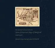
    Maryland State Archives Atlas of Historical Maps of Maryland, 1608-1908

    AvEdward C. Papenfuse,Joseph M. Coale III

    Inbunden, Engelska, 2003

    813 kr

    Tillfälligt slut

    Beskrivning

    Maryland presents cartographers with a formidable test of their skills: unusual natural boundaries, border disputes, and in 1790 the gift of sixty-seven square miles for the creation of the District of Columbia have given the state a distinctively irregular configuration. Since the early seventeenth century, generations of mapmakers have met this challenge with artistic imagination and a variety of cartographical techniques. In The Maryland State Archives Atlas of Historical Maps of Maryland, 1608-1908, Edward C. Papenfuse and Joseph M. Coale III bring together in one volume the results of these remarkable efforts, from Captain John Smith's 1608 detailed sketch of the region to the map resulting from the Supreme Court's determination of the state's western border in 1908. Utilizing the latest digital imaging and printing technology, the Atlas contains stunning, full-color reproductions of more than 250 of the most significant historical maps from state and federal archives.This handsome and informative collection-a thoroughly updated and greatly expanded version of the authors' landmark book, The Hammond-Harwood House Atlas of Historical Maps of Maryland (1982)-provides an in-depth history of mapmaking in Maryland and charts the state's early settlement patterns.

    Produktinformation

    • Utgivningsdatum:2003-06-20
    • Mått:318 x 368 x 22 mm
    • Vikt:2 427 g
    • Format:Inbunden
    • Språk:Engelska
    • Antal sidor:240
    • Upplaga:3020
    • Förlag:Johns Hopkins University Press
    • ISBN:9780801872358

    Utforska kategorier

    • Socialhistoria och kulturhistoria inom Historia och arkeologi
    • Historisk geografi inom Historia och arkeologi
    • Geografi inom Naturvetenskap och teknik

    Mer om författaren

    Edward C. Papenfuse is the State Archivist and Commissioner of Land Patents at the Maryland State Archives. He is the author or co-author of several books on Maryland history, including Maryland: A New Guide to the Old Line State (with Earl Arnett and Robert J. Brugger), also available from Johns Hopkins. Joseph M. Coale III is a Maryland historian and the author of Middling Planters of Ruxton, 1694-1850.

    Recensioner i media

    The book is an aesthetic delight... a feast for the eyes... The authors and publishers are to be congratulated for producing such a fine book. The scholar will find something useful and the general reader something delightful. -- John Rennie Short Maryland Historical Magazine The atlas is indeed one of the most comprehensive and well-compiled editions this reviewer has seen of Maryland mapping... The visuals rank among the best reproductions of the subject presently in print. -- William A. Stanley The Portolan The Maryland State Archives Atlas of Historical Maps of Maryland 1608-1908 is a joy to behold. In fact, it's the sort of book that will appeal to anyone even remotely interested in state history. -- John Lewis Baltimore Magazine Well designed, authoritative... and is reasonably priced. -- Marilyn Domas White American Reference Books Annual 2006