• Fri frakt över 249 kr
  • •
  • Snabba leveranser
  • •
  • Billiga böcker
Kundservice

Du är på sajten för privatpersoner.

Företag, bibliotek eller offentlig verksamhet?

Du handlar på classic.bokus.com, där alla dina funktioner finns intakta.
Till classic.bokus.com
Bokus logotyp. Gå till startsidan.
  • Erbjudanden
  • Nyheter
  • Student
  • Topplistor
  • Barn & ungdom
  • Bokus Play
  • E-böcker
  • Pocketböcker
  • Spel & pussel

10% rabatt på allt med kod NYSTART10 →

Sidfot

Mina sidor

    Hjälp

    • Kundservice
    • Vanliga frågor och svar
    • Frakt och leverans
    • Retur vid ångerrätt
    • Reklamera vara
    • Betalning
    • Köpvillkor
    • Allmänna villkor
    • Information om webbplatsens tillgänglighet

    Om Bokus

    • Om oss
    • Pressrum
    • För studenter
    • För företag
    • För bibliotek och offentlig verksamhet
    • För leverantörer
    • Hållbarhet

    Populärt

    • Aktuella erbjudanden
    • Presentkort
    • Studentlitteratur
    • Nya böcker
    • Topplistor
    • Signerade böcker
    • Engelska böcker

    Inspiration

    • Boktips
    • BookTok
    • Populära bokserier
    • Barnbokskaraktärer
    • Populära författare
    Logotyp för Bokus
    Följ oss på Facebook (extern länk)Följ oss på Instagram (extern länk)Följ oss på YouTube (extern länk)Följ oss på TikTok (extern länk)
    bokus @ CookiesAnpassa cookiesIntegritetspolicyKöpvillkor
    Till Citymail hemsida (extern länk)Till Budbee hemsida (extern länk)Till Postnord hemsida (extern länk)Till Schenker hemsida (extern länk)Till Early Bird hemsida (extern länk)Till Walleys hemsida (extern länk)
    1. Naturvetenskap och teknik
    2. Geovetenskap
    3. Geografi

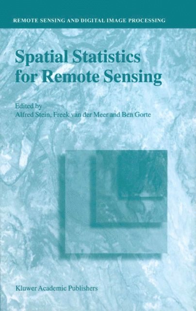
    Spatial Statistics for Remote Sensing

    AvA. Stein,Freek D. van der Meer

    Häftad, Engelska, 2002

    Del i serien Remote Sensing and Digital Image Processing

    1 625 kr

    Beställningsvara. Skickas inom 10-15 vardagar. Fri frakt över 249 kr.

    Beskrivning

    This book is a collection of papers on spatial statistics for remote sensing. The book emerges from a study day that was organized in 1996 at the International Institute for Aerospace Survey and Earth Sciences, ITC, in Enschede, The Netherlands. It was by several means a memorable event. The beautiful new building, according to a design by the famous modern Dutch architect Max van Huet was just opened, and this workshop was the first to take place there. Of course, much went wrong during the workshop, in particular as the newest electronic equipment regularly failed. But the workshop attrackted more than hundred attendants, and was generally well received. The results of the workshop have been published in Stein et al. (1998). The aim of the workshop was to address issues of spatial statistics for remote sensing. The ITC has a long history on collecting and analyzing satellite and other remote sensing data, but its involvement into spatial statistics is of a more recent date. Uncertainties in remote sensing images and the large amounts of data in many spectral bands are now considered to be of such an impact that it requires a separate approach from a statistical point of view. To quote from the justification of the study day, we read: Modern communication means such as remote sensing require an advanced use of collected data. Satellites collect data with different resolution on different spectral bands.

    Produktinformation

    • Utgivningsdatum:2002-03-31
    • Mått:155 x 235 x 17 mm
    • Vikt:464 g
    • Format:Häftad
    • Språk:Engelska
    • Serie:Remote Sensing and Digital Image Processing
    • Antal sidor:284
    • Upplaga:2002
    • Förlag:Kluwer Academic Publishers
    • ISBN:9781402005510

    Utforska kategorier

    • Geografi inom Naturvetenskap och teknik

    Recensioner i media

    "...constitutes a nice synopsis of an extensive array of topics and ideas. ...as a reference source, it is definitely worth having access to, and it would be an appropriate addition for most research libraries. ...it does represent a contribution to the literature that individuals involved in remote sensing data analysis should like to have at their disposal, and so libraries should be encouraged to add it to their collections." (Mathematical Geology, 35:1 (2003)

    Innehållsförteckning

    • Description of the data used in this book.- Some basic elements of statistics.- Physical principles of optical remote sensing.- Remote sensing and geographical information systems.- Spatial Statistics.- Spatial prediction by linear kriging.- Issues of scale and optimal pixel size.- Conditional Simulation: An alternative to estimation for achieving mapping objectives.- Supervised image classification.- Unsupervised class detection by adaptive sampling and density estimation.- Image classification through spectral unmixing.- Accuracy assessment of spatial information.- Spatial sampling schemes for remote sensing.- Remote sensing and decision support systems.