• Fri frakt över 249 kr
  • •
  • Snabba leveranser
  • •
  • Billiga böcker
Kundservice

Du är på sajten för privatpersoner.

Företag, bibliotek eller offentlig verksamhet?

Du handlar på classic.bokus.com, där alla dina funktioner finns intakta.
Till classic.bokus.com
Bokus logotyp. Gå till startsidan.
  • Erbjudanden
  • Nyheter
  • Student
  • Topplistor
  • Barn & ungdom
  • Bokus Play
  • E-böcker
  • Pocketböcker
  • Spel & pussel

10% rabatt på allt med kod NYSTART10 →

Sidfot

Mina sidor

    Hjälp

    • Kundservice
    • Vanliga frågor och svar
    • Frakt och leverans
    • Retur vid ångerrätt
    • Reklamera vara
    • Betalning
    • Köpvillkor
    • Allmänna villkor
    • Information om webbplatsens tillgänglighet

    Om Bokus

    • Om oss
    • Pressrum
    • För studenter
    • För företag
    • För bibliotek och offentlig verksamhet
    • För leverantörer
    • Hållbarhet

    Populärt

    • Aktuella erbjudanden
    • Presentkort
    • Studentlitteratur
    • Nya böcker
    • Topplistor
    • Signerade böcker
    • Engelska böcker

    Inspiration

    • Boktips
    • BookTok
    • Populära bokserier
    • Barnbokskaraktärer
    • Populära författare
    Logotyp för Bokus
    Följ oss på Facebook (extern länk)Följ oss på Instagram (extern länk)Följ oss på YouTube (extern länk)Följ oss på TikTok (extern länk)
    bokus @ CookiesAnpassa cookiesIntegritetspolicyKöpvillkor
    Till Citymail hemsida (extern länk)Till Budbee hemsida (extern länk)Till Postnord hemsida (extern länk)Till Schenker hemsida (extern länk)Till Early Bird hemsida (extern länk)Till Walleys hemsida (extern länk)
    1. Naturvetenskap och teknik
    2. Geovetenskap
    3. Geografi

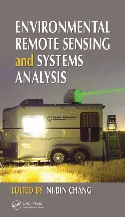
    Environmental Remote Sensing and Systems Analysis

    AvNi-Bin Chang

    Inbunden, Engelska, 2012

    2 648 kr

    Beställningsvara. Skickas inom 10-15 vardagar. Fri frakt över 249 kr.

    Beskrivning

    Using a systems analysis approach and extensive case studies, Environmental Remote Sensing and Systems Analysis shows how remote sensing can be used to support environmental decision making. It presents a multidisciplinary framework and the latest remote sensing tools to understand environmental impacts, management complexity, and policy implications.Organized into three parts, this full-color book provides systematic coverage of water quality monitoring, air quality monitoring, and monitoring of land use patterns and degradation. Chapters elaborate on the interactions between human and natural systems, addressing questions such as "what are the regional impacts of an oil spill in coastal environments?" and "how does urbanization affect the rate of infiltration of water at urban–rural interfaces?" Throughout, contributors discuss new techniques and methods for measurements, mathematical modeling, and image processing.Key features:Compares data mining, machine learning, and image processing methods to help you select the best one for your needsIncorporates ground-based monitoring networks as part of air and water quality managementEmphasizes environmental information management, with proper integration of GPS, GIS, and existing environmental databasesShows how modeling can be used for decision makingExamines how remote sensing can be used to understand environmental health implications and to shape environmental management policiesDemonstrates how systems analysis can be used to aid in environmental policy analysisDiscusses opportunities for integrated field and laboratory studies in remote sensing educationA useful reference for students, professionals, scientists, and policy makers in environmental management and informatics as well as environmental, agricultural, forest, and sustainability sciences, this book shows readers how to m

    Produktinformation

    • Utgivningsdatum:2012-03-23
    • Mått:156 x 234 x 26 mm
    • Vikt:997 g
    • Format:Inbunden
    • Språk:Engelska
    • Antal sidor:520
    • Förlag:Taylor & Francis Inc
    • ISBN:9781439877432

    Utforska kategorier

    • Geografi inom Naturvetenskap och teknik

    Mer om författaren

    Dr. Ni-Bin Chang is currently a professor with the Department of Civil, Environmental, and Construction Engineering at the University of Central Florida. He is also a senior member of the Institute of Electronics and Electrical Engineers (IEEE) and is affiliated with the IEEE Geoscience and Remote Sensing Society and the IEEE Computational Intelligence Society. He has earned the selectively awarded titles of Certificate of Leadership in Energy and Environment Design (LEED) in 2004, Board Certified Environmental Engineer (BCEE) in 2006, Diplomat of Water Resources Engineer (DWRE) in 2007, elected Member of the European Academy of Sciences (EAS) in 2008, elected Fellow of the American Society of Civil Engineers (ASCE) in 2009, and elected Fellow of the American Association for the Advancement of Science (AAAS) in 2011. He was one of the founders of International Society of Environmental Information Management and the former editor-in-chief of the Journal of Environmental Informatics. He is currently an editor, associate editor, or editorial board member of more than 30 international journals.

    Recensioner i media

    "... will help emerging environmental scientists as well as graduate and undergraduate students working on their research studies in formulating their research methods to incorporate appropriate RS data and techniques." -Photogrammetric Engineering & Remote Sensing, July 2013

    Innehållsförteckning

    • Linkages between Environmental Remote Sensing and Systems Analysis. Water Quality Monitoring, Watershed Development, and Coastal Management: Using Remote Sensing–Based Carlson Index Mapping to Assess Hurricane and Drought Effects on Lake Trophic State. Mapping Potential Annual Pollutant Loads in River Basins Using Remotely Sensed Imagery. Identifying the Impact of Oil Spills with the Remote Sensing– Based Oil Spread Index Method. Remote Sensing to Predict Estuarine Water Salinity. Multitemporal Remote Sensing of Coastal Sediment Dynamics. Estimating Total Phosphorus Impacts in a Coastal Bay with Remote Sensing Images and In Situ Measurements. Monitoring and Mapping of Flood Plumes in the Great Barrier Reef Based on In Situ and Remote Sensing Observations. Sensing and Monitoring for Land Use Patterns, Reclamation, and Degradation: Satellite Remote Sensing for Landslide Prediction. Analysis of Impervious Surface and Suburban Form Using High Spatial Resolution Satellite Imagery. Use of InSAR for Monitoring Land Subsidence in Mashhad Subbasin, Iran. Remote Sensing Assessment of Coastal Land Reclamation Impact in Dalian, China, Using High-Resolution SPOT Images and Support Vector Machine. Mapping Impervious Surface Distribution with the Integration of Landsat TM and QuickBird Images in a Complex Urban– Rural Frontier in Brazil. Air Quality Monitoring, Land Use/Land Cover Changes, and Environmental Health Concern: Using Lidar to Characterize Particles from Point and Diffuse Sources in an Agricultural Field. Measurement of Aerosol Properties over Urban Environments from Satellite Remote Sensing. DOAS Technique: Emission Measurements in Urban and Industrial Regions. Interactions between Ultraviolet-B and Total Ozone Concentrations in the Continental United States. Remote Sensing of Asian Dust Storms. Forest Fire and Air Quality Monitoring from Space. Satellite Remote Sensing of Global Air Quality.