• Fri frakt över 249 kr
  • •
  • Snabba leveranser
  • •
  • Billiga böcker
Kundservice

Du är på sajten för privatpersoner.

Företag, bibliotek eller offentlig verksamhet?

Du handlar på classic.bokus.com, där alla dina funktioner finns intakta.
Till classic.bokus.com
Bokus logotyp. Gå till startsidan.
  • Erbjudanden
  • Nyheter
  • Student
  • Topplistor
  • Barn & ungdom
  • Bokus Play
  • E-böcker
  • Pocketböcker
  • Spel & pussel

10% studentrabatt med kod TERM26

Sidfot

Mina sidor

    Hjälp

    • Kundservice
    • Vanliga frågor och svar
    • Frakt och leverans
    • Retur vid ångerrätt
    • Reklamera vara
    • Betalning
    • Köpvillkor
    • Allmänna villkor
    • Information om webbplatsens tillgänglighet

    Om Bokus

    • Om oss
    • Pressrum
    • För studenter
    • För företag
    • För bibliotek och offentlig verksamhet
    • För leverantörer
    • Hållbarhet

    Populärt

    • Aktuella erbjudanden
    • Presentkort
    • Studentlitteratur
    • Nya böcker
    • Topplistor
    • Signerade böcker
    • Engelska böcker

    Inspiration

    • Boktips
    • BookTok
    • Populära bokserier
    • Barnbokskaraktärer
    • Populära författare
    Logotyp för Bokus
    Följ oss på Facebook (extern länk)Följ oss på Instagram (extern länk)Följ oss på YouTube (extern länk)Följ oss på TikTok (extern länk)
    bokus @ CookiesAnpassa cookiesIntegritetspolicyKöpvillkor
    Till Citymail hemsida (extern länk)Till Budbee hemsida (extern länk)Till Postnord hemsida (extern länk)Till Schenker hemsida (extern länk)Till Early Bird hemsida (extern länk)Till Walleys hemsida (extern länk)
    1. Historia och arkeologi
    2. Historia
    3. Historia: särskilda händelser och ämnen
    4. Historisk geografi

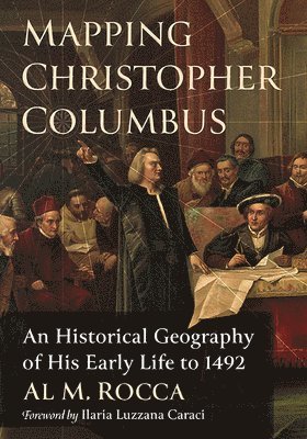
    Mapping Christopher Columbus

    An Historical Geography of His Early Life to 1492

    AvAl M. Rocca

    Häftad, Engelska, 2023

    865 kr

    Beställningsvara. Skickas inom 3-6 vardagar. Fri frakt över 249 kr.

    Beskrivning

    The impact of Christopher Columbus's first transatlantic voyage launched an unprecedented explosion of European exploration. Throughout the last 500 years, scholars have recognized this transforming event, and they have written extensively on the subject. To date, no American author has dedicated a book to Columbus's life before 1492. This biography does so, with a focus on geographical experiences that affected his formulation of a transatlantic concept.Incorporating extensive research from American and European scholars (historians, geographers, anthropologists, and cartographers), the author proposes that Columbus systematically built a transatlantic voyage proposal from knowledge gained on previous voyages in the Mediterranean Sea and Eastern Atlantic Ocean. The book's extensive use of maps place Columbus's actions on specific land and ocean locations. Persons interested in gleaning more information about Columbus's maritime background will find a plethora of maps to visualize the extent of his early travels.

    Produktinformation

    • Utgivningsdatum:2023-02-24
    • Mått:178 x 254 x 13 mm
    • Vikt:458 g
    • Format:Häftad
    • Språk:Engelska
    • Antal sidor:260
    • Förlag:McFarland & Co Inc
    • ISBN:9781476687551

    Utforska kategorier

    • Historisk geografi inom Historia och arkeologi
    • Allmän historia och världshistoria inom Historia och arkeologi
    • Biografier inom Biografier

    Mer om författaren

    Al M. Rocca is a professor emeritus of history and education at Simpson University in Redding, California. He has taught as an adjunct professor in history and geography at California State University, Monterey Bay. He served as editor of the Social Studies Review (California Council for the Social Studies) for many years and served as a member on several statewide committees constructing or reviewing history and social science educational materials and programs. He lives in Chico, California.

    Recensioner i media

    “Rocca’s book focuses on Columbus’s life and voyages prior to 1492 with the goal of determining how his idea of sailing west to reach Asia originated and evolved. ... [He] contends that Columbus, during his voyages in the Mediterranean Sea and the Atlantic Ocean, used his observations to develop a model for how the winds and currents circulated. This knowledge made sailing west across the Atlantic to reach Asia feasible... Rocca draws on many primary and secondary sources to support his conclusion...persuasive...recommended”—Choice

    Innehållsförteckning

    • Table of ContentsList of MapsForeword by Ilaria Luzzana CaraciPrefaceIntroduction1. Youth and Early Adventures, 1451–1476Young Columbus in the World of Genoese Mediterranean MercantilismThe Expanding Mediterranean World of ColumbusColumbus Enters the Atlantic Ocean2. The Ottoman Threat, 1453–1481Muslim (Ottoman) Expansion in the Eastern MediterraneanGenoese Colonies in the Black Sea Fall to OttomansOttoman Atrocities and an Attack on Italy3. History of Atlantic Exploratory ExpansionAtlantic Exploratory Voyages, Stage 1: PhoenicianAtlantic Exploratory Voyages, Stage 2: Roman Expansion of the Mediterranean and Extension into the AtlanticAtlantic Exploratory Voyages, Stage 3A: Medieval (Vikings)Atlantic Exploratory Voyages, Stage 3B: Medieval (Genoa and Venice)Atlantic Exploratory Voyages, Stage 4: North Atlantic Fishing and Zones of Opportunity4. Columbus Explores the North Atlantic, 1476–1478Columbus in Portugal and His Life in LisbonColumbus Sails North to England, 1476 or 1477Columbus and the Five Zones of HabitationFrom England to Iceland and Beyond, 1477Did Columbus Sail to Iceland?Is Thule Really Greenland?The Problem with Ancient and Medieval Translations5. Marriage, Madeira, Porto Santo, and the African Coast, 1478–1481Columbus Heads SouthColumbus MarriesThe Importance of the Islands of Porto Santo and MadeiraThe Enterprise to the Indies Is Conceived1482 and the Psychology of DiscoveryThe African Coast, São Jorge da Mina, and the Equatorial RegionThe Alonso Sánchez Mystery, 14826. Columbus and Slavery Before 1492Questions to Frame the DiscussionSlavery in the 15th CenturyColumbus’s Early Experience with SlaveryNew World Indigenous Slavery Before ColumbusColumbus and Slavery, 14927. The Toscanelli Map and King João II (Portugal), 1483–1485Columbus Builds a Transatlantic ConceptThe Toscanelli Letter and Atlantic GeographyPortuguese Atlantic ExplorationMuslim Expansion in Africa and King João’s Response8. Columbus Builds His Cartographic SupportChristopher and Bartholomew Columbus’s Mapmaking BusinessThe Ptolemy World Map and the Size of Asia1452 Leardo Map1457 Genoese Map1459 Fra Mauro MapToscanelli Map and the Small Earth ConceptAntillia and the Pareto Chart9. Columbus Wins Approval from King Ferdinand and Queen Isabella, 1485–1492Columbus Moves to SpainColumbus Meets Ferdinand and Isabella AgainColumbus Back in Portugal and the Dias VoyageFriar Juan Pérez, the Martellus Map, and the Behaim GlobeThe Columbus Plan and Atlantic Zones of OpportunityA New Plan and a New Approach, 1489–1492Expected Zones of First Contact10. Columbus’s Geographic Perspectives on the Eve of His 1492 VoyageColumbian View of the Atlantic WorldPerceptions of a Columbian ExchangeA Future for Social GlobalismThe Problem of Geographic ComplexityAcknowledgmentsChapter NotesSources and BibliographyIndex