• Fri frakt över 249 kr
  • •
  • Snabba leveranser
  • •
  • Billiga böcker
Kundservice

Du är på sajten för privatpersoner.

Företag, bibliotek eller offentlig verksamhet?

Du handlar på classic.bokus.com, där alla dina funktioner finns intakta.
Till classic.bokus.com
Bokus logotyp. Gå till startsidan.
  • Erbjudanden
  • Nyheter
  • Student
  • Topplistor
  • Barn & ungdom
  • Bokus Play
  • E-böcker
  • Pocketböcker
  • Spel & pussel

10% rabatt på allt med kod: NYSTART10 →

Sidfot

Mina sidor

    Hjälp

    • Kundservice
    • Vanliga frågor och svar
    • Frakt och leverans
    • Retur vid ångerrätt
    • Reklamera vara
    • Betalning
    • Köpvillkor
    • Allmänna villkor
    • Information om webbplatsens tillgänglighet

    Om Bokus

    • Om oss
    • Pressrum
    • För studenter
    • För företag
    • För bibliotek och offentlig verksamhet
    • För leverantörer
    • Hållbarhet

    Populärt

    • Aktuella erbjudanden
    • Presentkort
    • Studentlitteratur
    • Nya böcker
    • Topplistor
    • Signerade böcker
    • Engelska böcker

    Inspiration

    • Boktips
    • BookTok
    • Populära bokserier
    • Barnbokskaraktärer
    • Populära författare
    Logotyp för Bokus
    Följ oss på Facebook (extern länk)Följ oss på Instagram (extern länk)Följ oss på YouTube (extern länk)Följ oss på TikTok (extern länk)
    bokus @ CookiesAnpassa cookiesIntegritetspolicyKöpvillkor
    Till Citymail hemsida (extern länk)Till Budbee hemsida (extern länk)Till Postnord hemsida (extern länk)Till Schenker hemsida (extern länk)Till Early Bird hemsida (extern länk)Till Walleys hemsida (extern länk)
    1. Naturvetenskap och teknik
    2. Geovetenskap
    3. Geografi

    Cartographic Capital

    Mapping Third Republic Paris, 1889-1934

    AvKory Olson

    Inbunden, Engelska, 2018

    Del 1 i serien Studies in Modern and Contemporary France

    2 019 kr

    Beställningsvara. Skickas inom 5-8 vardagar. Fri frakt över 249 kr.

    Fler format och utgåvor

    Häftad

    571 kr

    Beskrivning

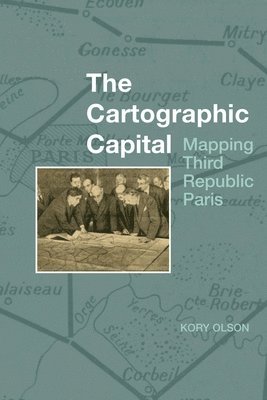
    Through official maps, this book looks at how government presentations of Paris and environs change over the course of the Third Republic (1889-1934). Governmental policies, such as the creation of a mandatory national uniform educational system that will eventually include geography, combined with technological advances in the printing industry, to alter the look, exposure, reception, and distribution of government maps. The government initially seemed to privilege an exclusively positive view of the capital city and limited its presentation of it to land inside the walled fortifications. However, as the Republic progressed and Paris grew, technology altered how Parisians used and understood their urban space. Rail and automobiles made moving about the city and environs easier while increased industrialization moved factories and their workers further out into the Seine Department. During this time, maps transitioned from reflecting the past to documenting the present. With the advent of French urbanism after World War I, official mapped views of greater Paris abandoned privileging past achievements and began to mirror actual residential and industrial development as it pushed further out from the city centre. Finally, the government needed to plan for the future of greater Paris and official maps begin to show how the government viewed the direction of its capital city.

    Produktinformation

    • Utgivningsdatum:2018-05-04
    • Mått:163 x 239 x undefined mm
    • Format:Inbunden
    • Språk:Engelska
    • Serie:Studies in Modern and Contemporary France
    • Antal sidor:320
    • Förlag:Liverpool University Press
    • ISBN:9781786940964

    Utforska kategorier

    • Geografi inom Naturvetenskap och teknik

    Mer om författaren

    Kory Olson is Associate Professor of French at Stockton University.

    Recensioner i media

    'Olson’s book makes a unique and worthy contribution to the history of cartography and the history of modern Paris. It is a useful and readable text for anyone interested in Third Republic Paris who wishes to orient themselves geographically and spatially in the city’s shifting physiognomy. Through Olson’s careful analysis, we see how the map archive has much to teach us about the history of core/periphery relationships, boundary-making, and infrastructure development in modern Paris.' Catherine Dunlop, H-France Review

    Innehållsförteckning

    • Introduction: Creating Republican ParisChapter 1: Working with MapsChapter 2: Creating Map Readers: The Rise of Geography and Cartography in Nineteenth-Century FranceChapter 3: The Triumphant Republic: ‘Paris en 1889, [Les] Opérations de Voirie exécutées entre 1871 et 1889’Chapter 4: A New Way of Seeing Paris: La Carte de FranceChapter 5: The Beginning of French Urbanism: Léon Jausseuly’s 1919 Plan d’extensionChapter 6: The Rise of Suburban Paris: Henri Prost’s Carte généraleConclusion