
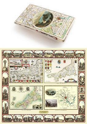
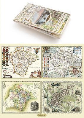
Hampshire 1610 – 1836 – Fold Up Map that features a collection of Four Historic Maps, John Speed’s County Map 1611, Johan Blaeu’s County Map of 1648, Thomas Moules County Map of 1836 and a Plan of Winchester 1805 by Cole and Roper. The maps also feature three historic views from the 1840’s, Gosport, Men of War at Spithead and The Saluting Platform at Portsmouth.
245 kr
Tillfälligt slut
Produktinformation
Utforska kategorier
Hoppa över listan


Du kanske också är intresserad av
Del 22
- Signerad!
SIGNERAD - Enkel privatekonomi : Din praktiska guide till livets alla pengafrågor
Annifrid Lilja, Björn Lilja
Kartonnage, 2026
229 kr
- 4 för 3
- 4 för 3
Del 2
- 4 för 3
Del 11