Häftad, Engelska, 2018
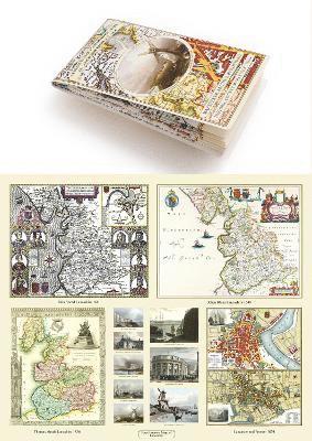
Lancashire 1611 – 1836 – Fold Up Map that features a collection of Four Historic Maps, John Speed’s County Map 1611, Johan Blaeu’s County Map of 1648, Thomas Moules County Map of 1836 and a Plan of Lancaster and Preston from 1824. The maps also feature early Victorian views around Liverpool as well as Manchester and Blackpool.
Del 19 i serien Historic English Counties Collection
259 kr
Skickas onsdag 11/11. Fri frakt över 249 kr.
Beskrivning
Produktinformation
- Utgivningsdatum: 2018-12-12
- Mått: 134 x 227 x 47 mm
- Vikt: 102 g
- Format: Häftad
- Språk: Engelska
- Serie: Historic English Counties Collection
- Antal sidor: 1
- Förlag: Historical Images Ltd
- ISBN: 9781844918478
Utforska kategorier
Recensioner i media
Select Guide Rating
Betyg & recensioner
0 recensioner
Inga recensioner tillgängliga.