• Fri frakt över 249 kr
  • •
  • Snabba leveranser
  • •
  • Billiga böcker
Kundservice

Du är på sajten för privatpersoner.

Företag, bibliotek eller offentlig verksamhet?

Du handlar på classic.bokus.com, där alla dina funktioner finns intakta.
Till classic.bokus.com
Bokus logotyp. Gå till startsidan.
  • Erbjudanden
  • Nyheter
  • Student
  • Topplistor
  • Barn & ungdom
  • Bokus Play
  • E-böcker
  • Pocketböcker
  • Spel & pussel

10% rabatt på allt med kod NYSTART10 →

Sidfot

Mina sidor

    Hjälp

    • Kundservice
    • Vanliga frågor och svar
    • Frakt och leverans
    • Retur vid ångerrätt
    • Reklamera vara
    • Betalning
    • Köpvillkor
    • Allmänna villkor
    • Information om webbplatsens tillgänglighet

    Om Bokus

    • Om oss
    • Pressrum
    • För studenter
    • För företag
    • För bibliotek och offentlig verksamhet
    • För leverantörer
    • Hållbarhet

    Populärt

    • Aktuella erbjudanden
    • Presentkort
    • Studentlitteratur
    • Nya böcker
    • Topplistor
    • Signerade böcker
    • Engelska böcker

    Inspiration

    • Boktips
    • BookTok
    • Populära bokserier
    • Barnbokskaraktärer
    • Populära författare
    Logotyp för Bokus
    Följ oss på Facebook (extern länk)Följ oss på Instagram (extern länk)Följ oss på YouTube (extern länk)Följ oss på TikTok (extern länk)
    bokus @ CookiesAnpassa cookiesIntegritetspolicyKöpvillkor
    Till Citymail hemsida (extern länk)Till Budbee hemsida (extern länk)Till Postnord hemsida (extern länk)Till Schenker hemsida (extern länk)Till Early Bird hemsida (extern länk)Till Walleys hemsida (extern länk)
    1. Naturvetenskap och teknik
    2. Geovetenskap
    3. Geografi

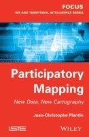
    Participatory Mapping

    New Data, New Cartography

    AvJean-Christophe Plantin

    Inbunden, Engelska, 2014

    1 800 kr

    Beställningsvara. Skickas inom 5-8 vardagar. Fri frakt över 249 kr.

    Fler format och utgåvor

    E-bok

    2 199 kr

    E-bok

    2 193 kr

    Beskrivning

    This book is intended for applications of online digital mapping, called mashups (or composite application), and to analyze the mapping practices in online socio-technical controversies. The hypothesis put forward is that the ability to create an online map accompanies the formation of online audience and provides support for a position in a debate on the Web.The first part provides a study of the map: - a combination of map and statistical reason- crosses between map theories and CIS theories- recent developments in scanning the map, from Geographic Information Systems (GIS) to Web map.The second part is based on a corpus of twenty "mashup" maps, and offers a techno-semiotic analysis highlighting the "thickness of the mediation" they are in a process of communication on the Web. Map as a device to "make do" is thus replaced through these stages of creation, ranging from digital data in their viewing, before describing the construction of the map as a tool for visual evidence in public debates, and ending with an analysis of the delegation action against Internet users.The third section provides an analysis of these mapping practices in the case study of the controversy over nuclear radiation following the accident at the Fukushima plant on March 11, 2011. Techno-semiotic method applied to this corpus of radiation map is supplemented by an analysis of web graphs, derived from "digital methods" and graph theory, accompanying the analysis of the previous steps maps (creating Geiger data or retrieving files online), but also their movement, once maps are made.

    Produktinformation

    • Utgivningsdatum:2014-07-01
    • Mått:163 x 241 x 20 mm
    • Vikt:454 g
    • Format:Inbunden
    • Språk:Engelska
    • Antal sidor:160
    • Förlag:ISTE Ltd and John Wiley & Sons Inc
    • ISBN:9781848216617

    Utforska kategorier

    • Geografi inom Naturvetenskap och teknik

    Mer om författaren

    Jean-Christophe Plantin is a Research Fellow at the University of Michigan, USA and the Université de Technologie de Compiègne, France. His research interests include the Geospatial Web, participatory mapping projects and digital methods in the social sciences and humanities.

    Innehållsförteckning

    • Introduction ixPart 1 Origins and Properties of Online Maps 1Chapter 1 Tooling Up for Complexity 3Chapter 2 From GIS to Web Maps 19Chapter 3 A Participant in the Web of Platform 37Chapter 4 Maps and Web-Based Data 49Part 2 Mapping Practices in Emergency Situations 75Chapter 5 The State of Information After the Fukushima 77Chapter 6 Production Radiation Maps 87Chapter 7 Circulation and Use of Maps 109Chapter 8 The Shape of Public Engagement 125Conclusion 145Bibliography 149Index 159