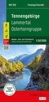
Häftad, Engelska, Franska, 2026
Tennengebirge Hiking, cycling and leisure map
165 kr
Beställningsvara. Skickas inom 3-6 vardagar. Fri frakt över 249 kr.
Beskrivning
The freytag & berndt hiking map 'Tennengebirge - Lammertal - Osterhorngruppe 1:50,000' is the ideal hiking companion thanks to its detailed digital cartography and precise scale. It is regularly updated and contains current information on hiking trails, cycling and mountain biking routes, mountain huts, natural monuments, cultural attractions, and leisure facilities. The accompanying information booklet includes a selection of the best hiking trails, cycling routes, and mountain bike trails, as well as a brief description of the region. (Language: German) Leisure information, hiking and long-distance hiking trails, mountain biking and cycling tours, place name index with postal codes, GPS compatible, via ferrata, ski route, cross-country ski trail, Nordic walking route;
Produktinformation
- Utgivningsdatum: 2026-08-01
- Mått: 100 x 205 x 11 mm
- Vikt: 100 g
- Format: Häftad
- Språk: Engelska, Franska
- Serie: freytag & berndt Wanderkarte
- Antal sidor: 2
- Upplaga: 2026
- Förlag: Freytag-Berndt
- ISBN: 9783707920819
Utforska kategorier
Betyg & recensioner
0 recensioner
Inga recensioner tillgängliga.