
John Coefield – illustratör
Upptäck titlar med illustrationer av John Coefield.
2 produkter
2 produkter
206 kr
Skickas
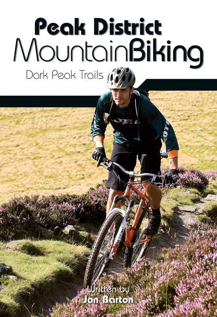
Peak District Mountain Biking - Dark Peak Trails is the full second edition of the groundbreaking mountain bike guidebook Dark Peak Mountain Biking - True Grit Trails, described by leading mountain biking website Bikemagic.com as 'far and away the best Peak guide we've come across.'All route information has been thoroughly checked for this new edition, to give the most up-to-date and comprehensive guidebook to some of the finest and most popular riding in the country. As with all new Vertebrate MTB guidebooks, this new edition features industry-standard Ordnance Survey mapping, and is illustrated with stunning action photography.Featured within the book are 26 of the best mountain bike rides in the Dark Peak, between 11.5 and 105 (!) kilometres in length, suitable for all levels of mountain bikers. Researched, ridden and written by a local rider, each route features easy-to-follow directions; details of distance, timings and difficulty gradings; refreshment stops and local knowledge; and clear and easy to use Ordnance Survey 1:50,000 maps. A Bonus Section includes Top Ten Climbs, Downhills and Singletracks, Sheffield City Links and a detailed Appendix.
206 kr
Skickas
"South West Mountain Biking - Quantocks, Exmoor, Dartmoor" - is the full second edition of the bestselling guide to the outstanding mountain biking in the south west of England. Featured are 26 of the best mountain bike rides in Dartmoor, Exmoor and the Quantock Hills, between 10km and 30km in length, suitable for all levels of mountain bikers. All route information has been thoroughly checked for this new edition to give the most up-to-date and - currently - the only comprehensive guidebook to this great area. Explore wild and epic moorland, plunge into steep and deep woodland combes, and speed along some of the best singletrack in the country: the south west has it all. As with all new Vertebrate MTB guidebooks, this new edition features industry-standard Ordnance Survey mapping, and is illustrated with stunning, all-new action photography. Researched, ridden and written by Nick Cotton, author of over 40 mountain biking and cycling guides, each route features clear and easy to use Ordnance Survey 1:50,000 maps, easy-to-follow directions, details of distance, timings and difficulty gradings, and refreshment stops and local knowledge.There is a detailed Appendix that provides essential information on where to eat, drink and sleep.