Regional maps - Sweden – serie
Visar alla böcker i serien Regional maps - Sweden. Handla med fri frakt och snabb leverans.
6 produkter
6 produkter
Del 1 - Regional maps - Sweden
Süd-Schweden (Süd) Nr. 01 Regionalkarte Schweden 1:250 000
Engelska, 2023
151 kr
Skickas inom 3-6 vardagar
Outdoor mapHiking instead of swimming pool. Nordic Walking or cross-country skiing instead of driving in a crowded coach. A ski tour instead of shopping in the air-conditioned shopping mall. Cycling and biking instead of deckchair. Cozy alpine hut instead of snake are at the self-service buffet.No matter what type you are. In the new outdoor maps of Kummerley + Frey you will find everything worth knowing and much more. Razor-sharp digital cartography in Swiss quality on waterproof and tear-resistant paper.As a further highlight you can load your card for free on your smartphone. Thanks to the GPS-exact position in the map, you always know exactly where you are.
Del 1 - Regional maps - Sweden
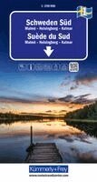
Kümmerly+Frey Regional-Strassenkarte 1 Schweden Süd 1:250.000
Engelska, 2026
167 kr
Skickas inom 3-6 vardagar
Southern Sweden 1 k&f 1:250,000Malmoe - Helsingborg - KalmarThe map covers the main areas of interest from Malmoe via Kalmar to Helsingborg.Thanks to the clearly marked, easy-to-read and up-to-date roads, the uncluttered, up-to-date map layout and the level of detail, the map is the perfect tool to help you make the most of your visit to this exceptional region.The thematic map contains detailed information on towns and the connecting road network. Travellers by car or motorbike will always find their way thanks to the clearly recognisable, clearly laid-out motorways, dual carriageways, main roads, country roads and side roads.The fold-out map for motorists and motorcyclists features a sturdy cover and durable paper. It won't let you down, even after repeated use.Should your GPS fail or your mobile phone run out of battery, the clearly marked roads, viewpoints, railway stations, places to stop for refreshments, campsites, car parks, etc. on the map will always help you find your way.
Del 2 - Regional maps - Sweden
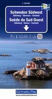
Kümmerly+Frey Regional-Strassenkarte 2 Schweden Südwest 1:250.000
Engelska, 2026
167 kr
Skickas inom 3-6 vardagar
South-West Sweden 1 k&f 1:250,000Gothenburg-Lake Vanern-KarlstadThe Kummerly+Frey road map of South-West Sweden, on a scale of 1:250,000, provides everything you need for navigation and inspiration.The map covers the main areas of interest from Gothenburg across Lake Vanern to Karlstad.Thanks to the clearly marked, easy-to-read and up-to-date roads, the uncluttered, up-to-date map layout and the level of detail, the map is the perfect tool to help you make the most of your visit to this exceptional region.The thematic map contains detailed information on towns and the connecting road network. Travellers by car or motorbike will always find their way thanks to the clearly recognisable, clearly laid-out motorways, dual carriageways, main roads, country roads and side roads.The fold-out map for motorists and motorcyclists features a sturdy cover and durable paper. It won't let you down, even after repeated use.Should your GPS fail or your mobile phone run out of battery, the clearly marked roads, viewpoints, railway stations, places to stop for refreshments, campsites, car parks, etc. on the map will always help you find your way.
Del 3 - Regional maps - Sweden
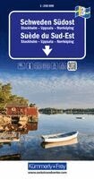
Kümmerly+Frey Regional-Strassenkarte 3 Schweden Südost 1:250.000
Engelska, 2026
167 kr
Skickas inom 3-6 vardagar
Southeast Sweden 1 k&f 1:250,000Stockholm-Uppsala-NorrkoepingThe Kummerly+Frey road map of Southeast Sweden, at a scale of 1:250,000, provides everything you need for navigation and inspiration.The map covers the main areas of interest from Uppsala via Stockholm to Norrkoeping.Thanks to the clearly marked, easy-to-read and up-to-date roads, the uncluttered, up-to-date map layout and the level of detail, the map is the perfect tool to help you make the most of your visit to this exceptional region.The thematic map contains detailed information on towns and the connecting road network. Travellers by car or motorbike will always find their way thanks to the clearly recognisable, clearly laid-out motorways, dual carriageways, main roads, country roads and side roads.The fold-out map for motorists and motorcyclists features a sturdy cover and durable paper. It won't let you down, even after repeated use.Should your GPS fail or your mobile phone run out of battery, the clearly marked roads, viewpoints, railway stations, places to stop for refreshments, campsites, car parks, etc. on the map will always help you find your way.
Del 4 - Regional maps - Sweden
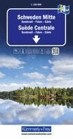
Kümmerly+Frey Regional-Strassenkarte 4 Schweden Mitte 1:250.000
Engelska, 2026
167 kr
Skickas inom 3-6 vardagar
Central Sweden 1 k&f 1:250,000Sundsvall-Falun-GavleThe Kummerly+Frey road map of Central Sweden, at a scale of 1:250,000, provides everything you need for navigation and inspiration.The map covers the main areas of interest from Sundsvall via Gavle to Falun.Thanks to the clearly marked, easy-to-read and up-to-date roads, the uncluttered, up-to-date map layout and the level of detail, the map is the perfect tool to help you make the most of your visit to this exceptional region.The thematic map contains detailed information on towns and the connecting road network. Travellers by car or motorbike will always find their way thanks to the clearly recognisable, clearly laid-out motorways, dual carriageways, main roads, country roads and minor roads.The fold-out map for motorists or motorcyclists features a sturdy cover and durable paper. Even after repeated use, it won't let you down.Should your GPS fail or your mobile phone run out of battery, the clearly marked roads, viewpoints, railway stations, places to stop for refreshments, campsites, car parks, etc. on the map will always help you find your way.
Del 5 - Regional maps - Sweden
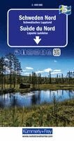
Kümmerly+Frey Regional-Strassenkarte 5 Schweden Nord 1:400.000
Engelska, 2026
167 kr
Skickas inom 3-6 vardagar
Northern Sweden 1 k&f 1:250,000Swedish LaplandThe Kummerly+Frey road map of Northern Sweden, at a scale of 1:250,000, provides everything you need for navigation and inspiration.The map shows the main areas of interest in Swedish Lapland.Thanks to the clearly marked, easy-to-read and up-to-date roads, the uncluttered, up-to-date map layout and the level of detail, the map is the perfect tool to help you make the most of your visit to this extraordinary region.The thematic map contains detailed information about towns and the connecting road network. Travellers by car or motorbike will always find their way thanks to the clearly recognisable, clearly laid-out motorways, dual-carriageways, main roads, country roads and minor roads.The fold-out map for motorists or motorcyclists features a sturdy cover and durable paper. Even after repeated use, it won't let you down.Should your GPS fail or your mobile phone run out of battery, the clearly marked roads, viewpoints, railway stations, places to stop for refreshments, campsites, car parks, etc. on the map will always help you find your way.