• Fri frakt över 249 kr
  • •
  • Snabba leveranser
  • •
  • Billiga böcker
Kundservice

Du är på sajten för privatpersoner.

Företag, bibliotek eller offentlig verksamhet?

Du handlar på classic.bokus.com, där alla dina funktioner finns intakta.
Till classic.bokus.com
Bokus logotyp. Gå till startsidan.
  • Erbjudanden
  • Nyheter
  • Student
  • Topplistor
  • Barn & ungdom
  • Bokus Play
  • E-böcker
  • Pocketböcker
  • Spel & pussel

10% studentrabatt med kod TERM26

Sidfot

Mina sidor

    Hjälp

    • Kundservice
    • Vanliga frågor och svar
    • Frakt och leverans
    • Retur vid ångerrätt
    • Reklamera vara
    • Betalning
    • Köpvillkor
    • Allmänna villkor
    • Information om webbplatsens tillgänglighet

    Om Bokus

    • Om oss
    • Pressrum
    • För studenter
    • För företag
    • För bibliotek och offentlig verksamhet
    • För leverantörer
    • Hållbarhet

    Populärt

    • Aktuella erbjudanden
    • Presentkort
    • Studentlitteratur
    • Nya böcker
    • Topplistor
    • Signerade böcker
    • Engelska böcker

    Inspiration

    • Boktips
    • BookTok
    • Populära bokserier
    • Barnbokskaraktärer
    • Populära författare
    Logotyp för Bokus
    Följ oss på Facebook (extern länk)Följ oss på Instagram (extern länk)Följ oss på YouTube (extern länk)Följ oss på TikTok (extern länk)
    bokus @ CookiesAnpassa cookiesIntegritetspolicyKöpvillkor
    Till Citymail hemsida (extern länk)Till Budbee hemsida (extern länk)Till Postnord hemsida (extern länk)Till Schenker hemsida (extern länk)Till Early Bird hemsida (extern länk)Till Walleys hemsida (extern länk)
    1. Historia och arkeologi
    2. Historia
    3. Historia: särskilda händelser och ämnen
    4. Historisk geografi

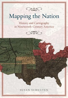
    Mapping the Nation – History and Cartography in Nineteenth–Century America

    AvSusan Schulten

    Häftad, Engelska, 2013

    293 kr

    Beställningsvara. Skickas inom 5-8 vardagar. Fri frakt över 249 kr.

    Beskrivning

    In the nineteenth century, Americans began to use maps in extraordinary new ways. Medical men mapped diseases to understand epidemics, natural scientists mapped climate to uncover weather patterns, and Northerners created slave maps to assess the power of the South. And after the Civil War, federal agencies embraced statistical and thematic mapping in order to profile the ethnic, racial, economic, moral, and physical attributes of a reunified nation. In Mapping the Nation, Susan Schulten charts how thematic maps demonstrated the analytical potential of cartography. This radical shift in spatial thought and representation opened the door to the idea that maps were not just illustrations of data, but visual tools that are uniquely equipped to convey complex ideas, changing forever the very meaning of a map.

    Produktinformation

    • Utgivningsdatum:2013-09-11
    • Mått:178 x 254 x 15 mm
    • Vikt:484 g
    • Format:Häftad
    • Språk:Engelska
    • Antal sidor:264
    • Förlag:The University of Chicago Press
    • ISBN:9780226103969

    Utforska kategorier

    • Historisk geografi inom Historia och arkeologi
    • Amerikas historia inom Historia och arkeologi
    • Geografi inom Naturvetenskap och teknik

    Mer om författaren

    Susan Schulten is professor of history at the University of Denver. In 2010 she was named a fellow of the John Simon Guggenheim Foundation.

    Recensioner i media

    "Powerful.... Satisfying.... Though both the book and the website can stand alone, together they productively bring the careful, intimate, controlled narrative of the book form alongside the full-color, hyperlinked social nature of web-based projects to convincingly argue that America without maps would have been a different kind of place altogether." (Public Books)"