• Fri frakt över 249 kr
  • •
  • Snabba leveranser
  • •
  • Billiga böcker
Kundservice

Du är på sajten för privatpersoner.

Företag, bibliotek eller offentlig verksamhet?

Du handlar på classic.bokus.com, där alla dina funktioner finns intakta.
Till classic.bokus.com
Bokus logotyp. Gå till startsidan.
  • Erbjudanden
  • Nyheter
  • Student
  • Topplistor
  • Barn & ungdom
  • Bokus Play
  • E-böcker
  • Pocketböcker
  • Spel & pussel

10% rabatt på allt med kod NYSTART10 →

Sidfot

Mina sidor

    Hjälp

    • Kundservice
    • Vanliga frågor och svar
    • Frakt och leverans
    • Retur vid ångerrätt
    • Reklamera vara
    • Betalning
    • Köpvillkor
    • Allmänna villkor
    • Information om webbplatsens tillgänglighet

    Om Bokus

    • Om oss
    • Pressrum
    • För studenter
    • För företag
    • För bibliotek och offentlig verksamhet
    • För leverantörer
    • Hållbarhet

    Populärt

    • Aktuella erbjudanden
    • Presentkort
    • Studentlitteratur
    • Nya böcker
    • Topplistor
    • Signerade böcker
    • Engelska böcker

    Inspiration

    • Boktips
    • BookTok
    • Populära bokserier
    • Barnbokskaraktärer
    • Populära författare
    Logotyp för Bokus
    Följ oss på Facebook (extern länk)Följ oss på Instagram (extern länk)Följ oss på YouTube (extern länk)Följ oss på TikTok (extern länk)
    bokus @ CookiesAnpassa cookiesIntegritetspolicyKöpvillkor
    Till Citymail hemsida (extern länk)Till Budbee hemsida (extern länk)Till Postnord hemsida (extern länk)Till Schenker hemsida (extern länk)Till Early Bird hemsida (extern länk)Till Walleys hemsida (extern länk)
    1. Naturvetenskap och teknik
    2. Geovetenskap
    3. Geografi

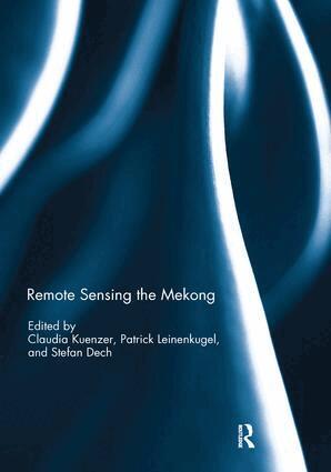
    Remote Sensing the Mekong

    AvClaudia Kuenzer,Patrick Leinenkugel

    Häftad, Engelska, 2019

    723 kr

    Beställningsvara. Skickas inom 10-15 vardagar. Fri frakt över 249 kr.

    Beskrivning

    The Mekong Basin in Southeast Asia is one of the largest international river basins in the world. Its abundant natural resources are shared by six riparian countries and provide the basis for the livelihoods of more than 75 million people. However, ongoing socio-economic growth and related anthropogenic interventions impact the region’s ecosystems, and there is an urgent need for the monitoring of the basin's land surface dynamics. Remote sensing has evolved as a key tool for this task, allowing for up-to-date analyses and regular monitoring of environmental dynamics beyond physical or political boundaries and at various temporal and spatial scales. This book serves as a forum for remote-sensing scientists with an interest in the Mekong River Basin to present their recent basin-related works as well as applied case studies of the region. A broad range of sensors from high to medium resolution, and from multispectral to SAR systems, are applied, covering topics such as land cover/land use classification and comparison, time series analyses of climate variables, vegetation structure and vegetation productivity, as well as studies on flood mapping or water turbidity monitoring. This book was originally published as a special issue of the International Journal of Remote Sensing.

    Produktinformation

    • Utgivningsdatum:2019-01-11
    • Mått:174 x 246 x 22 mm
    • Vikt:360 g
    • Format:Häftad
    • Språk:Engelska
    • Antal sidor:192
    • Förlag:Taylor & Francis Ltd
    • ISBN:9780367139063

    Utforska kategorier

    • Geografi inom Naturvetenskap och teknik
    • Hydrologi inom Naturvetenskap och teknik
    • Geovetenskap inom Naturvetenskap och teknik

    Mer om författaren

    Claudia Kuenzer is Head of the ‘Land Surface’ Department in the Earth Observation Centre at the German Aerospace Centre (DLR). She has led several research projects on the Mekong region and published numerous journal articles, book chapters, and a book on the Mekong Delta.Patrick Leinenkugel is Vice-Head of the ‘Land Surface Dynamics’ team in the Earth Observation Centre at the German Aerospace Centre (DLR). He has contributed to multiple research initiatives in the Mekong Basin and has published several remote sensing studies for the region. Stefan Dech is Director of DLR’s German Remote Sensing Data Center, and University Professor and holder of the endowed chair in remote sensing in the Department of Geography at Julius Maximilian University, Germany. He has co-authored numerous Mekong-related papers.

    Innehållsförteckning

    • 1. Preface: Remote sensing the Mekong Claudia Kuenzer 2. Comparing global land-cover products – implications for geoscience applications: an investigation for the trans-boundary Mekong Basin Claudia Kuenzer, Patrick Leinenkugel, Matthias Vollmuth, and Stefan Dech 3. Land-surface temperature dynamics in the Upper Mekong Basin derived from MODIS time series C.M. Frey and C. Kuenzer 4. Sensitivity analysis for predicting continuous fields of tree-cover and fractional land-cover distributions in cloud-prone areas Patrick Leinenkugel, Michel L. Wolters, Claudia Kuenzer, Natascha Oppelt, and Stefan Dech 5. Recent climate variability and its impact on precipitation, temperature, and vegetation dynamics in the Lancang River headwater area of China Chong Huang, Yafei Li, Gaohuan Liu, Hailong Zhang, and Qingsheng Liu 6. Drought impact on vegetation productivity in the Lower Mekong Basin Binghua Zhang, Li Zhang, Huadong Guo, Patrick Leinenkugel, Yu Zhou, Li Li, and Qian Shen 7. Suitability of SAR imagery for automatic flood mapping in the Lower Mekong Basin Felix Greifeneder, Wolfgang Wagner, Daniel Sabel, and Vahid Naeimi 8. Ecosystem assessment in the Tonle Sap Lake region of Cambodia using RADARSAT-2 Wide Fine-mode SAR data Lu Zhang, Huadong Guo, Xinwu Li, and Liyan Wang 9. The Ha Tien Plain – wetland monitoring using remote-sensing techniques Tim Funkenberg, Tran Thai Binh, Florian Moder, and Stefan Dech 10. Operational multi-sensor monitoring of turbidity for the entire Mekong Delta Thomas Heege, Viacheslav Kiselev, Magnus Wettle, and Nguyen Nghia Hung