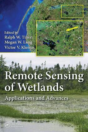
Remote Sensing of Wetlands
Applications and Advances
AvRalph W. Tiner,Megan W. Lang
2 998 kr
Läs direkt i Bokus Reader – eller ladda ned till din enhet (PDF kräver ofta zoom och scroll på små skärmar).
Du är på sajten för privatpersoner.
AvRalph W. Tiner,Megan W. Lang
2 998 kr
Läs direkt i Bokus Reader – eller ladda ned till din enhet (PDF kräver ofta zoom och scroll på små skärmar).
Ralph W. Tiner recently retired from the U.S. Fish and Wildlife Service (FWS) where he served as regional wetland coordinator for the Northeast Region, Hadley, Massachusetts. He has been mapping wetlands since 1970, first as a graduate student at the University of Connecticut, then with the State of South Carolina, and finally as part of the FWS's National Wetlands Inventory Program. Through his participation on national committees, he has helped standardize on-the-ground wetland delineation practices for implementing federal wetland regulations in the United States. He is editor of the Wetland Science and Practice journal and the author of over 200 publications.Megan W. Langis a research associate professor at the Department of Geographical Sciences, University of Maryland, College Park, Maryland. Her career in wetland sciences began in 1996, as an undergraduate student researching succession in abandoned rice fields while at the College of Charleston, South Carolina. She leads the U.S. Department of Agriculture Mid-Atlantic Wetland Conservation Effects Assessment Project, serves as an associate editor for the journal Wetlands, and has published over 40 scientific articles and book chapters. She has also helped to develop wetland monitoring strategies for the state of Maryland and the United States.Victor V. Klemasis professor emeritus at the School of Marine Science and Policy, University of Delaware, Newark, Delaware. Since 1976, he has directed the university's Center for Remote Sensing, where he pioneered the application of a wide range of remote sensing techniques in the study of wetland and estuarine ecosystems in the United States and overseas. Dr. Klemas has published his research results in 120 scientific journal articles and coauthored several books. He has also served on six scientific committees of the National Research Council (National Academy of
"... an important reference for operational wetlands mappers. Over the years, I have been told you should be using this technology instead of the one we were using at the time. A book like this would have provided an overview of the technology and more importantly the names of the experts." -Bill O. Wilen, PhD, USFWS, National Wetlands Inventory [this book] encompasses information essential to anyone engaged in either identifying and/or understanding wetlands using remote imagery. It brings together in one place a critical examination of the strengths and shortcomings of the many types of imagery available today. It explores the opportunity to combine various types of remote imagery to describe and analyze wetlands. It includes extensive case studies of the application of remote sensing imagery by wetland type." -Jeanne Christie, Association of State Wetland Managers
Ralph W. Tiner
Inbunden, 2009
604 kr
John Dorney, Rick Savage, Ralph W Tiner, Paul Adamus
Häftad, 2018
1 477 kr
Du är på sajten för privatpersoner.
AvRalph W. Tiner,Megan W. Lang
2 998 kr
Läs direkt i Bokus Reader – eller ladda ned till din enhet (PDF kräver ofta zoom och scroll på små skärmar).
Ralph W. Tiner recently retired from the U.S. Fish and Wildlife Service (FWS) where he served as regional wetland coordinator for the Northeast Region, Hadley, Massachusetts. He has been mapping wetlands since 1970, first as a graduate student at the University of Connecticut, then with the State of South Carolina, and finally as part of the FWS's National Wetlands Inventory Program. Through his participation on national committees, he has helped standardize on-the-ground wetland delineation practices for implementing federal wetland regulations in the United States. He is editor of the Wetland Science and Practice journal and the author of over 200 publications.Megan W. Langis a research associate professor at the Department of Geographical Sciences, University of Maryland, College Park, Maryland. Her career in wetland sciences began in 1996, as an undergraduate student researching succession in abandoned rice fields while at the College of Charleston, South Carolina. She leads the U.S. Department of Agriculture Mid-Atlantic Wetland Conservation Effects Assessment Project, serves as an associate editor for the journal Wetlands, and has published over 40 scientific articles and book chapters. She has also helped to develop wetland monitoring strategies for the state of Maryland and the United States.Victor V. Klemasis professor emeritus at the School of Marine Science and Policy, University of Delaware, Newark, Delaware. Since 1976, he has directed the university's Center for Remote Sensing, where he pioneered the application of a wide range of remote sensing techniques in the study of wetland and estuarine ecosystems in the United States and overseas. Dr. Klemas has published his research results in 120 scientific journal articles and coauthored several books. He has also served on six scientific committees of the National Research Council (National Academy of
"... an important reference for operational wetlands mappers. Over the years, I have been told you should be using this technology instead of the one we were using at the time. A book like this would have provided an overview of the technology and more importantly the names of the experts." -Bill O. Wilen, PhD, USFWS, National Wetlands Inventory [this book] encompasses information essential to anyone engaged in either identifying and/or understanding wetlands using remote imagery. It brings together in one place a critical examination of the strengths and shortcomings of the many types of imagery available today. It explores the opportunity to combine various types of remote imagery to describe and analyze wetlands. It includes extensive case studies of the application of remote sensing imagery by wetland type." -Jeanne Christie, Association of State Wetland Managers
Ralph W. Tiner
Inbunden, 2009
604 kr
John Dorney, Rick Savage, Ralph W Tiner, Paul Adamus
Häftad, 2018
1 477 kr