• Fri frakt över 249 kr
  • •
  • Snabba leveranser
  • •
  • Billiga böcker
Kundservice

Du är på sajten för privatpersoner.

Företag, bibliotek eller offentlig verksamhet?

Du handlar på classic.bokus.com, där alla dina funktioner finns intakta.
Till classic.bokus.com
Bokus logotyp. Gå till startsidan.
  • Erbjudanden
  • Student
  • Topplistor
  • Barn & ungdom
  • Bokus Play
  • E-böcker
  • Ljudböcker
  • Pocketböcker
  • Spel och pussel

Pocketfynda! Hundratals böcker för 49 kr/st →

Sidfot

Mina sidor

    Hjälp

    • Kundservice
    • Vanliga frågor och svar
    • Frakt och leverans
    • Retur vid ångerrätt
    • Reklamera vara
    • Betalning
    • Köpvillkor
    • Allmänna villkor
    • Information om webbplatsens tillgänglighet

    Om Bokus

    • Om oss
    • Pressrum
    • För studenter
    • För företag
    • För bibliotek och offentlig verksamhet
    • För leverantörer
    • Hållbarhet

    Populärt

    • Aktuella erbjudanden
    • Presentkort
    • Studentlitteratur
    • Nya böcker
    • Topplistor
    • Signerade böcker
    • Engelska böcker

    Inspiration

    • Boktips
    • BookTok
    • Barnbokskaraktärer
    • Populära författare
    Logotyp för Bokus
    Följ oss på Facebook (extern länk)Följ oss på Instagram (extern länk)Följ oss på YouTube (extern länk)Följ oss på TikTok (extern länk)
    bokus @ CookiesAnpassa cookiesIntegritetspolicyKöpvillkor
    Till Citymail hemsida (extern länk)Till Budbee hemsida (extern länk)Till Postnord hemsida (extern länk)Till Schenker hemsida (extern länk)Till Early Bird hemsida (extern länk)Till Walleys hemsida (extern länk)
    1. Samhälle och politik
    2. Samhälle och kultur
    3. Kultur och medier
    4. Referensverk och tvärvetenskap

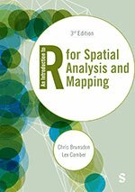
    An Introduction to R for Spatial Analysis and Mapping

    AvChris Brunsdon,Lex Comber

    Inbunden, Engelska, 2025

    Del i serien Spatial Analytics and GIS

    2 448 kr

    Beställningsvara. Skickas inom 3-6 vardagar. Fri frakt över 249 kr.

    Fler format och utgåvor

    Häftad

    597 kr

    Beskrivning

    The ever-expanding availability of spatial data continues to revolutionise research. This book is your go-to guide to getting the most out of handling, mapping and analysing location-based data.

    Without assuming prior knowledge of GIS, geocomputation or R, this book helps you understand spatial analysis and mapping and develop your programming skills, from learning about scripting and writing functions to point pattern analysis and spatial attribute analysis.

    The book:

    • Illustrates approaches to analysis on a range of datasets that are new to this edition.
    • Enables you to put your skills into practice with embedded exercises and over 30 self-test questions.
    • Showcases the possibilities of using spatial analysis to explore spatial inequalities.

    Whether you’re an R novice or experienced user, this book equips upper undergraduates, postgraduates and researchers with the tools needed for spatial data handling and rich analysis.

    Produktinformation

    • Utgivningsdatum:2025-04-25
    • Mått:170 x 242 x 26 mm
    • Vikt:840 g
    • Format:Inbunden
    • Språk:Engelska
    • Serie:Spatial Analytics and GIS
    • Antal sidor:400
    • Upplaga:3
    • Förlag:SAGE Publications
    • ISBN:9781529687514

    Utforska kategorier

    • Referensverk och tvärvetenskap inom Samhälle och politik
    • Geografi inom Naturvetenskap och teknik

    Mer om författaren

    Chris Brunsdon is Professor of Geocomputation and Director of the National Centre for Geocomputation at the National University of Ireland, Maynooth, having worked previously in the Universities of Newcastle, Glamorgan, Leicester and Liverpool, variously in departments focusing on both geography and computing. He has interests that span both of these disciplines, including spatial statistics, geographical information science, and exploratory spatial data analysis, and in particular the application of these ideas to crime pattern analysis, the modelling of house prices, medical and health geography and the analysis of land use data. He was one of the originators of the technique of geographically weighted regression (GWR). He has extensive experience of programming in R, going back to the late 1990s, and has developed a number of R packages which are currently available on CRAN, the Comprehensive R Archive Network. He is an advocate of free and open source software, and in particular the use of reproducible research methods, and has contributed to a large number of workshops on the use of R and of GWR in a number of countries, including the UK, Ireland, Japan, Canada, the USA, the Czech Republic and Australia. When not involved in academic work he enjoys running, collecting clocks and watches, and cooking – the last of these probably cancelling out the benefits of the first.Alexis Comber, Lex, is Professor of Spatial Data Analytics at Leeds Institute for Data Analytics (LIDA) the University of Leeds. He worked previously at the University of Leicester where he held a chair in Geographical Information Science. His first degree was in Plant and Crop Science at the University of Nottingham and he completed a PhD in Computer Science at the Macaulay Institute, Aberdeen (now the James Hutton Institute) and the University of Aberdeen. This developed expert systems for land cover monitoring from satellite imagery and brought him into the world of spatial data, spatial analysis, and mapping. Lex’s research interests span many different application areas including environment, land cover / land use, demographics, public health, agriculture, bio-energy and accessibility, all of which require multi-disciplinary approaches. His research draws from methods in geocomputation, mathematics, statistics and computer science and he has extended techniques in operations research / location-allocation (what to put where), graph theory (cluster detection in networks), heuristic searches (how to move intelligently through highly dimensional big data), remote sensing (novel approaches for classification), handling divergent data semantics (uncertainty handling, ontologies, text mining) and spatial statistics (quantifying spatial and temporal process heterogeneity). He has co-authored (with Chris Brunsdon) An Introduction to R for Spatial Analysis and Mapping, the first ‘how to book’ for spatial analyses and mapping in R, the open source statistical software, now in its second edition.Outside of academic work and in no particular order, Lex enjoys his vegetable garden, walking the dog and playing pinball (he is the proud owner of a 1981 Bally Eight Ball Deluxe).

    Recensioner i media

    There′s no better text for showing students and data analysts how to use R for spatial analysis, mapping and reproducible research. If you want to learn how to make sense of geographic data and would like the tools to do it, this is your guide.

    Innehållsförteckning

    • Chapter 1: Introduction and Getting StartedChapter 2: Data and PlotsChapter 3: Spatial Data Handling in RChapter 4: Scripting and Writing Functions in RChapter 5: Using R as a GISChapter 6: Point Pattern Analysis Using RChapter 7: Spatial Attribute Analysis With R: Point Based DataChapter 8: Spatial Attribute Analysis With R: Area Based DataChapter 9: Localised Spatial AnalysisChapter 10: Working with Data from the InternetEpilogue: Spatial Analysis and R - Review and Prospect