• Fri frakt över 249 kr
  • •
  • Snabba leveranser
  • •
  • Billiga böcker
Kundservice

Du är på sajten för privatpersoner.

Företag, bibliotek eller offentlig verksamhet?

Du handlar på classic.bokus.com, där alla dina funktioner finns intakta.
Till classic.bokus.com
Bokus logotyp. Gå till startsidan.
  • Erbjudanden
  • Nyheter
  • Student
  • Topplistor
  • Barn & ungdom
  • Bokus Play
  • E-böcker
  • Pocketböcker
  • Spel & pussel

10% rabatt på allt med kod NYSTART10 →

Sidfot

Mina sidor

    Hjälp

    • Kundservice
    • Vanliga frågor och svar
    • Frakt och leverans
    • Retur vid ångerrätt
    • Reklamera vara
    • Betalning
    • Köpvillkor
    • Allmänna villkor
    • Information om webbplatsens tillgänglighet

    Om Bokus

    • Om oss
    • Pressrum
    • För studenter
    • För företag
    • För bibliotek och offentlig verksamhet
    • För leverantörer
    • Hållbarhet

    Populärt

    • Aktuella erbjudanden
    • Presentkort
    • Studentlitteratur
    • Nya böcker
    • Topplistor
    • Signerade böcker
    • Engelska böcker

    Inspiration

    • Boktips
    • BookTok
    • Populära bokserier
    • Barnbokskaraktärer
    • Populära författare
    Logotyp för Bokus
    Följ oss på Facebook (extern länk)Följ oss på Instagram (extern länk)Följ oss på YouTube (extern länk)Följ oss på TikTok (extern länk)
    bokus @ CookiesAnpassa cookiesIntegritetspolicyKöpvillkor
    Till Citymail hemsida (extern länk)Till Budbee hemsida (extern länk)Till Postnord hemsida (extern länk)Till Schenker hemsida (extern länk)Till Early Bird hemsida (extern länk)Till Walleys hemsida (extern länk)
    1. Naturvetenskap och teknik
    2. Geovetenskap
    3. Geografi

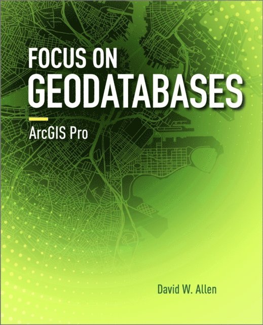
    Focus on Geodatabases in ArcGIS Pro

    AvDavid W. Allen

    Häftad, Engelska, 2019

    Del i serien Focus On

    996 kr

    Beställningsvara. Skickas inom 5-8 vardagar. Fri frakt över 249 kr.

    Fler format och utgåvor

    E-bok

    874 kr

    Beskrivning

    Focus on Geodatabases in ArcGIS Pro introduces readers to the geodatabase, the comprehensive information model for representing and managing geographic information across the ArcGIS platform.Sharing best practices for creating and maintaining data integrity, chapter topics include the careful design of a geodatabase schema, building geodatabases that include data integrity rules, populating geodatabases with existing data, working with topologies, editing data using various techniques, building 3D views, and sharing data on the web. Each chapter includes important concepts with hands-on, step-by-step tutorials, sample projects and datasets, 'Your turn' segments with less instruction, study questions for classroom use, and an independent project. Instructor resources are available by request.


    Produktinformation

    • Utgivningsdatum:2019-08-01
    • Mått:190 x 234 x 19 mm
    • Vikt:706 g
    • Format:Häftad
    • Språk:Engelska
    • Serie:Focus On
    • Antal sidor:260
    • Förlag:ESRI Press
    • ISBN:9781589484450

    Utforska kategorier

    • Geografi inom Naturvetenskap och teknik

    Mer om författaren

    David W. Allen has been working in the GIS field for over 35 years, the last 30 with the City of Euless, Texas, and has seen many versions of ArcInfo and ArcGIS come along since he started with version 5. He spent 18 years as an adjunct professor at Tarrant County College in Fort Worth, Texas, and now serves as the State Director of Operations for a volunteer emergency response group developing databases and templates. Mr. Allen is the author of GIS Tutorial 2: Spatial Analysis Workbook (Esri Press, 2016).

    Innehållsförteckning

    • IntroductionChapter 1 Designing the geodatabase schemaTutorial 1-1: Creating a geodatabase--building a logical modelExercise 1-1Tutorial 1-2: Creating a geodatabas--expanding the logical modelExercise 1-2Chapter 2 Creating a geodatabaseTutorial 2-1: Building a geodatabaseExercise 2-1Tutorial 2-2: Adding complex geodatabase componentsExercise 2-2Chapter 3 Populating and sharing a geodatabaseTutorial 3-1: Loading data into a geodatabaseExercise 3-1Tutorial 3-2: Populating geodatabase subtypesExercise 3-2Chapter 4 Extending data formatsTutorial 4-1: Putting your data onlineExercise 4-1Tutorial 4-2: Creating 3D scenesExercise 4-2Chapter 5 Working with featuresTutorial 5-1: Creating new featuresExercise 5-1Tutorial 5-2: Using context menu creation toolsExercise 5-2Chapter 6 Advanced editingTutorial 6-1: Exploring more creation toolsExercise 6-1Tutorial 6-2: Building feature templatesExercise 6-2Chapter 7 Working with topologyTutorial 7-1: Working with map topologyExercise 7-1Tutorial 7-2:Working with geodatabase topologyExercise 7-2Index