• Fri frakt över 249 kr
  • •
  • Snabba leveranser
  • •
  • Billiga böcker
Kundservice

Du är på sajten för privatpersoner.

Företag, bibliotek eller offentlig verksamhet?

Du handlar på classic.bokus.com, där alla dina funktioner finns intakta.
Till classic.bokus.com
Bokus logotyp. Gå till startsidan.
  • Erbjudanden
  • Student
  • Topplistor
  • Barn & ungdom
  • Bokus Play
  • E-böcker
  • Ljudböcker
  • Pocketböcker
  • Spel & pussel

10% rabatt på allt med kod NYSTART10 →

Sidfot

Mina sidor

    Hjälp

    • Kundservice
    • Vanliga frågor och svar
    • Frakt och leverans
    • Retur vid ångerrätt
    • Reklamera vara
    • Betalning
    • Köpvillkor
    • Allmänna villkor
    • Information om webbplatsens tillgänglighet

    Om Bokus

    • Om oss
    • Pressrum
    • För studenter
    • För företag
    • För bibliotek och offentlig verksamhet
    • För leverantörer
    • Hållbarhet

    Populärt

    • Aktuella erbjudanden
    • Presentkort
    • Studentlitteratur
    • Nya böcker
    • Topplistor
    • Signerade böcker
    • Engelska böcker

    Inspiration

    • Boktips
    • BookTok
    • Populära bokserier
    • Barnbokskaraktärer
    • Populära författare
    Logotyp för Bokus
    Följ oss på Facebook (extern länk)Följ oss på Instagram (extern länk)Följ oss på YouTube (extern länk)Följ oss på TikTok (extern länk)
    bokus @ CookiesAnpassa cookiesIntegritetspolicyKöpvillkor
    Till Citymail hemsida (extern länk)Till Budbee hemsida (extern länk)Till Postnord hemsida (extern länk)Till Schenker hemsida (extern länk)Till Early Bird hemsida (extern länk)Till Walleys hemsida (extern länk)
    1. Data och IT
    2. Systemvetenskap och AI

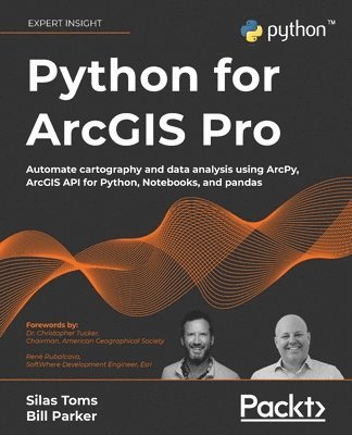
    Python for ArcGIS Pro

    Automate cartography and data analysis using ArcPy, ArcGIS API for Python, Notebooks, and pandas

    AvSilas Toms,William Parker

    Häftad, Engelska, 2022

    860 kr

    Beställningsvara. Skickas inom 5-8 vardagar. Fri frakt över 249 kr.

    Beskrivning

    Extend your ArcGIS expertise by unlocking the world of Python programming. A fully hands-on guide that takes you through exercise after exercise using real data and real problems. NOTE: This book is compatible with ArcGIS Pro 2.9.Key FeaturesLearn the core components of the two Python modules for ArcGIS: ArcPy and ArcGIS API for PythonUse ArcPy, pandas, NumPy, and ArcGIS in ArcGIS Pro Notebooks to manage and analyze geospatial data at scaleIntegrate with ArcGIS Online using Python to publish and manage dataBook DescriptionIntegrating Python into your day-to-day ArcGIS work is highly recommended when dealing with large amounts of geospatial data. Python for ArcGIS Pro aims to help you get your work done faster, with greater repeatability and higher confidence in your results.Starting from programming basics and building in complexity, two experienced ArcGIS professionals-turned-Python programmers teach you how to incorporate scripting at each step: automating the production of maps for print, managing data between ArcGIS Pro and ArcGIS Online, creating custom script tools for sharing, and then running data analysis and visualization on top of the ArcGIS geospatial library, all using Python.You’ll use ArcGIS Pro Notebooks to explore and analyze geospatial data, and write data engineering scripts to manage ongoing data processing and data transfers. This exercise-based book also includes three rich real-world case studies, giving you an opportunity to apply and extend the concepts you studied earlier.Irrespective of your expertise level with Esri software or the Python language, you’ll benefit from this book’s hands-on approach, which takes you through the major uses of Python for ArcGIS Pro to boost your ArcGIS productivity.What you will learnAutomate map production to make and edit maps at scale, cutting down on repetitive tasksPublish map layer data to ArcGIS OnlineAutomate data updates using the ArcPy Data Access module and cursorsTurn your scripts into script tools for ArcGIS ProLearn how to manage data on ArcGIS OnlineQuery, edit, and append to feature layers and create symbology with renderers and colorizersApply pandas and NumPy to raster and vector analysisLearn new tricks to manage data for entire cities or large companiesWho this book is forThis book is ideal for anyone looking to add Python to their ArcGIS Pro workflows, even if you have no prior experience with programming. This includes ArcGIS professionals, intermediate ArcGIS Pro users, ArcGIS Pro power users, students, and people who want to move from being a GIS Technician to GIS Analyst; GIS Analyst to GIS Programmer; or GIS Developer/Programmer to a GIS Architect. Basic familiarity with geospatial/GIS syntax, ArcGIS, and data science (pandas) is helpful, though not necessary.

    Produktinformation

    • Utgivningsdatum:2022-04-29
    • Mått:191 x 235 x 32 mm
    • Vikt:1 079 g
    • Format:Häftad
    • Språk:Engelska
    • Antal sidor:586
    • Förlag:Packt Publishing Limited
    • ISBN:9781803241661

    Utforska kategorier

    • Systemvetenskap och AI inom Data och IT

    Mer om författaren

    Silas Toms is a certified GIS Professional and the author of the first edition of ArcPy and ArcGIS. President and founder of Loki Intelligent Corporation, a location information firm located in San Francisco, California, he is an expert in real-time geographic information systems and analysis automation. Along with Dara O'Beirne and Arini Geographics, he developed the real-time common operational picture used at Super Bowl 50 and all other events at Levi's Stadium in Santa Clara, California. This dynamic system was recognized by the White House and ESRI President, Jack Dangermond, as a unique and powerful application of GIS, allowing the federal, state, and local government to coordinate and communicate in real time, for the first time ever.As the President of Loki Intelligent, Silas is focused on unique applications of GIS that will power the future of location information. The sheer amount of data collected through sensors and mobile reporting demands automation and data processing improvements to turn the raw input into location intelligence. He believes that correct application of geospatial analysis, web mapping, and mobile data collection will improve the decision-making processes within the government and business. Loki is location information, and information is power. Bill Parker is a GIS Professional with over 15 years of GIS and Python experience. He previously worked at ICF as a GIS lead on large scale environmental projects, using ArcPy to automate GIS analyses and map production. His project highlights include being the GIS lead for the Caltrain Modernization EIR/S, California High Speed Rail Project San Jose to Merced, and San Francisco to San Jose EIR/S.

    Innehållsförteckning

    • Table of ContentsIntroduction to Python for GISBasics of ArcPyArcGIS API for PythonThe Data Access Module and Cursors Publishing to ArcGIS OnlineArcToolbox Script ToolsAutomated Map ProductionPandas, Data Frames, and Vector DataRaster Analysis with PythonGeospatial Data Processing with NumPyCase Study: ArcGIS Online Administration and Data ManagementCase Study: Advanced Map AutomationCase Study: Predicting Crop Yields