Silas Toms – författare
Visar alla böcker från författaren . Handla med fri frakt och snabb leverans.
5 produkter
5 produkter
Häftad, Engelska, 2015
651 kr
Skickas inom 5-8 vardagar
Häftad, Engelska, 2017
732 kr
Skickas inom 5-8 vardagar
Häftad, Engelska, 2018
732 kr
Skickas inom 5-8 vardagar
E-bok
Engelska, 2018535 kr
Läs direkt efter köp
Explore GIS processing and learn to work with various tools and libraries in Python.
Key Features
[*] Analyze and process geospatial data using Python libraries such as; Anaconda, GeoPandas[*] Leverage new ArcGIS API to process geospatial data for the cloud.[*] Explore various Python geospatial web and machine learning frameworks.Book Description
Python comes with a host of open source libraries and tools that help you work on professional geoprocessing tasks without investing in expensive tools. This book will introduce Python developers, both new and experienced, to a variety of new code libraries that have been developed to perform geospatial analysis, statistical analysis, and data management. This book will use examples and code snippets that will help explain how Python 3 differs from Python 2, and how these new code libraries can be used to solve age-old problems in geospatial analysis.You will begin by understanding what geoprocessing is and explore the tools and libraries that Python 3 offers. You will then learn to use Python code libraries to read and write geospatial data. You will then learn to perform geospatial queries within databases and learn PyQGIS to automate analysis within the QGIS mapping suite. Moving forward, you will explore the newly released ArcGIS API for Python and ArcGIS Online to perform geospatial analysis and create ArcGIS Online web maps. Further, you will deep dive into Python Geospatial web frameworks and learn to create a geospatial REST API.What you will learn
[*] Manage code libraries and abstract geospatial analysis techniques using Python 3.[*] Explore popular code libraries that perform specific tasks for geospatial analysis.[*] Utilize code libraries for data conversion, data management, web maps, and REST API creation.[*] Learn techniques related to processing geospatial data in the cloud.[*] Leverage features of Python 3 with geospatial databases such as PostGIS, SQL Server, and SpatiaLite.Who this book is for
The audience for this book includes students, developers, and geospatial professionals who need a reference book that covers GIS data management, analysis, and automation techniques with code libraries built in Python 3.
Häftad, Engelska, 2022
862 kr
Skickas inom 5-8 vardagar
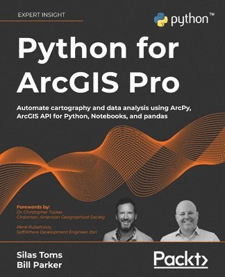
Extend your ArcGIS expertise by unlocking the world of Python programming. A fully hands-on guide that takes you through exercise after exercise using real data and real problems. NOTE: This book is compatible with ArcGIS Pro 2.9.Key FeaturesLearn the core components of the two Python modules for ArcGIS: ArcPy and ArcGIS API for PythonUse ArcPy, pandas, NumPy, and ArcGIS in ArcGIS Pro Notebooks to manage and analyze geospatial data at scaleIntegrate with ArcGIS Online using Python to publish and manage dataBook DescriptionIntegrating Python into your day-to-day ArcGIS work is highly recommended when dealing with large amounts of geospatial data. Python for ArcGIS Pro aims to help you get your work done faster, with greater repeatability and higher confidence in your results.Starting from programming basics and building in complexity, two experienced ArcGIS professionals-turned-Python programmers teach you how to incorporate scripting at each step: automating the production of maps for print, managing data between ArcGIS Pro and ArcGIS Online, creating custom script tools for sharing, and then running data analysis and visualization on top of the ArcGIS geospatial library, all using Python.You’ll use ArcGIS Pro Notebooks to explore and analyze geospatial data, and write data engineering scripts to manage ongoing data processing and data transfers. This exercise-based book also includes three rich real-world case studies, giving you an opportunity to apply and extend the concepts you studied earlier.Irrespective of your expertise level with Esri software or the Python language, you’ll benefit from this book’s hands-on approach, which takes you through the major uses of Python for ArcGIS Pro to boost your ArcGIS productivity.What you will learnAutomate map production to make and edit maps at scale, cutting down on repetitive tasksPublish map layer data to ArcGIS OnlineAutomate data updates using the ArcPy Data Access module and cursorsTurn your scripts into script tools for ArcGIS ProLearn how to manage data on ArcGIS OnlineQuery, edit, and append to feature layers and create symbology with renderers and colorizersApply pandas and NumPy to raster and vector analysisLearn new tricks to manage data for entire cities or large companiesWho this book is forThis book is ideal for anyone looking to add Python to their ArcGIS Pro workflows, even if you have no prior experience with programming. This includes ArcGIS professionals, intermediate ArcGIS Pro users, ArcGIS Pro power users, students, and people who want to move from being a GIS Technician to GIS Analyst; GIS Analyst to GIS Programmer; or GIS Developer/Programmer to a GIS Architect. Basic familiarity with geospatial/GIS syntax, ArcGIS, and data science (pandas) is helpful, though not necessary.