Häftad, Engelska, 2019
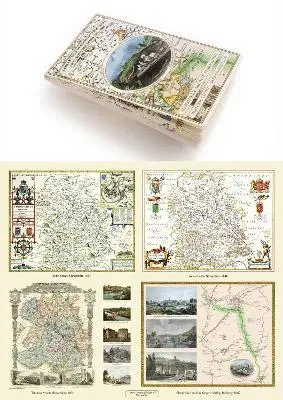
Shropshire 1611 – 1836 – Fold Up Map that features a collection of Four Historic Maps, John Speed’s County Map 1611, Johan Blaeu’s County Map of 1648, Thomas Moules County Map of 1836 and a Map of the Severn Valley Railway in 1887.The maps also feature a number of early views across Shropshire including the famous Ironbridge over the Severn and the Severn at Bridgnorth.
Av Mapseeker Publishing Ltd Mapseeker Publishing Ltd
Del 29 i serien Historic English Counties Maps Collection
259 kr
Tillfälligt slut
Beskrivning
Produktinformation
- Utgivningsdatum: 2019-01-01
- Mått: 134 x 227 x 55 mm
- Vikt: 102 g
- Format: Häftad
- Språk: Engelska
- Serie: Historic English Counties Maps Collection
- Antal sidor: 1
- Förlag: Historical Images Ltd
- ISBN: 9781844918447
Utforska kategorier
Recensioner i media
Select Guide Rating
Betyg & recensioner
0 recensioner
Inga recensioner tillgängliga.