• Fri frakt över 249 kr
  • •
  • Snabba leveranser
  • •
  • Billiga böcker
Kundservice

Du är på sajten för privatpersoner.

Företag, bibliotek eller offentlig verksamhet?

Du handlar på classic.bokus.com, där alla dina funktioner finns intakta.
Till classic.bokus.com
Bokus logotyp. Gå till startsidan.
  • Erbjudanden
  • Nyheter
  • Student
  • Topplistor
  • Barn & ungdom
  • Bokus Play
  • E-böcker
  • Pocketböcker
  • Spel & pussel

10% studentrabatt med kod TERM26

Sidfot

Mina sidor

    Hjälp

    • Kundservice
    • Vanliga frågor och svar
    • Frakt och leverans
    • Retur vid ångerrätt
    • Reklamera vara
    • Betalning
    • Köpvillkor
    • Allmänna villkor
    • Information om webbplatsens tillgänglighet

    Om Bokus

    • Om oss
    • Pressrum
    • För studenter
    • För företag
    • För bibliotek och offentlig verksamhet
    • För leverantörer
    • Hållbarhet

    Populärt

    • Aktuella erbjudanden
    • Presentkort
    • Studentlitteratur
    • Nya böcker
    • Topplistor
    • Signerade böcker
    • Engelska böcker

    Inspiration

    • Boktips
    • BookTok
    • Populära bokserier
    • Barnbokskaraktärer
    • Populära författare
    Logotyp för Bokus
    Följ oss på Facebook (extern länk)Följ oss på Instagram (extern länk)Följ oss på YouTube (extern länk)Följ oss på TikTok (extern länk)
    bokus @ CookiesAnpassa cookiesIntegritetspolicyKöpvillkor
    Till Citymail hemsida (extern länk)Till Budbee hemsida (extern länk)Till Postnord hemsida (extern länk)Till Schenker hemsida (extern länk)Till Early Bird hemsida (extern länk)Till Walleys hemsida (extern länk)
    1. Historia och arkeologi
    2. Historia
    3. Historia: särskilda händelser och ämnen
    4. Sjöfartshistoria

    Historical Sea Charts

    Visions and Voyages Through the Ages

    AvKatherine Parker

    Inbunden, Engelska, 2023

    Del i serien Through the Ages

    374 kr

    Tillfälligt slut

    Beskrivning

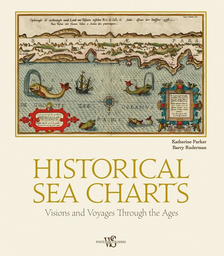
    This book shows the history of charts and nautical maps from the earliest known examples to the one used in the Twentieth Century, with a special focus on the map makers and the methods of use from 1300 to 1900. The maps included are part of the collection owned by Barry Lawrence Rudeman Antique Maps Inc., the world leader institution for nautical maps. The reader can find in this book the most indicative of trends and ideas through time. For each example in the volume, the reader will find out how the maps where designed and created, as well as how they were used during navigation or in preparation of the journey.

    Produktinformation

    • Utgivningsdatum:2023-10-17
    • Mått:275 x 315 x 27 mm
    • Vikt:1 770 g
    • Format:Inbunden
    • Språk:Engelska
    • Serie:Through the Ages
    • Antal sidor:208
    • Förlag:White Star
    • ISBN:9788854417168

    Utforska kategorier

    • Sjöfartshistoria inom Historia och arkeologi
    • Allmän historia och världshistoria inom Historia och arkeologi

    Mer om författaren

    Katherine Parker, fellowship of the Royal Geographical Society, is the Research Officer at Barry Lawrence Ruderman Antique Maps Inc. She received her PhD in History from the University of Pittsburgh in 2016. She has published in an array of scholarly journals and edited collections. Barry Lawrence Ruderman Antique Maps Inc. is located in La Jolla, California, and is a leading dealer of fine antique maps and atlases. It was established in 1992 and since then, it has earned a reputation for handling top-quality authentic antique maps.

    Innehållsförteckning

    • IntroductionIsolarios, Portolans, and the Charting of the EarlyModern Mediterranean World(1500–1700)Dutch Hydrography in the Golden Age(1600–1700)The Proliferation and Rationalization of Charts(1700–1800)National Hydrographic Services and OrganizationsPrivate and Corporate Chart and Mapmakingin the Nineteenth CenturyThe Continuing Manuscript Tradition of Sea ChartsThe Authors—Acknowledgements—Photo Credits