• Fri frakt över 249 kr
  • •
  • Snabba leveranser
  • •
  • Billiga böcker
Kundservice

Du är på sajten för privatpersoner.

Företag, bibliotek eller offentlig verksamhet?

Du handlar på classic.bokus.com, där alla dina funktioner finns intakta.
Till classic.bokus.com
Bokus logotyp. Gå till startsidan.
  • Erbjudanden
  • Nyheter
  • Student
  • Topplistor
  • Barn & ungdom
  • Bokus Play
  • E-böcker
  • Pocketböcker
  • Spel & pussel

10% studentrabatt med kod TERM26

Sidfot

Mina sidor

    Hjälp

    • Kundservice
    • Vanliga frågor och svar
    • Frakt och leverans
    • Retur vid ångerrätt
    • Reklamera vara
    • Betalning
    • Köpvillkor
    • Allmänna villkor
    • Information om webbplatsens tillgänglighet

    Om Bokus

    • Om oss
    • Pressrum
    • För studenter
    • För företag
    • För bibliotek och offentlig verksamhet
    • För leverantörer
    • Hållbarhet

    Populärt

    • Aktuella erbjudanden
    • Presentkort
    • Studentlitteratur
    • Nya böcker
    • Topplistor
    • Signerade böcker
    • Engelska böcker

    Inspiration

    • Boktips
    • BookTok
    • Populära bokserier
    • Barnbokskaraktärer
    • Populära författare
    Logotyp för Bokus
    Följ oss på Facebook (extern länk)Följ oss på Instagram (extern länk)Följ oss på YouTube (extern länk)Följ oss på TikTok (extern länk)
    bokus @ CookiesAnpassa cookiesIntegritetspolicyKöpvillkor
    Till Citymail hemsida (extern länk)Till Budbee hemsida (extern länk)Till Postnord hemsida (extern länk)Till Schenker hemsida (extern länk)Till Early Bird hemsida (extern länk)Till Walleys hemsida (extern länk)
    1. Naturvetenskap och teknik
    2. Geovetenskap
    3. Geografi

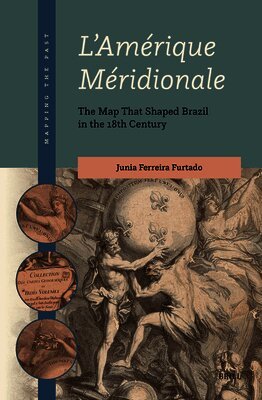
    L'Amérique Méridionale: The Map That Shaped Brazil in the 18th Century

    AvJunia Ferreira Furtado

    Inbunden, Engelska, 2024

    Del 4 i serien Mapping the Past

    2 022 kr

    Beställningsvara. Skickas inom 5-8 vardagar. Fri frakt över 249 kr.

    Beskrivning

    This book explores how the origins of Brazil’s modern borders can be traced to the cartography of the Americas produced by the eighteenth-century French cartographer J.B.B. d’Anville. It argues that this map reflects the geopolitical policies of the Portuguese diplomat D. Luis da Cunha, who was involved in Portugal’s negotiations with the Spanish to formally establish Brazil’s frontiers, and highlights how and why these policies were adopted in the Treaty of Madrid in 1750.

    Produktinformation

    • Utgivningsdatum:2024-10-04
    • Mått:155 x 235 x 24 mm
    • Vikt:787 g
    • Format:Inbunden
    • Språk:Engelska
    • Serie:Mapping the Past
    • Antal sidor:344
    • Förlag:Brill
    • ISBN:9789004708310

    Utforska kategorier

    • Geografi inom Naturvetenskap och teknik

    Mer om författaren

    Junia Ferreira Furtado, Ph.D. (1996), Universidade Federal de Minas Gerais, is Professor at that university. She has written many articles, and chapters in the History of Cartography, including Quebra Cabeça africano (Odisseia, 2021).

    Recensioner i media

    "The author’s conclusions are based on exhaustive research, as evidenced by the volume’s impressive bibliography, featuring primary and secondary sources written in English, Portuguese, Spanish, Latin, and French. (...) The text is enriched by numerous illustrations (...). This comprehensive approach enables Furtado to demonstrate convincingly how the evolution of geopolitical thought and changing cartographic conventions developed symbiotically over the course of the eighteenth century. L’Amérique Méridionale is a worthy addition to Brill’s Mapping the Past series." – Judy Bieber, in: Imago Mundi 77:2 (2025), p. 230.

    Innehållsförteckning

    • AcknowledgmentsList of Figures and TablesAbbreviationsIntroductionPart 1: Oracles1 D. Luis da Cunha: Oracle of Geopolitics1 Mirror for a Prince2 The Fifth Evangelist3 Academies4 The Ambassador and the Art of Diplomacy5 The Salons and the Dinner Table2 Jean Baptiste Bourguignon d’Anville: Oracle of Geography1 An Armchair Geographer and His Fortune2 Origins and Education3 Between an Oblong and an Oblate Earth4 Paper Earth5 Royal GeographerPart 2: Encounters3 Minerva’s Forest: the Ambassador, the Cartographer, and D. João V’s Royal Library1 An Enlightened King and His Library2 Delisle and the New Measuring of the Tordesillas Meridian3 Mathematical Instruments and Their Experts4 Maps and Prints5 The Tordesillas Meridian4 The Portuguese Imperium in D. Luis da Cunha’s Geopolitical View and the Formulation of Uti possidetis1 Minas Gerais Captaincy or the Old Lady’s Goods2 The State of Maranhão and the Mill Mule3 The Colônia do Sacramento or the Touchstone4 The Fernando de Noronha Island, the War of Jenkins’s Ear, and the English Threat5 The Uti possidetis or the Colonization as an Act of PossessionPart 3: Maps5 Amérique méridionale, a Modern Knowledge1 An Enlightened Map2 Placing Names3 Map Sources4 Oracles of a Living Geography5 The Nunes Brothers6 Amérique méridionale, a Distorting Mirror1 The Blank and the Void2 Simulacra3 The Amazonas Warriors4 El Dorado5 The Return of ParimaEpilogue: A Lost Treasure1 Diplomacy and Cartography2 The Rio de la Plata Basin3 The Midwest and Amazonia4 Cabo do Norte and the Guianas5 The Treaty of Madrid and Uti possidetis6 The Amérique méridionale versus the Mapa das cortesBibliographyIndex