
2000 Chart Packs – serie
Visar alla böcker i serien 2000 Chart Packs. Handla med fri frakt och snabb leverans.
2 produkter
2 produkter
956 kr
Skickas
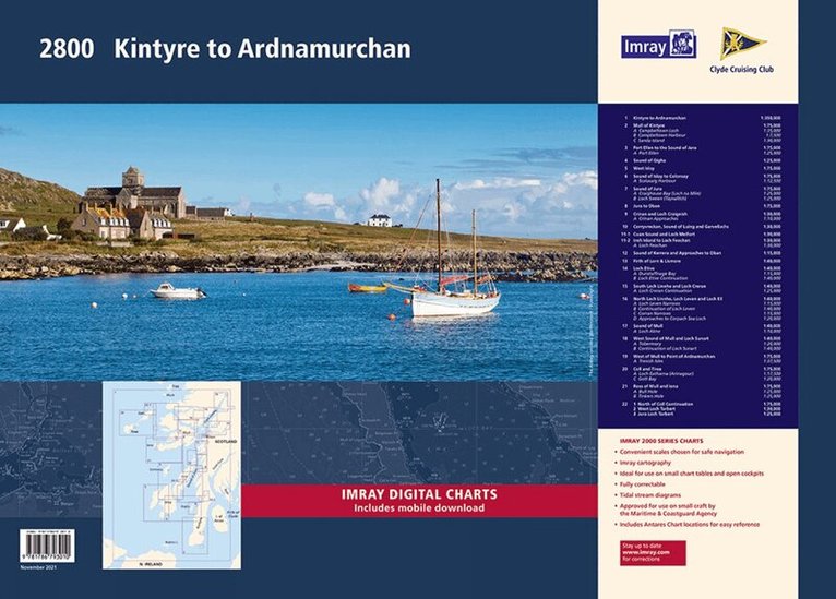
This complete redesign of our 2800 Kintyre to Ardnamurchan chart pack now includes more detailed coverage of the area and comes as a paper and digital edition. This edition consists of 11 extra chart sheets, twice the coverage of the previous edition, and incorporates all the latest official bathymetric surveys. Created in association with the Clyde Cruising Club for use alongside their sailing directions, coverage includes detail of this delightful area of Scotland and there is reference to the popular large scale Antares Charts. The 22 chart sheets in this pack provide all the necessary information for passage planning, detailed approach to yacht havens and marinas, and the numerous anchorages and sailing areas recommended for small craft. Coverage includes large scale charts from Kintyre sailing north, with newly included charts of Kintyre, Gigha, Islay, Jura and Colonsay. Large scale coverage continues with Mull, Loch Linnhe, Lock Etive, Lock Sunart Coll, Tiree to Ardnamurchan. Full details of charts and their scales are listed below. Also available wiro bound, see code IC2800-3W. 1st edition charts Y80, Y81, Y82, Y83, Y84, Y85, Y86 and Y87 have been published that replicate charts 2800.4, 2800.10, 2800.11, 2800.12, 2800.13, 2800.15, 2800.17 & 2800.18 respectively and sold individually. These are part of our 'small format Y chart series' that mirror coverage from the corresponding atlas and are A2 size. For details of these please see the relevant page on our website. Imray Digital Charts: Free mobile download A voucher code to download ID30 Imray digital charts into Imray Navigator (our app for iPad, iPhone and Android) is included with this pack. Charts included: 2800.1 Kintyre to Ardnamurchan (1:350 000) 2800.2 Mull of Kintyre (1:75 000) Plans Campbeltown Loch (1:35 000), Campbeltown Harbour (1:7500), Sanda Island (1:30 000) 2800.3 Port Ellen to the Sound of Jura (1:75 000) Plan Port Ellen (1:25 000) 2800.4 Sound of Gigha (1:25 000) 2800.5 West Islay (1:75 000) 2800.6 Sound of Islay to Colonsay (1:75 000) Plan Scalasaig (1:12 500) 2800.7 Sound of Jura (1:75000) Plans Craighouse Bay (Loch na Mile) (1:25 000), Loch Sween (Tayvallich) (1:25 000) 2800.8 Jura to Oban (1:75 000) 2800.9 Crinan and Loch Craignish (1:30 000) Plan Crinan Approaches (1:10 000) 2800.10 Corryvreckan, Sound of Luing and Garvellachs (1:30 000) 2800.11 Cuan Sound and Loch Melfort (1:30 000) Insh Island to Loch Feochan (1:30 000) Plan Loch Feochan (1:30 000) 2800.12 Sound of Kerrera and Approaches to Oban (1:15 000) 2800.13 Firth of Lorn & Lismore (1:40 000) 2800.14 Loch Etive (1:40 000) Plans Dunstaffnage Bay (1:15 000), Loch Etive Continuation (1:40 000) 2800.15 South Loch Linnhe and Loch Creran (1:40 000) Plan Loch Creran Continuation (1:25 000) 2800.16 North Loch Linnhe, Loch Leven and Loch Eil (1:40 000) Plans Loch Leven Narrows (1:15 000), Continuation of Loch Leven (1:40 000), Corran Narrows (1:15 000), Approaches to Corpach Sea Loch (1:20 000) 2800.17 Sound of Mull (1:40 000) Plan Loch Aline (1:10 000) 2800.18 West Sound of Mull and Loch Sunart (1:40 000) Plans Tobermory (1:20 000), Continuation of Loch Sunart (1:40 000) 2800.19 West Mull to Point of Ardnamurchan (1:75 000) Plan Treshnish Isles (1:37 500) 2800.20 Coll and Tiree (1:75 000) Plans Loch Eatharna (Arinagour) (1:17 500), Gott Bay (1:20 000) 2800.21 Ross of Mull and Iona (1:75 000) Plans Bull Hole (1:25 000), Tinkers Hole (1:25 000) 2800.22 North of Coll Continuation (1:75 000) West Loch Tarbert (1:30 000) Jura Loch Tarbert (1:25 000)
837 kr
Skickas
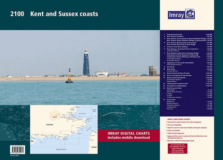
A handy-sized A2 pack of charts covering the Kent and Sussex coasts.This fully revised edition includes the latest official UKHO data combined with additional information sourced from Imray's network to make it ideal for small craft. This product is also available wiro bound, please use code IC2100-8W. 2100.1Thames Estuary South (1:120 000)2100.2River Thames Sea Reach (1:42 500)2100.3River Thames - Canvey Island to Queen Elizabeth II Bridge (1:42 500)River Thames - Queen Elizabeth II Bridge to Barking Creek (1:42 500)2100.4River Thames - Barking Creek to Bow Creek (1:17 500)River Thames - Bow Creek to Tower Bridge (1:17 500)2100.5Entrance to the River Medway (1:20 000)2100.6 River Medway: Horseshoe Point to Folly Point (1:20 000)Plan Whitton Marine (1:6000)2100.7River Medway: Folly Point to Rochester Bridge (1:20 000)Continuation of River Medway to Holborough (1:25 000)Continuation of River Medway to Allington Lock (1:25 000)Plans Gillingham Marina (1:10 000), Chatham Marina (1:10 000)2100.8Approaches to The Swale & Whitstable (1:42 500)Plan Whitstable Harbour (1:7000)2100.9East Swale (1:20 000)2100.10 West Swale (1:20 000)Plan Swale Marina (1:7500)2100.11North Foreland to Dover & Calais (1:120 000)2100.12Dover to Dungeness & Cap Gris-Nez (1:120 000)2100.13Beachy Head to Dungeness (1:120 000)Plans Sovereign Harbour (1:20 000), Rye Harbour (1:35 000) 2100.14 Littlehampton to Beachy Head (1:120 000)2100.15East Solent to Littlehampton (1:120 000)2100.16Plans Ramsgate (1:6500), River Stour Entrance (1:35 000), Dover (1:15 000), Calais (1:20 000), Folkestone Harbour (1:10 000)2100.17Plans Newhaven (1:16 500), Brighton Marina (1:8500), Shoreham Harbour (1:20 000), Littlehampton (1:13 500), The Looe (1:60 000)Imray Digital Charts: Free mobile download A voucher code to download the relevant Imray digital charts into our Imray Navigator app is included with this atlas.