• Fri frakt över 249 kr
  • •
  • Snabba leveranser
  • •
  • Billiga böcker
Kundservice

Du är på sajten för privatpersoner.

Företag, bibliotek eller offentlig verksamhet?

Du handlar på classic.bokus.com, där alla dina funktioner finns intakta.
Till classic.bokus.com
Bokus logotyp. Gå till startsidan.
  • Erbjudanden
  • Nyheter
  • Student
  • Topplistor
  • Barn & ungdom
  • Bokus Play
  • E-böcker
  • Pocketböcker
  • Spel & pussel

10% rabatt på allt med kod NYSTART10 →

Sidfot

Mina sidor

    Hjälp

    • Kundservice
    • Vanliga frågor och svar
    • Frakt och leverans
    • Retur vid ångerrätt
    • Reklamera vara
    • Betalning
    • Köpvillkor
    • Allmänna villkor
    • Information om webbplatsens tillgänglighet

    Om Bokus

    • Om oss
    • Pressrum
    • För studenter
    • För företag
    • För bibliotek och offentlig verksamhet
    • För leverantörer
    • Hållbarhet

    Populärt

    • Aktuella erbjudanden
    • Presentkort
    • Studentlitteratur
    • Nya böcker
    • Topplistor
    • Signerade böcker
    • Engelska böcker

    Inspiration

    • Boktips
    • BookTok
    • Populära bokserier
    • Barnbokskaraktärer
    • Populära författare
    Logotyp för Bokus
    Följ oss på Facebook (extern länk)Följ oss på Instagram (extern länk)Följ oss på YouTube (extern länk)Följ oss på TikTok (extern länk)
    bokus @ CookiesAnpassa cookiesIntegritetspolicyKöpvillkor
    Till Citymail hemsida (extern länk)Till Budbee hemsida (extern länk)Till Postnord hemsida (extern länk)Till Schenker hemsida (extern länk)Till Early Bird hemsida (extern länk)Till Walleys hemsida (extern länk)
    1. Naturvetenskap och teknik
    2. Geovetenskap
    3. Geovetenskap

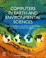
    Computers in Earth and Environmental Sciences

    Artificial Intelligence and Advanced Technologies in Hazards and Risk Management

    AvHamid Reza Pourghasemi

    Häftad, Engelska, 2021

    1 933 kr

    Beställningsvara. Skickas inom 10-15 vardagar. Fri frakt över 249 kr.

    Beskrivning

    Computers in Earth and Environmental Sciences: Artificial Intelligence and Advanced Technologies in Hazards and Risk Management addresses the need for a comprehensive book that focuses on multi-hazard assessments, natural and manmade hazards, and risk management using new methods and technologies that employ GIS, artificial intelligence, spatial modeling, machine learning tools and meta-heuristic techniques. The book is clearly organized into four parts that cover natural hazards, environmental hazards, advanced tools and technologies in risk management, and future challenges in computer applications to hazards and risk management.

    Researchers and professionals in Earth and Environmental Science who require the latest technologies and advances in hazards, remote sensing, geosciences, spatial modeling and machine learning will find this book to be an invaluable source of information on the latest tools and technologies available.


    • Covers advanced tools and technologies in risk management of hazards in both the Earth and Environmental Sciences
    • Details the benefits and applications of various technologies to assist researchers in choosing the most appropriate techniques for purpose
    • Expansively covers specific future challenges in the use of computers in Earth and Environmental Science
    • Includes case studies that detail the applications of the discussed technologies down to individual hazards

    Produktinformation

    • Utgivningsdatum:2021-09-22
    • Mått:216 x 276 x 37 mm
    • Vikt:1 810 g
    • Format:Häftad
    • Språk:Engelska
    • Antal sidor:704
    • Förlag:Elsevier Science
    • ISBN:9780323898614

    Utforska kategorier

    • Geovetenskap inom Naturvetenskap och teknik
    • Företagsekonomi inom Ekonomi och Ledarskap
    • Affärsapplikationer inom Data och IT

    Mer om författaren

    Hamid Reza Pourghasemi is a Professor of watershed management engineering in the College of Agriculture, Shiraz University, Iran. His main research interests are GIS-based spatial modelling using machine learning/data mining techniques in different fields such as landslides, floods, gully erosion, forest fires, land subsidence, species distribution modelling, and groundwater/hydrology. Professor Pourghasemi also works on multi-criteria decision-making methods in natural resources and environmental science. He has published over 230 peer-reviewed papers in high-quality journals, is an active reviewer for over 90 international journals, and has led numerous edited books. He was also selected as one of the five young scientists under 40 by The World Academy of Science (TWAS 2019).

    Innehållsförteckning

    • 1. Predicting Dissolved Oxygen Concentration in River using New Advanced Machines Learning: Long-Short Term Memory (LSTM) Deep Learning.2. Fractal analysis of valley sections in geological formations of arid areas3. Data-driven approach for estimating contaminants in natural water4. Application of analytical hierarchy process (AHP) in landslide susceptibility mapping for Qazvin province, N Iran5. Assessment of machine learning algorithms in land use classification 6. Evaluation of land use change predictions using CA-Markov model and managerial scenarios7. Topographical features and soil erosion processes8. Mapping the NDVI and monitoring of its changes using Google Earth Engine and Sentinel-2 images 9. Spatiotemporal Urban Sprawl and Land Resource Assessment using Google Earth Engine Platform in Lahore District, Pakistan10. Using OWA - AHP method to predict landslide-prone areas11. Multi-scale drought hazard assessment in the Philippines12. Selection of the best pixel-based algorithm for land cover mapping in Zagros forests of Iran using Sentinel-2A satellite image: A case study in Khuzestan province13. Identify the important driving forces on gully erosion, Chaharmahal and Bakhtiari province, Iran14. Analysis of social resilience of villagers in the face of drought using LPCIEA indicator, Case study: Downstream of Dorodzan dam, Iran15. Spatial and seasonal modelling of land surface temperature using Random Forest16. Municipal solid waste landfill suitability analysis through spatial multi-criteria decision analysis: a case study 17. Predictive habitat suitability models for Teucrium polium L. using boosted regression trees18. Ecoengineering practices for Soil degradation protection for vulnerable hill slopes19. Soft computing applications in rainfall induced landslide analysis and protection – Recent trends, techniques, and opportunities20. Remote sensing and machine learning techniques to monitor fluvial corridor evolution: the Aras River between Iran and Azerbaijan 21. Studies on potential plant selection focusing on soil bioengineering application for land degradation protection22. IoT applications in landslide prediction and abatement – Trends, opportunities and challenge23. Application of WEPP model for runoff and sediment yield simulation from ungauged watershed in Shivalik foothills24. Parameter estimation of a new four-parameter Muskingum flood routing model25. Predicting areas affected by forest fire based on machine learning algorithm 26. Management of pest-infected oak trees using remote sensing-based classification algorithms and GIS data27. The COVID-19 Crisis and Its Consequences for Global Warming and Climate Change28. Earthquake anomalies for global events from GNSS TEC and other satellites29. Landslide spatial modelling using a bivariate statistical method in Kermanshah Province, Iran30. Normalized Difference Vegatation Index analysis of Forest Cover Change Detection in Paro Dzongkhag, Bhutan31. Rate of penetration prediction in drilling wells from the Hassi Messaoud oil field (SE Algeria): use of artificial intelligence techniques and environmental implications32. Soil erodibility and its influential factors in arid and semi-arid regions of the Middle-East33. Non-carcinogenic health risk assessment of fluoride in groundwater of the alluvial plains of River Yamuna, Delhi, India34. Digital soil mapping of organic carbon at two depths in loess hilly region of Northern Iran35. Hydrochemistry and geogenic pollution assessment of groundwater in Akşehir (Konya/Turkey) using GIS36. Comparison of the frequency ratio, index of entropy, and artificial neural networks models for landslide susceptibility mapping: A case study in Pınarbaşı/Kastamonu (North of Turkey)37. Remote Sensing Technology for Post-Disaster Building Damage Assessment38. Doing More with Less: Coupling Morphometric Indices for Automated Gully Pattern Extraction (A Case Study in the Southeast of Iran)39. Identification of land subsidence prone areas and its mapping using machine learning algorithms40. Monitoring of Spatiotemporal Changes of Soil Salinity and Alkalinity in Eastern and Central Parts of Iran41. Fine-grain Sparse Woodlands Mapping, Using Kernel-based Granulometry of Textural Pattern Measures on Satellite Imageries42. Badland erosion mapping and effective factors on its occurrence using random forest model43. Application of machine learning algorithms in Hydrology44. Digital soil mapping of bulk density in loess derived- soils with complex topography45. Landslide Susceptibility Mapping along the Thimphu-Phuentsholing Highway using Machine Learning46. Drought Assessment using the Standardized Precipitation Index (SPI) in Greece47. COVID-19: An overview on official reports in Iran and world along with some comparisons to other hazards 48. Multi-hazard risk analysis and governance across a provincial capital in northern Iran