• Fri frakt över 249 kr
  • •
  • Snabba leveranser
  • •
  • Billiga böcker
Kundservice

Du är på sajten för privatpersoner.

Företag, bibliotek eller offentlig verksamhet?

Du handlar på classic.bokus.com, där alla dina funktioner finns intakta.
Till classic.bokus.com
Bokus logotyp. Gå till startsidan.
  • Erbjudanden
  • Nyheter
  • Student
  • Topplistor
  • Barn & ungdom
  • Bokus Play
  • E-böcker
  • Pocketböcker
  • Spel & pussel

10% rabatt på allt med kod: NYSTART10 →

Sidfot

Mina sidor

    Hjälp

    • Kundservice
    • Vanliga frågor och svar
    • Frakt och leverans
    • Retur vid ångerrätt
    • Reklamera vara
    • Betalning
    • Köpvillkor
    • Allmänna villkor
    • Information om webbplatsens tillgänglighet

    Om Bokus

    • Om oss
    • Pressrum
    • För studenter
    • För företag
    • För bibliotek och offentlig verksamhet
    • För leverantörer
    • Hållbarhet

    Populärt

    • Aktuella erbjudanden
    • Presentkort
    • Studentlitteratur
    • Nya böcker
    • Topplistor
    • Signerade böcker
    • Engelska böcker

    Inspiration

    • Boktips
    • BookTok
    • Populära bokserier
    • Barnbokskaraktärer
    • Populära författare
    Logotyp för Bokus
    Följ oss på Facebook (extern länk)Följ oss på Instagram (extern länk)Följ oss på YouTube (extern länk)Följ oss på TikTok (extern länk)
    bokus @ CookiesAnpassa cookiesIntegritetspolicyKöpvillkor
    Till Citymail hemsida (extern länk)Till Budbee hemsida (extern länk)Till Postnord hemsida (extern länk)Till Schenker hemsida (extern länk)Till Early Bird hemsida (extern länk)Till Walleys hemsida (extern länk)
    1. Djur och Natur
    2. Naturböcker
    3. Växtböcker

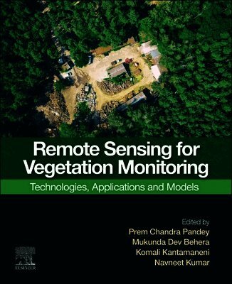
    Remote Sensing for Vegetation Monitoring

    Technologies, Applications and Models

    AvPrem Chandra Pandey,Mukunda Behera

    Häftad, Engelska, 2026

    1 622 kr

    Kommande

    Beskrivning

    Remote Sensing for Vegetation Monitoring: Technologies, Applications and Models provides insight on the pivotal role that remote sensing plays in vegetation monitoring. As traditional field assessments face challenges due to inaccessible study sites and lengthy data collection, this book offers a comprehensive view of remote sensing applications for monitoring various vegetation ecosystems, including forests, grasslands, mangroves, and agriculture. The book presents a coherent and consistent structure, across five sections that build upon prior knowledge and detail the quantitative and qualitative assessments made possible through remote sensing technologies. Remote Sensing for Vegetation Monitoring: Technologies, Applications and Models caters to a diverse audience, including researchers and practitioners seeking to navigate the evolving landscape of vegetation monitoring through case studies, new algorithms and state-of-the-art methods.

    • Provides the latest remote sensing techniques applied in all aspects of vegetation monitoring including forests, agriculture, grassland, phytoplankton, and mangroves
    • Chapters are well-integrated and interdisciplinary, with consistent quality and continuity
    • Includes recent, practical case studies across major global geographies that are formatted to be easily understood and reproduced

    Produktinformation

    • Utgivningsdatum:2026-10-15
    • Mått:191 x 235 x undefined mm
    • Format:Häftad
    • Språk:Engelska
    • Antal sidor:450
    • Förlag:Elsevier Science
    • ISBN:9780443330766

    Utforska kategorier

    • Växtböcker inom Djur och Natur
    • Botanik inom Naturvetenskap och teknik
    • Geografi inom Naturvetenskap och teknik

    Mer om författaren

    Dr. Prem Chandra Pandey received PhD from the University of Leicester, United Kingdom, under Commonwealth Scholarship and Fellowship Plan. Currently, he is working as an assistant professor at the Department of Life Sciences, School of Natural Sciences, Shiv Nadar Institution of Eminence (Deemed to be University), UP, India. Previously, he has been associated with Banaras Hindu University, India, as an SERB-NPDF fellow. He received BSc and MSc degrees from Banaras Hindu University and MTech degree (Remote Sensing) from Birla Institute of Technology, India. He has worked as a professional research fellow on remote sensing applica tions in the National Urban Information System funded by NRSC Government of India. He has been a recipient of several awards including Commonwealth Fellow, United Kingdom, INSPIRE fellow GoI, MHRD-UGC fellow GoI, Malviya Gold Medal from Banaras Hindu University, SERB-NPDF from Government of India, and Young Investigator Award. Dr. Pandey is working in three projects related to monitoring of wetlands/Chilika lake mainly focusing on Ramsar sites along with other natural resources based research work funded by NGP and SERB Government of India. He has published more than 50 peer reviewed journal papers, seven edited books, several book chapters, and presented his work in national and international conferences. He is serving as a member of editorial board for Geocarto International journal, Taylor & Francis, Sustainable Development (Wiley- IF 12.5) and acted as a guest editor for Remote Sensing, Dr. Mukunda Dev Behera is an associate Professor in the Centre for Oceans, Rivers, Atmosphere and Land Sciences at the Indian Institute of Technology Kharagpur. Prior to this, he has worked for the Indian Space Research Organization (ISRO). Dr. Behera has made outstanding contributions to the fields of forest remote sensing, land and water resource management, and ecological climatology by theorizing, modeling, and conducting innovative experiments and field-based measurements with satellite remote sensing. He has developed innovative protocols and new methods for estimating a range of vegetation photosynthetic/ structural variables including leaf area index, canopy height, aboveground biomass and productivity using suite of satellite data products and modeling. He has over 110 peer-reviewed journal publications, and has co-edited several books. He serves the editorial boards of several reputed environmental journals and contributed to IPCC AR-6 of WG-II. Dr Kantamaneni is currently working as a Senior Research Fellow at the Faculty of Science and Technology, University of Central Lancashire (UCLan), United Kingdom. Her research has produced, for the first time, a combined vulnerability assessment based on physical science parameters and economic drivers. Her academic background gives her different perspectives, and she engages with interdisciplinary and multidisciplinary projects such as coastal and water infrastructures, natural disasters, risk assessment and management. Her research focuses mainly on coastal vulnerability, natural disasters, natural hazards, climate change, water infrastructure and GIS mapping, and she has been plenary/keynote and invited speaker at many major international conferences. Dr Kantamaneni has been an evaluator for various coastal and maritime research projects, and is also Principal Investigator and Co-Investigator to a number of international research projects.Dr. Navneet Kumar serves as a Professor and Head of the Geo-Meteorological Risk Management Division (GMRD) at the National Institute of Disaster Management (NIDM), under the Ministry of Home Affairs, Government of India. He holds a PhD in Engineering (Hydrology and Climatology) from the University of Bonn, Germany with a DAAD scholarship and a Master’s degree in Geoinformatics from the Faculty of Geo-Information Science and Earth Observation (ITC), Netherlands. He has worked on various aspects of disaster risk reduction and management, advanced applications of remote sensing and GIS for vegetation monitoring, drought, flood, and landslide risk assessment, mapping, and modelling with particular emphasis on the real-time monitoring frameworks, climate change and risk analysis and land degradation. He coordinated several projects in Africa and Asia, including India, West Africa, Algeria, Ethiopia, and South Korea. He has contributed to capacity-building initiatives at the Pan African University Institute of Water and Energy Sciences based in Tlemcen, Algeria and collaborated on a global classroom program with institutions in the USA and Brazil. Prof. Kumar has lectured, conducted trainings and workshops, and presented at several international conferences and earned several awards. He has published several papers in International peer-reviewed journals, co-edited four handbooks, co-authored several book chapters, proceedings, and global reports reflecting both scientific rigour and policy relevance. Prof. Kumar also served as a guest editor for various international journals, reviewer of several grant proposals from Germany, Austria and Czech Republic and served as a member of international committees. Prior to joining NIDM, Prof. Kumar worked at the University of Bonn, Germany. In this capacity, he had coordinated disciplinary PhD courses and participated as a member of the ethical committee for the doctoral program at the Center for Development Research (ZEF) as well as coordinated several research and capacity building projects. Additionally, he has held a position at the United Nations University – Institute for Environment and Human Security (UNU-EHS), also located in Bonn, Germany. His responsibilities included the proactive promotion, strengthening, and expansion of scientific networks to establish partnerships with pertinent institutions, including United Nations organizations.

    Innehållsförteckning

    • 1. Introduction to Remote Sensing for Vegetation Monitoring Editorial Message2. Advances in Remote Sensing Images, Classification Techniques and Applications for Vegetation Analysis: The Indian Context3. Monitoring Vegetation Productivity, Phenology and Biodiversity in Semi-arid India using MODIS Data4. Monitoring Vegetation Health: Harnessing the Power of Remote Sensing5. A polarimetric approach for monitoring and retrieval of vegetation growth parameters using SAR satellite data6. Remote Sensing-Based Phenological Monitoring in Water-Limited Forest Ecosystems: Digital Imagery and Machine Learning Integration for Vegetation Assessment7. Enhancing Fire Fuel Mapping in Semi-Arid and Semi-Mediterranean Regions: A Comparative Analysis of Vegetation Indices Using Sentinel-2 and MODIS Data8. Forest and rangeland promotes infiltration and minimize runoff: a water balance based approach using SWAT9. Monitoring sunderbans mangrove vegetation using geospatial techniques10. Mangrove Monitoring with Geospatial Tools: Aligning with SDG Targets11. Earth Observation (EO) Data and Advanced Remote Sensing (RS) Technologies for Enhanced Irrigation System Monitoring and Management12. Crop Damage Assessment Using Multi-Sensors and Multi-Source Remote Sensing Data13. Artificial Intelligence -driven remote sensing applications for comprehensive agricultural monitoring in developing countries14. Examining the potential of Spaceborne EnMAP Hyperspectral Imager in estimating sour-and-sweetveld grass quality under senescence condition15. Advancing Grassland Monitoring Through Remote Sensing Techniques: Applications, Challenges, and Future Perspectives16. Quantifying Cooling Effects of Urban Green Spaces: An Empirical Study from Primary Parks in Bangkok Metropolis17. Using Remote Sensing to Assess How Green Spaces Contribute to Mitigating Urban Heat Island (UHI) Effects18. Computational Analysis of Water, Temperature and Vegetation Indices of Bahraich District of Uttar Pradesh