• Fri frakt över 249 kr
  • •
  • Snabba leveranser
  • •
  • Billiga böcker
Kundservice

Du är på sajten för privatpersoner.

Företag, bibliotek eller offentlig verksamhet?

Du handlar på classic.bokus.com, där alla dina funktioner finns intakta.
Till classic.bokus.com
Bokus logotyp. Gå till startsidan.
  • Erbjudanden
  • Student
  • Topplistor
  • Barn & ungdom
  • Bokus Play
  • E-böcker
  • Ljudböcker
  • Pocketböcker
  • Spel & pussel

Upp till 25% på utvalda nyheter →

Sidfot

Mina sidor

    Hjälp

    • Kundservice
    • Vanliga frågor och svar
    • Frakt och leverans
    • Retur vid ångerrätt
    • Reklamera vara
    • Betalning
    • Köpvillkor
    • Allmänna villkor
    • Information om webbplatsens tillgänglighet

    Om Bokus

    • Om oss
    • Pressrum
    • För studenter
    • För företag
    • För bibliotek och offentlig verksamhet
    • För leverantörer
    • Hållbarhet

    Populärt

    • Aktuella erbjudanden
    • Presentkort
    • Studentlitteratur
    • Nya böcker
    • Topplistor
    • Signerade böcker
    • Engelska böcker

    Inspiration

    • Boktips
    • BookTok
    • Populära bokserier
    • Barnbokskaraktärer
    • Populära författare
    Logotyp för Bokus
    Följ oss på Facebook (extern länk)Följ oss på Instagram (extern länk)Följ oss på YouTube (extern länk)Följ oss på TikTok (extern länk)
    bokus @ CookiesAnpassa cookiesIntegritetspolicyKöpvillkor
    Till Citymail hemsida (extern länk)Till Budbee hemsida (extern länk)Till Postnord hemsida (extern länk)Till Schenker hemsida (extern länk)Till Early Bird hemsida (extern länk)Till Walleys hemsida (extern länk)
    1. Naturvetenskap och teknik
    2. Matematik och naturvetenskap
    3. Matematik
    4. Tillämpad matematik

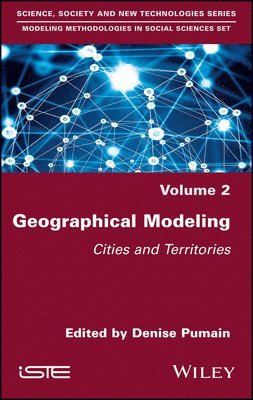
    Geographical Modeling

    Cities and Territories

    AvDenise Pumain

    Inbunden, Engelska, 2020

    1 800 kr

    Beställningsvara. Skickas inom 5-8 vardagar. Fri frakt över 249 kr.

    Beskrivning

    The modeling of cities and territories has progressed greatly in the last 20 years. This is firstly due to geographic information systems, followed by the availability of large amounts of georeferenced data – both on the Internet and through the use of connected objects. In addition, the rise in performance of computational methods for the simulation and exploration of dynamic models has facilitated advancement. Geographical Modeling presents previously unpublished information on the main advances achieved by these new approaches. Each of the six chapters builds a bibliographic review and precisely describes the methods used, highlighting their advantages and discussing their interpretations. They are all illustrated by many examples. The book also explains with clarity the theoretical foundations of geographical analysis, the delicate operations of model selection, and the applications of fractals and scaling laws. These applications include gaining knowledge of the morphology of cities and the organization of urban transport, and finding new methods of building and exploring simulation models and visualizations of data and results.

    Produktinformation

    • Utgivningsdatum:2020-02-14
    • Mått:162 x 236 x 22 mm
    • Vikt:522 g
    • Format:Inbunden
    • Språk:Engelska
    • Antal sidor:256
    • Förlag:ISTE Ltd and John Wiley & Sons Inc
    • ISBN:9781786304902

    Utforska kategorier

    • Tillämpad matematik inom Naturvetenskap och teknik
    • Geografi inom Naturvetenskap och teknik

    Mer om författaren

    Denise Pumain is Professor at the University of Paris I Pantheon-Sorbonne (France), co founder of the CNRS Geographie-cités laboratory and Director of Cybergeo: European Journal of Geography. She participates in the development of numerous models for an evolutionary theory of cities.

    Innehållsförteckning

    • Introduction ixDenise PUMAINChapter 1. Complexity in Geography 1Denise PUMAIN1.1. A first bifurcation in the epistemology of geographic modeling 31.1.1. “Vertical” explanations for the “science of places, not people” 41.1.2. “Horizontal” explanations for the science of the spatiality of societies 51.1.3. The discussed status of modeling 71.2. Modeled regularities 101.2.1. Proximity and distances 111.2.2. The scale 151.2.3. Concentration and accumulation: geographical inequalities and scaling laws 191.2.4. Spatial change and trajectory dependence 211.2.5. Territorial drifts, space-time compression, and globalization 251.3. Conclusion 29Chapter 2. Choosing Models to Explain the Dynamics of Cities and Territories 31Lena SANDERS2.1. Introduction 312.2. Explaining by reasons or laws: choosing an epistemological framework 322.3. The modeling approach: diversity of models 362.4. Explaining through statistical relationships or mechanisms 382.5. Choosing the level of abstraction for the phenomenon to be explained: general versus particular 412.6. Choosing the level of abstraction for the model: stylized or realistic, KISS or KIDS 442.6.1. Modes of representation of space: from a stylized space to a realistic space 452.6.2. Formalizing spatial mechanisms: from stylized to realistic 482.7. Conclusion 50Chapter 3. Effects of Distance and Scale Dependence in Geographical Models of Cities and Territories 53Cécile TANNIER3.1. Three fundamental principles for modeling cities and territories 553.1.1. Effects of distance 573.1.2. Effects of scale dependence 583.2. Role of distance in spatial simulation models 613.3. Modeling scale dependence 763.3.1. Scale dependence as a result of processes acting at different scales 773.3.2. Scale invariance for the description of geographical phenomena 833.3.3. Scale dependence as a generative mechanism for simulated spatial configurations 883.4. Conclusion 93Chapter 4. Incremental Territorial Modeling 95Clémentine COTTINEAU, Paul CHAPRON, Marion LE TEXIER and Sébastien REY-COYREHOURCQ4.1. The map and the territory 964.1.1. Modeling as one map: selection and schematization 964.1.2. The representation of territory as an input of the model 1004.1.3. The representation of territory as an output of the model 1024.2. Generality and specificity: explaining by ways of geographical models 1064.2.1. Historical contingency and non-ergodicity 1064.2.2. General/specific/singular 1094.3. Incremental territorial modeling 1104.3.1. Identifying the object, scale, configuration, and stylized facts 1114.3.2. Gathering the different theoretical explanations 1124.3.3. Hierarchizing the interaction processes between agents 1134.3.4. Hierarchizing the interaction processes between agents and their environment 1144.3.5. Implementing mechanisms and their formal alternatives 1154.3.6. Combining, simulating, and comparing 1164.4. Challenges and limits of multi-modeling 1174.4.1. The combinatorial curse 1184.4.2. Human and technical costs 1184.4.3. Subjectivity in the choice of building blocks 1194.4.4. Comparing models of different structures 1194.4.5. Sharing and accumulation of knowledge 1214.5. Conclusion 121Chapter 5. Methods for Exploring Simulation Models 125Juste RAIMBAULT and Denise PUMAIN5.1. Social sciences and experimentation 1265.2. Geographical data and computer skills 1275.3. New generation simulations 1305.3.1. A virtual laboratory: the OpenMOLE platform 1315.3.2. The SimpopLocal experiment: simulation of an emergence in geography 1345.3.3. Implementation of SimpopLocal, from NetLogo to OpenMOLE 1375.3.4. Calibration and validation 1395.4. Other examples of OpenMOLE applications: network–territory interaction models 1435.5. Perspectives 1475.5.1. Methods 1475.5.2. Tools 1485.6. Conclusion 149Chapter 6. Model Visualization 151Robin CURA6.1. Introduction 1516.2. Visualization as modeling 1536.2.1. Visualization as a tool for interdisciplinarity 1556.2.2. Visualization and reproducibility 1606.2.3. Visualizing a model means learning 1626.3. Visualize to evaluate 1636.3.1. Visualize before modeling 1646.3.2. Visualize during the simulation 1666.3.3. Visualizing after the simulation 1696.4. Visualizing to compare 1726.4.1. Which models should be compared? 1726.4.2. How should visual comparison be done? 1746.5. Visualizing to communicate 1786.5.1. Visualizing to disseminate 1796.6. Some obstacles inherent in model visualization 1826.6.1. Producing and visualizing massive data 1836.6.2. Visualization of aggregated data 1876.7. Conclusion 191References 193List of Authors 221Index 223