• Fri frakt över 249 kr
  • •
  • Snabba leveranser
  • •
  • Billiga böcker
Kundservice

Du är på sajten för privatpersoner.

Företag, bibliotek eller offentlig verksamhet?

Du handlar på classic.bokus.com, där alla dina funktioner finns intakta.
Till classic.bokus.com
Bokus logotyp. Gå till startsidan.
  • Erbjudanden
  • Student
  • Topplistor
  • Barn & ungdom
  • Bokus Play
  • Bokus Play
  • E-böcker
  • Ljudböcker
  • Pocketböcker
  • Spel & pussel

10% rabatt på allt med kod NYSTART10 →

Sidfot

Mina sidor

    Hjälp

    • Kundservice
    • Vanliga frågor och svar
    • Frakt och leverans
    • Retur vid ångerrätt
    • Reklamera vara
    • Betalning
    • Köpvillkor
    • Allmänna villkor
    • Information om webbplatsens tillgänglighet

    Om Bokus

    • Om oss
    • Pressrum
    • För studenter
    • För företag
    • För bibliotek och offentlig verksamhet
    • För leverantörer
    • Hållbarhet

    Populärt

    • Aktuella erbjudanden
    • Presentkort
    • Studentlitteratur
    • Nya böcker
    • Topplistor
    • Signerade böcker
    • Engelska böcker

    Inspiration

    • Boktips
    • BookTok
    • Populära bokserier
    • Barnbokskaraktärer
    • Populära författare
    Logotyp för Bokus
    Följ oss på Facebook (extern länk)Följ oss på Instagram (extern länk)Följ oss på YouTube (extern länk)Följ oss på TikTok (extern länk)
    bokus @ CookiesAnpassa cookiesIntegritetspolicyKöpvillkor
    Till Citymail hemsida (extern länk)Till Budbee hemsida (extern länk)Till Postnord hemsida (extern länk)Till Schenker hemsida (extern länk)Till Early Bird hemsida (extern länk)Till Walleys hemsida (extern länk)
    1. Historia och arkeologi
    2. Historia
    3. Historia: särskilda händelser och ämnen
    4. Sjöfartshistoria

    Sea Chart

    AvJohn Blake

    Inbunden, Engelska, 2016

    386 kr

    Beställningsvara. Skickas inom 5-8 vardagar. Fri frakt över 249 kr.

    Beskrivning

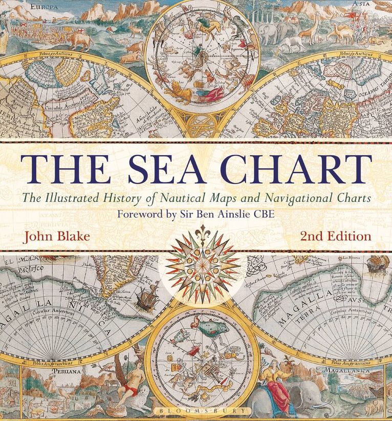
    To sail the oceans needed skill as well as courage and experience, and the sea chart with, where appropriate, the coastal view, was the tool by which ships of trade, transport or conquest navigated their course. This book looks at the history and development of the chart and the related nautical map, in both scientific and aesthetic terms, as a means of safe and accurate seaborne navigation. The Italian merchant-venturers of the early thirteenth century developed the earliest ‘portulan’ pilot charts of the Mediterranean. The subsequent speed of exploration by European seafarers, encompassing the New World, the extraordinary voyages around the Cape of Good Hope and the opening up of the trade to the East, India and the Spice Islands were both a result of the development of the sea chart and additionally as an aid to that development. By the eighteenth century the discovery and charting of the coasts and oceans of the globe had become a strategic naval and commercial requirement. Such involvements led to Cook’s voyages in the Pacific, the search for the Northwest Passage and races to the Arctic and Antarctic.The volume is arranged along chronological and then geographical lines. Each of the ten chapters is split into two distinct halves examining the history of the charting of a particular region and the context under which such charting took place following which specific navigational charts and views together with other relevant illustrations are presented. Key figures or milestones in the history of charting are then presented in stand-alone story box features.This new edition features around 40 new charts and accompanying text.

    Produktinformation

    • Utgivningsdatum:2016-03-10
    • Mått:287 x 305 x 23 mm
    • Vikt:1 725 g
    • Format:Inbunden
    • Språk:Engelska
    • Antal sidor:192
    • Upplaga:2
    • Förlag:Bloomsbury Publishing PLC
    • ISBN:9781844863143

    Utforska kategorier

    • Sjöfartshistoria inom Historia och arkeologi
    • Historisk geografi inom Historia och arkeologi
    • Sjöfart och skeppsbyggnad inom Naturvetenskap och teknik

    Mer om författaren

    Lieutenant-Commander John Blake, FRIN, spent twelve years in the Royal Navy. He has worked extensively with the UK Hydrographic Office, the producers of Admiralty Charts, and is a Fellow of the Royal Institute of Navigation. John is the author of the acclaimed Conway publications The Sea Chart (2003) and Sea Charts of the British Isles (2005). His research interests span the maritime world, from nautical charts and surveying to merchant shipping.

    Recensioner i media

    The magnificent, enduring legacy which Lt Cdr John Blake, RN, has bequeathed to the world is one of those astonishing volumes which changes lives because it transforms the way history is viewed. Thank you, Lt Cmdr Blake. You have become the second Blake to bring nautical greatness to the Royal Navy!