• Fri frakt över 249 kr
  • •
  • Snabba leveranser
  • •
  • Billiga böcker
Kundservice

Du är på sajten för privatpersoner.

Företag, bibliotek eller offentlig verksamhet?

Du handlar på classic.bokus.com, där alla dina funktioner finns intakta.
Till classic.bokus.com
Bokus logotyp. Gå till startsidan.
  • Erbjudanden
  • Nyheter
  • Student
  • Topplistor
  • Barn & ungdom
  • Bokus Play
  • E-böcker
  • Pocketböcker
  • Spel & pussel

10% rabatt på allt med kod: NYSTART10 →

Sidfot

Mina sidor

    Hjälp

    • Kundservice
    • Vanliga frågor och svar
    • Frakt och leverans
    • Retur vid ångerrätt
    • Reklamera vara
    • Betalning
    • Köpvillkor
    • Allmänna villkor
    • Information om webbplatsens tillgänglighet

    Om Bokus

    • Om oss
    • Pressrum
    • För studenter
    • För företag
    • För bibliotek och offentlig verksamhet
    • För leverantörer
    • Hållbarhet

    Populärt

    • Aktuella erbjudanden
    • Presentkort
    • Studentlitteratur
    • Nya böcker
    • Topplistor
    • Signerade böcker
    • Engelska böcker

    Inspiration

    • Boktips
    • BookTok
    • Populära bokserier
    • Barnbokskaraktärer
    • Populära författare
    Logotyp för Bokus
    Följ oss på Facebook (extern länk)Följ oss på Instagram (extern länk)Följ oss på YouTube (extern länk)Följ oss på TikTok (extern länk)
    bokus @ CookiesAnpassa cookiesIntegritetspolicyKöpvillkor
    Till Citymail hemsida (extern länk)Till Budbee hemsida (extern länk)Till Postnord hemsida (extern länk)Till Schenker hemsida (extern länk)Till Early Bird hemsida (extern länk)Till Walleys hemsida (extern länk)
    1. Naturvetenskap och teknik
    2. Geovetenskap
    3. Geografi

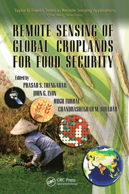
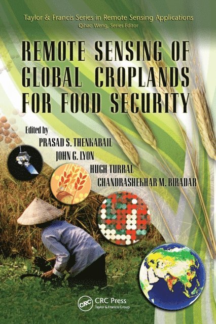
    Remote Sensing of Global Croplands for Food Security

    AvPrasad Thenkabail,John G. Lyon

    Inbunden, Engelska, 2009

    Del i serien Remote Sensing Applications Series

    2 185 kr

    Tillfälligt slut

    Beskrivning

    Increases in populations have created an increasing demand for food crops while increases in demand for biofuels have created an increase in demand for fuel crops. What has not increased is the amount of croplands and their productivity. These and many other factors such as decreasing water resources in a changing climate have created a crisis like situation in global food security. Decision makers in these situations need accurate information based on science. Remote Sensing of Global Croplands for Food Security provides a comprehensive knowledge base in use of satellite sensor-based maps and statistics that can be used to develop strategies for croplands (irrigated and rainfed) and their water use for food security. Over 50 Multi-disciplinary Global Experts Give Insight and Provide Practical Approaches Emphasizing practical mapping technologies based on advanced remote sensing data and methods, this book provides approaches for estimating irrigated and rainfed cropland areas and their water use on a national, continental, or global basis. Written by 50+ leading experts working at the forefront of this critical area, it offers case studies from a variety of continents highlighting the subtle requirements of each. In a very practical way it demonstrates the experience, utility, and models for determining water resources used and resulting yields of irrigated and rainfed croplands. The authors discuss: (a) innovative methods used for mapping croplands, (b) approaches adopted to collect cropland data in different countries by traditional and non-traditional means, (c) accuracies, uncertainties, and errors involved in producing cropland products, (d) surface energy balance models used to assess crop water use, and (e) extensive results and outcomes pertaining to global croplands and their water use.Develop Strategies for an Enhanced Green Revolution and an Accelerated Blue RevolutionLinking croplands to water use and food security, the book provides a global perspective on this sensitive issue. It gives insight into the extent of cropland usage, their spatial distribution, their cropping intensities, and their water use patterns. The editors collect the experience, methods, models, and results that show the way forward and help in decision-making on water resources and food security. All of this is required for developing strategies for an enhanced green revolution and for an accelerated blue revolution.

    Produktinformation

    • Utgivningsdatum:2009-06-24
    • Mått:156 x 234 x 35 mm
    • Vikt:948 g
    • Format:Inbunden
    • Språk:Engelska
    • Serie:Remote Sensing Applications Series
    • Antal sidor:556
    • Förlag:Taylor & Francis Inc
    • ISBN:9781420090093

    Utforska kategorier

    • Geografi inom Naturvetenskap och teknik
    • Lantbruksteknik inom Naturvetenskap och teknik
    • Agronomi och lantbruk inom Naturvetenskap och teknik

    Mer om författaren

    Prasad Thenkabail, John G. Lyon, Hugh Turral, Chandrashekhar Biradar

    Recensioner i media

    … provides unique means for understanding and comparing different cropland mapping strategies by utilizing different satellite sensors and ancillary data sets. The chapters are well written for entry level through advanced level remote sensing or agricultural specialists, and each chapter can be read sequentially or separately. … thoroughly documents the techniques and error assessment methods utilized to develop the world's first global irrigated map derived from remote sensing data. … the numerous international authors, color plates, and national cropland statistical tables makes the book an attractive and authoritative reference for mapping global croplands from remote sensing data.—Curt A. Reynolds, Crop Analyst, Foreign Agricultural Service, USDA, Washington, D.C., in Photogrammetric Engineering & Remote Sensing, June 2010

    Innehållsförteckning

    • Background and History of Global Irrigated Area Maps (GIAM). Global Irrigated Area Mapping (GIAM) Using Remote Sensing. GIAM Mapping Section for Selected Global Regions. Evapotranspiration Models, Water Use, and Irrigated Areas. Rain-Fed Cropland Areas of the World. Methods of Mapping Croplands Using Remote Sensing. Accuracies and Errors. Way Forward in Mapping Global Irrigated and Rain-Fed Croplands.