Jan Harff - Böcker
Visar alla böcker från författaren Jan Harff. Handla med fri frakt och snabb leverans.
11 produkter
11 produkter
Computerized Basin Analysis
Prognosis of Energy and Mineral Resources - Proceedings of an International Symposium Held in Gustrow, Germany, June 19-22, 1990
Inbunden, Engelska, 1993
859 kr
Skickas inom 10-15 vardagar
Submerged Landscapes of the European Continental Shelf
Quaternary Paleoenvironments
Inbunden, Engelska, 2017
1 145 kr
Skickas inom 7-10 vardagar
Quaternary Paleoenvironments examines the drowned landscapes exposed as extensive and attractive territory for prehistoric human settlement during the Ice Ages of the Pleistocene, when sea levels dropped to 120m-135m below their current levels. This volume provides an overview of the geological, geomorphological, climatic and sea-level history of the European continental shelf as a whole, as well as a series of detailed regional reviews for each of the major sea basins. The nature and variable attractions of the landscapes and resources available for human exploitation are examined, as are the conditions under which archaeological sites and landscape features are likely to have been preserved, destroyed or buried by sediment during sea-level rise. The authors also discuss the extent to which we can predict where to look for drowned landscapes with the greatest chance of success, with frequent reference to examples of preserved prehistoric sites in different submerged environments.Quaternary Paleoenvironments will be of interest to archaeologists, geologists, marine scientists, palaeoanthropologists, cultural heritage managers, geographers, and all those with an interest in the drowned landscapes of the continental shelf.
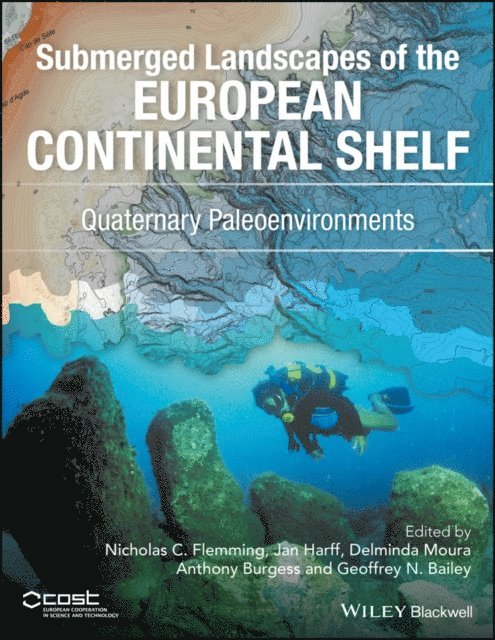
540 kr
Skickas inom 10-15 vardagar
This symposium on 'Computerized Basin Analysis for Prognosis of Energy - and Mineral Resources' was organized by Dr. Jan Harff, chairman ofthe Scientific Committee for the meeting, in Giistrowin what was then East Germany. Sponsors ofthis meeting were the International Union of Geological Sciences' Commission on Storage, Automatic Pro cessing and Retrieval of Geologic Data (COGEODATA), Academy of Sciences of the German Democratic Republic (GDR), National Oil and Gas Trustofthe GDR, and the International Association for Mathematical Geology (IAMG). Main topics of the symposium, held from 19-22 June 1990, were application of computer methods to the exploration and exploitation of oil and gas, coal, and other energy and mineral resources. There were computer demonstrations as well as a one-day field trip to the geothermic heating plant in Waren. The Regional Group for Eastern Europe of COG EO DATA also met during the conference. Fifty-one papers were presented including eight poster sessions by authors from 14 countries. As was to be expected, there was a large percentage of papers from the East Bloc of European countries, especially the GDR, USSR, and the CSSR with a fair representation from the FRG and USA and a smattering from the nine others. Most of the papers were application oriented and related to the mineral industries. There was ample time for exchange of ideas and dissemination of material.
Del 19 - Coastal Research Library
Coastline Changes of the Baltic Sea from South to East
Past and Future Projection
Inbunden, Engelska, 2017
1 073 kr
Skickas inom 10-15 vardagar
This book discusses sea-level and coastline changes. These topics are becoming increasingly important for populations living along the edge of the world’s oceans and seas, especially in areas where eustatic sea-level rise is superimposed on isostatic subsidence and storm-induced coastal erosion. This is the case at the southern and eastern Baltic Sea coast: in the south, glacio-isostatic subsidence enhances the effect of climate-induced sea-level rise and strong storm effects are causing a continuous retreat of the coast. On the eastern coast glacio-isostatic uplift compensates for eustatic sea-level rise, but storm-induced waves are responsible for permanent morphodynamic changes to the coastline. There is an increasing need for protection concepts for defense but also for the economic use of the different types of coastal zones. The elaboration of these management concepts can be facilitated through models that generate future projections of coastal developments in the light of modern climate change. This anthology comprises the results of the research project “Coastline Changes of the southern Baltic Sea – Past and future projection (CoPaF)” funded by the Polish Ministry of Science and Higher Education, which was run by a team of Estonian, German, Lithuanian, and Polish geoscientists and coastal engineers from 2010 to 2013 and overlapped with and complemented the work of COST Action SPLASHCOS supported by COST (European Cooperation in Science and Technology). As the southern and eastern Baltic serves as a natural laboratory for the investigation of coastal processes, the project’s findings contribute not only to the solution of regional problems in Baltic coastal research and engineering, but also to worldwide interests in description, modelling and parameterization of coastal processes and morphodynamics.
1 630 kr
Skickas inom 10-15 vardagar
This book focuses on issues of method and interpretation in studies of submerged landscapes, concentrating on illustrations and case studies from around Europe with additional examples from other parts of the world. Such landscapes were once exposed as dry land during the low sea levels that prevailed during the glacial periods that occupied most of the past million years and provided extensive new territories for human exploitation. Their study today involves underwater investigation, using techniques and strategies which are clearly set out in these chapters. The underwater landscape provides a rich source of information about the archaeology of human settlement and long-term changes in environment, climate and sea-level. This book highlights how such information can be revealed and interpreted.The examples presented here and the focus on techniques make this book of worldwide relevance. Chapters describe examples of underwater archaeological investigation as well as collaboration with offshore industries and legal, management and training issues relating to underwater cultural heritage. Such studies point to the significance of this drowned landscape, and readers are invited to consider its human impact in terms of past settlement and population dispersal through palaeolandscape reconstruction and interpretation in relation to broader themes in human prehistory.This volume is based on work from COST Action SPLASHCOS, a four-year multi-disciplinary and multi-national research program supported by COST (European Cooperation in Science and Technology) and has something to benefit all those with an interest in the sea floor of the continental shelf and the archaeological and social impact of sea-level change, including archaeologists, marine scientists, geographers, cultural-heritage managers, commercial and governmental organisations, policy makers and interested members of the public.
1 638 kr
Skickas inom 10-15 vardagar
This book focuses on issues of method and interpretation in studies of submerged landscapes, concentrating on illustrations and case studies from around Europe with additional examples from other parts of the world. Such landscapes were once exposed as dry land during the low sea levels that prevailed during the glacial periods that occupied most of the past million years and provided extensive new territories for human exploitation. Their study today involves underwater investigation, using techniques and strategies which are clearly set out in these chapters. The underwater landscape provides a rich source of information about the archaeology of human settlement and long-term changes in environment, climate and sea-level. This book highlights how such information can be revealed and interpreted.The examples presented here and the focus on techniques make this book of worldwide relevance. Chapters describe examples of underwater archaeological investigation as well as collaboration with offshore industries and legal, management and training issues relating to underwater cultural heritage. Such studies point to the significance of this drowned landscape, and readers are invited to consider its human impact in terms of past settlement and population dispersal through palaeolandscape reconstruction and interpretation in relation to broader themes in human prehistory.This volume is based on work from COST Action SPLASHCOS, a four-year multi-disciplinary and multi-national research program supported by COST (European Cooperation in Science and Technology) and has something to benefit all those with an interest in the sea floor of the continental shelf and the archaeological and social impact of sea-level change, including archaeologists, marine scientists, geographers, cultural-heritage managers, commercial and governmental organisations, policy makers and interested members of the public.
2 118 kr
Skickas inom 10-15 vardagar
Computerized modeling is a powerful tool to describe the complex interrelations between measured data and the dynamics of sedimentary systems. Complex interaction of environmental factors with natural variations and increasing anthropogenic intervention is reflected in the sedimentary record at varying scales. The understanding of these processes gives way to the reconstruction of the past and is a key to the prediction of future trends. Especially in cases where observations are limited and/or expensive, computer simulations may substitute for the lack of data. State-of-the-art research work requires a thorough knowledge of processes at the interfaces between atmosphere, hydrosphere, biosphere, and lithosphere, and is therefore an interdisciplinary approach.
2 118 kr
Skickas inom 10-15 vardagar
This book reports about the results of a Special Symposium “The Baltic Sea Basin”, held on August 11, 2008, within the frame of the 33rd IGC at Oslo, Norway in order to foster the understanding of the Baltic Basin as a unit in terms of genesis, structure, ongoing processes and utilization. It is the first time that in a joint publication, scientists from different disciplines give a comprehensive overview about the Baltic Sea basin in such a general sense. The book will be used not only by students and scientist but also by engineers and decision makers from industry and politics. Summarizing the state of the art in the investigation of the Baltic Sea Basin, but also in the resource utilisation of the basin the book will enhance the development of new monitoring strategies and technical device design including satellite observation methods, the establishment of international research laboratories, innovative topics for interdisciplinary research projects, etc.
2 118 kr
Skickas inom 10-15 vardagar
This book reports about the results of a Special Symposium “The Baltic Sea Basin”, held on August 11, 2008, within the frame of the 33rd IGC at Oslo, Norway in order to foster the understanding of the Baltic Basin as a unit in terms of genesis, structure, ongoing processes and utilization.
6 803 kr
Skickas inom 10-15 vardagar
This Encyclopedia comprises the current knowledge in marine geosciences whereby not only basic but also applied and technical sciences are covered. Through this concept a broad scale of users in the field of marine sciences and techniques is addressed, from students and scholars in academia to engineers and decision makers in industry and politics. Globally growing demand of energy and mineral resources, reliable future projection of climate processes and the protection of coasts to mitigate the threats of disasters and hazards require a comprehensive understanding of the structure, ongoing processes and genesis of the marine geosphere. Beyond the “classical” research fields in marine geology in current time more general concepts have been evolved integrating marine geophysics, hydrography, marine biology, climatology and ecology. As an umbrella the term “marine geosciences” has been broadly accepted for this new complex field of research and the solutions of practical tasks in the marine realm.